Nepal weighing options to relocate Bhotekoshi flood survivors
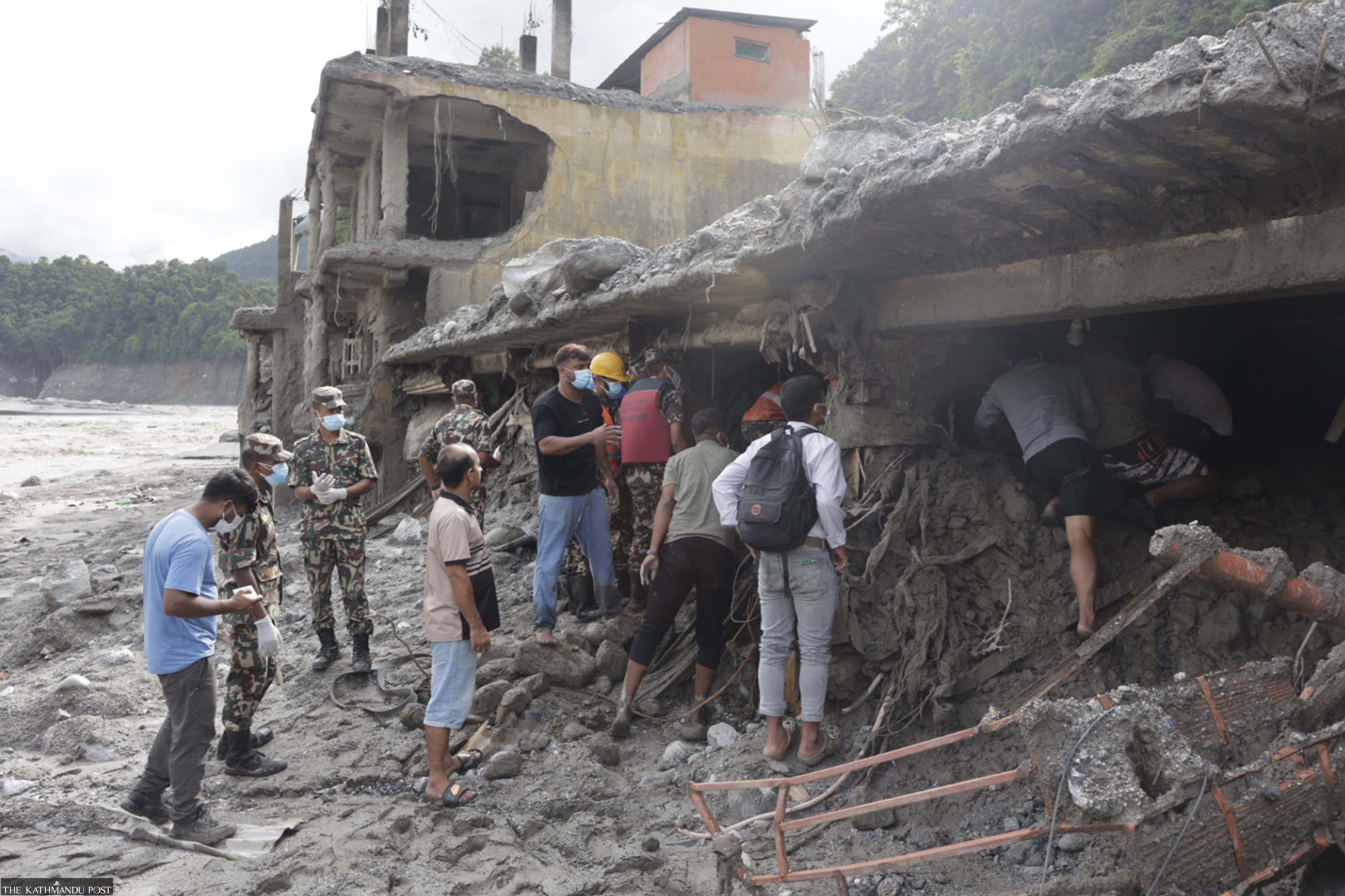
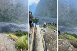
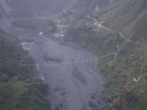
Authorities are mapping unsafe settlements and considering safer locations, but past disasters show that moving communities away from their land and livelihoods can be unsuitable. A scarred landscape near Syabrubesi shows the scale of devastation, with floodwaters cut through grey mud deposits right beside perched hillside settlements. Hemanta Shrestha/TKP
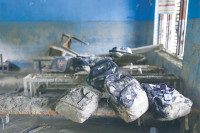
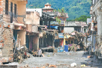
The August 26 Bhotekoshi flood destroyed around 15 settlements across Rasuwa, Nuwakot and Dhading, leaving communities that lived there for decades devastated. The government has begun homework to identify safe locations for the relocation and reconstruction of affected settlements.
The National Planning Commission (NPC) has begun work on a comprehensive master plan for rebuilding damaged infrastructure, developing safer settlements and addressing longer-term development needs in the flood-hit areas.
NPC Vice-chair Gunakar Bhatta said the commission had also started preparations for a Post-Disaster Needs Assessment (PDNA).
According to the National Disaster Risk Reduction and Management Authority, under the Ministry of Home Affairs, Rasuwa and Nuwakot districts suffered the heaviest damage. A preliminary assessment by the authority has found around 1.6 million people across 15 local units to be directly affected by the disaster.
In Rasuwa, a torrent of flood and debris destroyed settlements and market areas in Rasuwagadhi, Timure, Syafrubesi, Hakubesi, Mailung, Khalte, Betrawati, Dalphedi, Khaidi and Lingphung. In Nuwakot, settlements in Tupche, Dhunge, Trishuli Bazar, Bidur, Battar, Salletar, Shanti Bazar and Devighat were swept away.
Settlements in wards 1, 2, 3 and 5 of Gosaikunda Rural Municipality; wards 1, 2, 3, 4 and 5 of Uttargaya Rural Municipality; ward 1 of Aamachhodingmo Rural Municipality; ward 1 of Kalika Rural Municipality; and wards 1, 4, 5, 9 and 10 of Bidur Municipality in Nuwakot were severely affected.
NDRRMA data show that 8,317 houses were destroyed, with major damage concentrated in Rasuwa and Nuwakot.
“Along with rebuilding damaged infrastructure, we will prepare a master plan for settlement development and an overall development of the affected areas,” Bhatta of the planning commission said.
The Ministry of Infrastructure Development said it would first restore road and bridge links to reconnect the affected areas with the wider transport network before planning new settlements.
Ministry Secretary Gopal Prasad Sigdel said the government would then develop a long-term plan to relocate people to safer areas.
“The long-term plan will be to establish settlements in areas outside the flood-risk zones,” he said. “The detailed reconstruction plan will determine whether displaced families receive grants to build homes themselves or whether the government builds housing for them.”
Since rebuilding homes in the affected areas is improbable, the preferred option is to acquire government land in safer locations and establish new settlements.
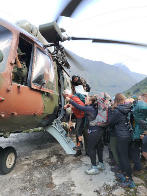
The government is mapping settlements that are no longer habitable while continuing search and rescue operations and providing temporary shelter, relief, medical care and counselling. Authorities are also preparing longer-term plans for displaced communities.
The assessment will examine damage and losses across productive sectors, service sectors, infrastructure, climate and the environment, macroeconomic impacts and other cross-cutting areas, Bhatta said.
As of now, 3,948 people rescued by the government are staying at holding centres in Nuwakot, Rasuwa, Dhading and Kathmandu.
NDRRMA chief executive Dharmaraj Upreti said authorities were assessing risks and identifying locations for new settlements while continuing rescue, relief and temporary shelter operations.
“People cannot return to settlements that have been swept away by the flood. The government has formed teams to identify safer locations and is working on a plan to relocate them,” Upreti said.
Authorities are considering several options, including moving some settlements to other districts or finding safer, vacant land within the affected districts.
Madhav Prasad Aryal, chair of Uttargaya Rural Municipality, said the flood struck just as the local government was preparing to resettle people displaced by the 2015 earthquake in Khalte. The disaster has created a new challenge: finding safe ground for those who survived.
“Khalte was home to around 300 households. Because we could not resettle them after the earthquake, the majority of the people from those families are now missing after the flood,” Aryal said.
“We had been trying to move the earthquake-displaced families to Tallopahire, but half of that area has also been swept away. Now we have to find another safe place.”
Nepal has earlier relocated communities after major disasters. Following the devastating 1993 floods and the 2015 earthquake, authorities moved settlements considered too risky to inhabit.
After the earthquake, the entire village of Laprak in Gorkha, near the quake’s epicentre, was relocated to Gupsipakha, where the Non-Resident Nepali Association built 602 houses as a model settlement. The National Reconstruction Authority later relocated 46 other settlements.
The 1993 floods struck several districts, including Makawanpur, Kavrepalanchok, Chitwan, Dhading and Mahottari, killing more than 1,300 people and affecting around 408,000. In the aftermath, authorities developed a settlement on vacant land along the Bagmati river in Sarlahi for people displaced by the disaster.
Experts with experience in post-disaster resettlement say the government should draw on those lessons and consider livelihoods, social ties and future disaster risks before deciding where to relocate Bhotekoshi flood victims. They also called for a long-term resettlement plan backed by adequate funding.
A comprehensive resettlement plan could also help Nepal secure international funding for new settlements, as it did during the post-earthquake reconstruction effort, they said.
Former prime minister Baburam Bhattarai said Nepal needs a comprehensive plan to relocate settlements in high-risk areas, warning that communities across the Himalayan belt, from the east to the far west, remain vulnerable to major disasters.
“There is a serious risk of major disasters in the Himalayan region from Taplejung to Darchula in the coming years,” he said. “People have lived in these areas for generations. Their lifestyles, livelihoods and sources of income are closely tied to the places where they live.”
Moving people hundreds of kilometres from their traditional homes would not be practical or scientifically sound, he said.
“Safer areas should be identified nearby, such as small valleys in the mountains and higher ground in the hills, where at-risk settlements can be relocated,” Bhattarai said.
The government has begun homework to identify safe locations for the relocation and reconstruction of affected settlements. Post Photo
Relocation plans should also account for the psychological and social ties people have to their communities, shaped by generations of shared history, livelihoods and traditions, he said.
“Moving an entire community hundreds of kilometres away, or relocating mountain communities to the plains, is not appropriate,” he said. “Instead, vulnerable settlements in the Himalayan region should be reorganised and made safer.”
Bhattarai said the relocation of Bhotekoshi flood victims should be guided by a broader settlement plan that accounts for the scale of future disasters.
“We cannot plan reconstruction or set construction standards based on old assumptions,” he said. “The Bhotekoshi disaster has shown that floods can reach far higher than previously expected, and settlement planning must reflect that risk.”
He said the government should first provide temporary accommodation for displaced people before developing plans for permanent resettlement.
Sushil Gyewali, chief executive officer of the then National Reconstruction Authority, said people should not be moved too far from their original settlements.
After the 2015 earthquake, the National Reconstruction Authority assessed around 300 settlements and identified 64 as being at risk. It developed 46 as integrated settlements and took measures to protect 19 others.
Gyewali said those lessons should guide the relocation of communities destroyed by the Bhotekoshi flood.
“During the post-earthquake reconstruction, we found that moving people far from their homes was not feasible,” he said. “Their livelihoods, economic and social ties, cultural connections and proximity to their land all mattered. Physical reconstruction therefore has to go hand in hand with economic and social rehabilitation.”
The government also struggled to find suitable land when relocating some settlements in Rasuwa after the earthquake, a challenge that could resurface after the Bhotekoshi disaster, he said.
“At the time, we conducted extensive studies to identify suitable land in Rasuwa, but found very few viable sites. Land availability remains a major constraint,” Gyewali said. “The priority now should be to assess whether suitable land can be found near the damaged settlements.”
Authorities should prioritise safe locations close to existing communities so that people can maintain their livelihoods and production systems, he said.
“Protecting people’s lives must come first, so they should not be forced to remain near their old settlements if those areas are unsafe,” he said. “The Valley and surrounding areas could be replanned and potentially developed as a satellite city of Kathmandu.”
Despite the scale of destruction, Gyewali said the disaster could also provide an opportunity to rethink settlement planning.
The government should assess the damage and mobilise resources to manage displaced communities, he said.
The National Planning Commission should immediately assess the damage and determine the funding needed for post-disaster rehabilitation, Gyewali said. “We should use this disaster as a turning point to relocate vulnerable settlements in the Himalayan and hill regions to safer areas.”
Nepal should seek international support for both immediate response and long-term reconstruction, he said.
“Climate change and global warming have caused immense suffering in Nepal. We need to take this issue to international forums and seek resources not only for reconstruction and rehabilitation, but also for disaster preparedness and risk reduction,” he said.
Govinda Pokharel, former CEO of the then National Reconstruction Authority, said infrastructure such as roads should gradually be moved to higher ground to encourage settlements to follow.
“Settlements will move only if the roads move first,” he said. “Families who have lost all their land will need a separate solution.”
He said the government should acquire land in high-risk areas and provide equivalent plots in safer locations.
Lessons from the 1993 flood
The floods and landslides of July 1993 caused widespread destruction in Makawanpur, Chitwan, Sarlahi, Rautahat, Sindhuli, Kavrepalanchok and Dhading. The disaster also severed Kathmandu’s connection with the rest of the country after bridges along the Prithvi Highway were washed away.
The floods caused major damage around Makawanpur after the Kulekhani hydropower dam was breached. Settlements along the Bagmati river were among those affected, according to the Nepal Disaster Report 2011.
The report says 18,322 houses were destroyed and another 20,721 partially damaged. Around 25,600 livestock also perished in the disaster.
The agricultural sector suffered extensive damage, with 14,826 hectares of land completely eroded.
At the time, Sher Bahadur Deuba was home minister and Bhojraj Pokharel the home secretary. Pokharel, who later served as the election commissioner and chief secretary, recalled the enormous challenges authorities faced.
“Kathmandu’s lifeline had been cut off. The hill districts along the Bagmati were hit by floods and landslides, while the Tarai was under water,” he said. “There were few helicopters available, and rescue operations were extremely difficult. Thatched houses were submerged, and people had no food or clothes. The challenge was simply how to save them.”
Health workers and medicines were deployed to prevent disease outbreaks in flooded settlements, he said. With Kathmandu’s supply lines cut, authorities also had to arrange fuel and food supplies.
“It took about 10 days to restore Kathmandu’s supply chain,” he said. “There was no cooking gas available to the general public as there is now. I remember bringing kerosene by aircraft and distributing it.”
People displaced by the floods and landslides in Makawanpur and the Tarai were relocated to houses built around the Bagmati river in Harion Municipality-10 of Sarlahi. The settlement was built with assistance from Taiwan.
Many of those relocated eventually returned to their original communities after the floodwaters receded.
The settlement built around the Bagmati river was not particularly successful, Pokharel said. “People returned to their old homes because of their farms, communities and social networks.”
For Bhotekoshi flood victims, relocation should take into account what displaced people themselves want, he said.
“Moving displaced people too far from their old settlements makes it difficult for them to access schools, healthcare, markets, jobs and farmland.”




 22.6°C Kathmandu