Gandaki Province
Landslide-blocked Rahughat stream finds outlet but danger not over yet
Downstream settlements still at risk, as landslide has not stopped and heavy rainfall has been forecast for several days.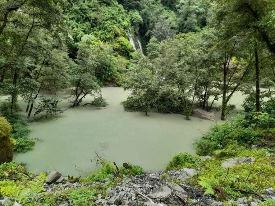
Ghanshyam Khadka
The immediate threat of flood in the Rahughat stream in Raghuganga Rural Municipality-6, Myagdi was averted on Thursday after the dam formed by a landslide was cleared after nine hours of blockage.
“The immediate threat has been averted, as the landslide debris made way for the stream water to flow. However, the stream can be blocked anytime, as the landslide is still running up at Rayokhor cliff,” said Ganesh Bahadur Adhikari, the chief district officer of Myagdi. “Meteorologists have forecast heavy rainfall for some days so the downstream settlements are still at risk of floods and landslides.”
The incident site is about 35 km north-west of Beni, the district headquarters of Myagdi.
According to local residents, the landslide that erupted from Rayokhor area dammed the Rahughat stream, which empties into the Kaligandaki river, at around 5 am on Thursday, forming an artificial lake of around one kilometre long, 20 metres wide and 15 metres deep. Huge boulders dammed the stream that flows in the narrow gorge between wards 6 and 7 of Raghuganga Rural Municipality.
Om Pun, a resident of Chimkhola in Raghuganga-7, told the Post that water started overflowing from the landslide-dammed lake at around 2pm.
Rayokhor is a landslide-prone area. A huge landslide in 2000 had displaced 40 households in a settlement.
A week ago, a landslide in Rayokhor had blocked the stream for half an hour. Similarly, the Rahughat stream had been blocked in Pakhapani area for around six hours three years ago.
Myagdi, a mountain district of Gandaki Province, is prone to floods and landslides. The landslides often fall and block the Rahughat, Myagdi and Kaligandaki—three major rivers in the district—leaving riverside settlements at high risk.
On July 25, a massive landslide blocked the Gurjakhola in Dhawalagiri Rural Municipality-1. Water started flowing out after eight hours but the lake dammed by the debris is still there.
“Riverbed settlements including Beni are at high risk of floods and landslides. Every year, we have to face flood-and-landslide-related disasters,” said Hari Krishna Shrestha, a local campaigner of the Beni Conservation Campaign. “We are making efforts to protect Beni bazaar and other riverbed settlements from such disasters.”
Badarjung cliff, which lies at the border of Myagdi-Mustang; Guithe cliff at Dana; Tatopani cliff in Bhurung; Nepane cliff in Gharkhola; and Timure cliff in Ghar are at risk of landslides. “If a landslide occurs in any part of these cliffs, Kaligandaki river will be blocked,” said Shrestha.
Like Raghuganga and Kali Gandaki rivers, Myagdi river, which originates from Paschimgurja, Churen and Dhaulagiri Himal, also gets blocked because of floods and landslide debris time and again.


 16.12°C Kathmandu
.jpg)
