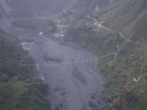
Around a dozen settlements along the Kali Gandaki river in Baglung face the risk of sudden flooding from landslides and glacial hazards upstream, potentially exposing hundreds of households.
The concern comes amid a history of floods and landslides in the district. Over the past decade, the Bhuji, Taman and Badigad rivers have repeatedly flooded and triggered landslides, displacing hundreds of households, putting dozens of settlements at risk and causing extensive damage to livestock and crops.
Authorities have yet to fully assess the exposure of communities along the Kali Gandaki river or put measures in place to reduce the danger. They are now assessing the risks along the river and preparing a contingency plan in case a sudden rise in water levels causes flooding.
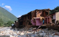
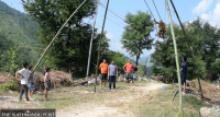
Landslides cut through several parts of Burtibang bazar, washing away houses and damaging bridges.
In 2018, a landslide blocked the Badigad river, creating a huge lake that remained for about a year. The lake submerged settlements and washed away roads, creating a serious threat to communities downstream. Fortunately, the Turture lake gradually drained after about a year. Had it burst suddenly, downstream settlements could have been at risk.
But the road has still not been rebuilt, and no effective measures have been taken to manage the risks around the Badigad river. The threat of another disaster remains.
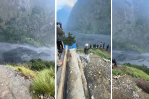
The settlements along the Kali Gandaki river, which flows through Baglung, face an even greater risk. Landslides falling into gorges in neighbouring Myagdi could suddenly raise the river’s water level, said soil conservation expert Sher Bahadur Shrestha.
Several years ago, a landslide at Baisari in Myagdi swept away about two dozen houses, spreading fear among communities downstream. In recent years, the risk has increased as dry landslides have become more common in Mustang and rainfall and flooding have begun occurring there amid climate change, Shrestha said.
He urged the state and local government to act in time to manage settlements along rivers and streams and reduce their exposure to disaster.
Settlements built along the banks of the Daram, Badigad, Bhuji and Gaudi rivers in central Baglung are also at risk, said Krishna Prasad Acharya, chief district officer and chair of the District Disaster Management Committee.
Acharya said many homes had been built close to rivers, leaving communities exposed to recurring risks. Authorities should raise awareness about potential hazards, he said.
He said the Disaster Management Committee normally responds to disasters, but is also taking steps to prepare for them before they occur, he said.
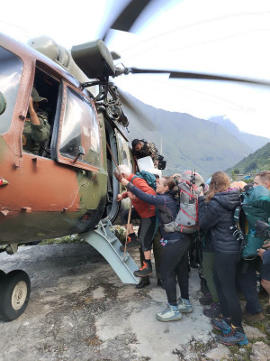
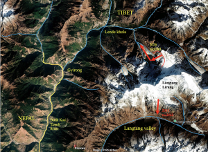
The committee has formed a team to assess the risks along the Kali Gandaki river. Because the river is fed by glaciers, there is a possibility of an ice or glacial landslide entering the river at any time, potentially causing an impact similar to the August 26 Bhotekoshi floods. The committee is therefore preparing a contingency plan to reduce potential damage based on a risk assessment.
Acharya said the team, including technical personnel, would collect data on households along the river and determine how far each house is from the river and how high it sits above the riverbank.
The committee has also begun discussions on a safety study after reports that the water level at Panchakunda, a lake near the Annapurna Base Camp, has risen. The committee is assessing whether an ice or glacial landslide could enter the Kali Gandaki river and trigger flooding.
Water from the lake flows through Mistri river to Narchyang in Myagdi before joining the Kali Gandaki river. Hydropower projects with a combined capacity of more than 150 MW are also under construction in the area.
The committee has asked the Infrastructure Development Office, the Integrated Service Office and other agencies to conduct a study using technical and other personnel to collect accurate data. The findings will be presented at a committee meeting for further discussion.
The committee also plans to prepare a long-term risk-reduction plan, with particular attention to areas up to nine metres above the river level and on both sides of the river, based on the fact that floodwaters in the Bhotekoshi disaster rose by as much as nine metres.
A dozen settlements lie along the Kali Gandaki river, including Beni bazar in Myagdi and Maldhunga, Nirayaghat, Majhi settlement, Dhodeni, Jaiminidham and Belbagar in Baglung. Hundreds of people and households live in these settlements.
The Galkot bazar lies along the banks of the Daram and Gaudi rivers, where hundreds of houses have also been built close to the riverbanks.
The risk in the event of a major flood is difficult to assess, said Bharat Sharma, mayor of Galkot Municipality.
“Many of the houses along the riverbanks were built before the municipality was established,” Sharma said. “The municipality has plans to reduce the risk, but technical difficulties have made it difficult to implement all of them.”
Even a normal flood in the Daram river could put markets such as Hatiya, Harichaur and Baskokhala at risk, he said.




 18.18°C Kathmandu
.jpg)