National
8,848.86 metres. That’s the height of Mt Everest now
The new height announced jointly by Nepal and China puts an end to the one constantly asked question: How tall is the world’s highest mountain?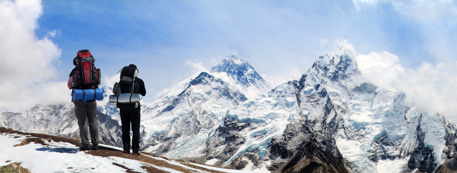
Sangam Prasain
8,848.86 metres.
That’s the new official height of Mount Everest Nepal announced on Tuesday. The new announcement puts an end to the decades-long debate on the height of the world’s tallest mountain.
The precise height of Mount Everest had been contested ever since a group of British surveyors in India declared the height of Peak XV, as it was initially called, to be 8,778 metres in 1847.
The new height was announced as per the joint measurement efforts by Nepal and China, the two countries the 8,848.86-metre mountain straddles. This new height converts to 29,031. 69 feet. The earlier accepted height was 8,848 metres or 29,028 feet.
[Read: This is what it takes to get a foreigner to Everest]
The official height was announced simultaneously in Kathmandu and Beijing amid a programme attended by Nepal’s Foreign Minister Pradeep Gyawali and his Chinese counterpart Wang Yi.
“This is a historic day,” Foreign Minister Gyawali said, making the much-awaited declaration on Tuesday. “The new height of Mt Everest is 8,848.86 metres.”
Chinese Foreign Minister Wang too announced the mountain's height to be 8,848.86 metres immediately afterwards.
Nepal had been working on the measurement of Everest since 2011.
“The measurement is within centimetres of accuracy,” Sushil Dangol, the national coordinator of the Mt Everest Height Measurement Secretariat at the Survey Department, told the Post. “The data of the survey conducted by Nepali and Chinese measurement teams was processed to calculate the height. The margin of error is within centimetres.”
The “rock height” has not been announced.
[Read: In a new record, over 200 climbers summit Everest in a single day]
A range of methods including traditional ones and those based on the latest technology were used to come up with the figure.
“There have been several surveys conducted in the last 170 years by different countries but Nepal has never measured its own peak,” said Padma Kumari Aryal, minister for land management, cooperatives and poverty alleviation. “This survey will end debates on the height of Everest once and for all. This will be a commonly accepted height.”
Between 1849 and 1855, the Survey of India made observations from Dehradun, India base to Sonakhoda base in Bihar. During these triangulation observations, the Himalayan peaks of Nepal were also observed. At that time it was not known that this peak in the Himalayas was the highest in the world.
During computations, the mean computed height of Peak XV came out to be 29,002 ft, or 8,839.80 metres, and it was later named after Sir George Everest, the ex surveyor-general of India.
[Read: Lonely Planet ranks Nepal’s Everest base camp as 4th best trek in the world]
The widely accepted height of 8,848 metres or 29,028 feet was determined by the Survey of India in 1954 from Bihar using the trigonometric method. It was the third survey conducted by India.
The second highest mountain in the world is K2, at 8,611 metres (28,251 ft) and is located in Pakistan.
The height of Everest has never been precise.

A Chinese survey in 1975 obtained the figure of 29,029.24 feet (8,848.11 metres), and an Italian survey, using satellite surveying techniques, worked out a value of 29,108 feet (8,872 metres) in 1987, but questions arose about the methods.
In 1999 an American survey, sponsored by the National Geographic Society and others, took precise measurements using a global positioning system, or GPS, equipment. Their finding of 29,035 feet (8,850 metres) was accepted by the society and by various specialists in the fields of geodesy and cartography.
Nepal had welcomed the revelations but continued to use the height of 8,848 metres determined in 1954.
“Their finding of 29,035 feet [8,850 metres], plus-minus 6.5 feet [2 metres] more than the accepted height, was accepted by the American society and by various specialists in the fields of geodesy and cartography. But Nepal did not accept it,” said Ganesh Prasad Bhatta, former head of the government's survey department.
[Read: Kami Rita Sherpa scales Everest, second time in a week, to take his record tally to 24]
Nepal said it would like to carry out its own measurements.
In 2005, the Chinese State Bureau of Surveying and Mapping re-measured the peak utilising the ice-penetrating radar system in conjunction with GPS equipment and declared 29,017.12 feet (8,844.43) metres to be the Everest rock-height.
Chinese and Nepali officials had then disagreed over the height of the iconic peak over whether the snow height or the rock height should be accepted.
Nepal disputed the Chinese figure, preferring what was termed the “snow height” of 29,028 feet.
Nepali mountaineering officials say that the height was one of the key reasons why Nepal had been drawing Everest aspirants in droves.
[Read: Road to Everest: Tourists can breakfast in Kathmandu and drive to Khumbu for dinner]
Ang Tsering Sherpa, former president of the Nepal Mountaineering Association, said that the number of Everest aspirants in Nepal started to swell from 2007 when China started issuing Everest climbing certificates stating the height as 8,844.57 metres against 8,848 metres in certificates issued by Nepal for the same peak.
The lower height was not recognised by various international organisations, including the Guinness World Record that tracks and documents record-breaking facts and achievements, he said.
Since 2016, China started issuing climbing permits stating the height as 8,848.13 metres.
“Now, there will be a common height which will end all debates,” said Sherpa about Tuesday’s announcement.
But it will give China a huge advantage in the Everest climbing industry.
“Climbing Everest through the northern side is much cheaper than climbing from the southern side,” he said. Everest is Nepal’s biggest cash cow when it comes to tourism.
[Read: Ang Rita Sherpa, who climbed Everest 10 times without bottled oxygen, dies at 72]
An Everest permit costs $11,000 for foreigners but most hopefuls end up spending an average of $50,000 on gear, room and board, and hiring guides and porters. The government collects $4 million from permits alone, according to the Department of Tourism.
“But the cost of climbing from the north is almost half of that. The package from China costs an average $25,000. As people are price sensitive, China will have a big advantage now,” said Sherpa. “However, in Nepal, the money spent by a climber mostly benefits Nepal’s rural economy.”
But climbing from Nepal, home to eight of the 14 highest mountains in the world, has many other advantages.
Sherpa said rescue from Nepali side is prompt, it enables trekkers to enjoy a complete adventure—trek for weeks to reach the base camp and then the adventure of climbing from south is a life changing experience, said Sherpa.
As for climbing from the Chinese side, there is a motorable road right up to the base camp and this has the additional hazard of altitude sickness.
Around the world, Nepal is known by two words—Everest and Sherpa. But that too is about to change.
“China is producing a lot of high altitude climbing guides. The government trains them for at least two years,” said Sherpa. “Within a few years, China will not require Nepali Sherpa climbing guides although the majority of climbing guides on the Chinese side are Sherpas now.”
According to the Sherpa, hiring Sherpa guides costs an extra $8,000 for a foreigner climbing from the north.
Ruan Zongze, executive vice president of the China Institute of International Studies, told the Global Times on Monday that reaching a consensus on the issue reflects the two countries' mutual respect and willingness to extend cooperation by promoting information sharing.
“Mount Qomolangma [Everest] could be seen as a symbol of friendship between the two countries,” the Chinese government’s mouthpiece Global Times quoted Ruan as saying. “Rather than surveying the height separately, China and Nepal agreed on a unified result, similar to the mountain's area division.”
Nepal had announced in 2011 measuring the mountain’s height as a “national pride” project but the project could not move forward because of political instability and a lack of funds.
But urgency was felt after some geologists speculated that the height of Everest could have changed due to the 2015 earthquake with a possible shift in its position, according to Nepal’s survey department.
The project finally kicked off in 2017. Nepal used early traditional as well as new technologies to measure the mountain’s height.
Dangol, the national coordinator of the Mt Everest Height Measurement Secretariat, said that the Nepali survey was a mixture of the traditional and latest technologies conducting five sets of surveys: precise levelling, trigonometric levelling, gravity survey, global navigation satellite system, or GNSS, survey and summit observation.
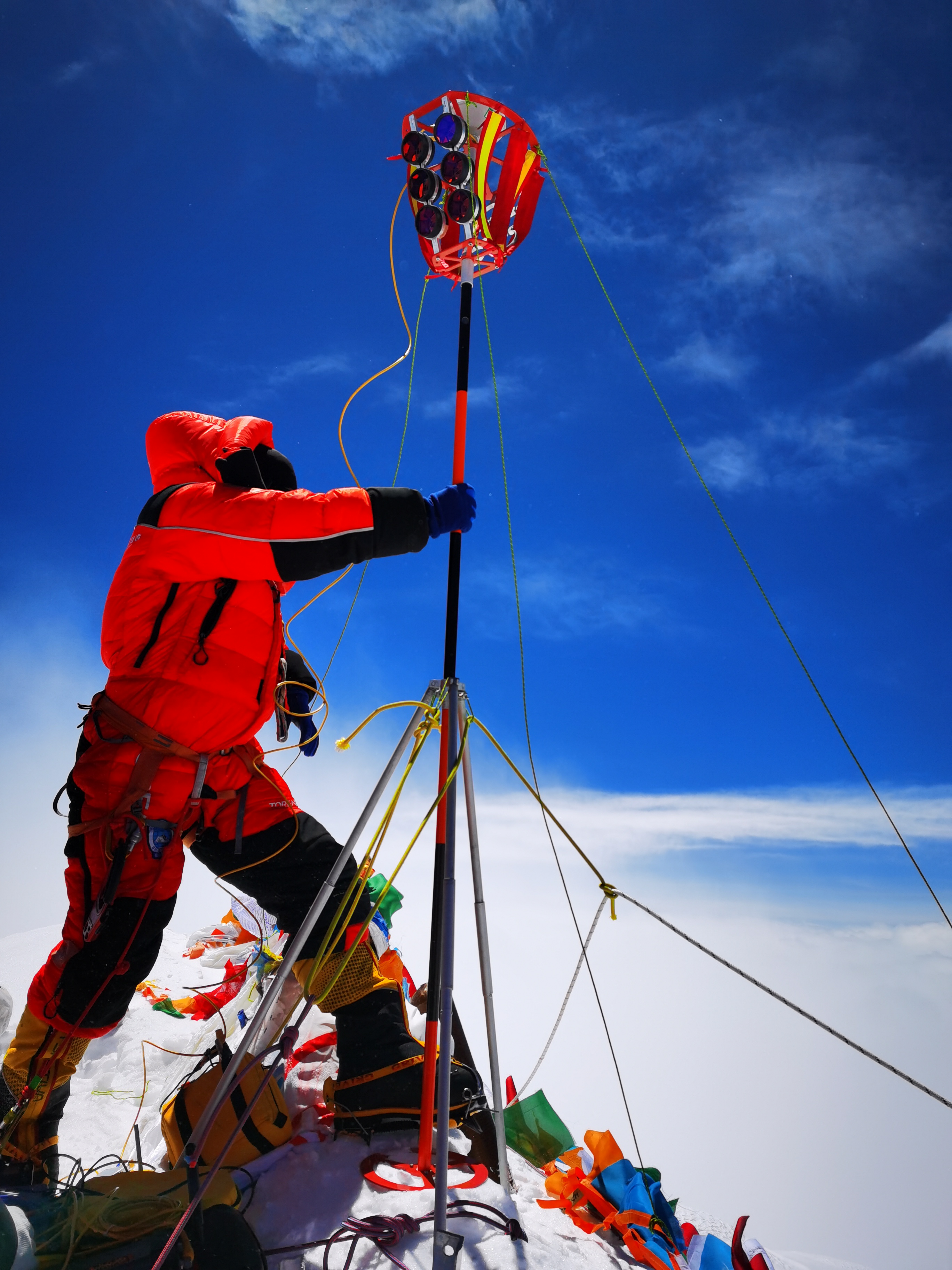
The GNSS survey, a constellation of satellites providing signals from space transmitting positioning and timing data, was conducted at the top of Everest and the data was collected for 1 hours 16 minutes and ground penetrating radar survey was also conducted at the time to find the snow depth, he said.
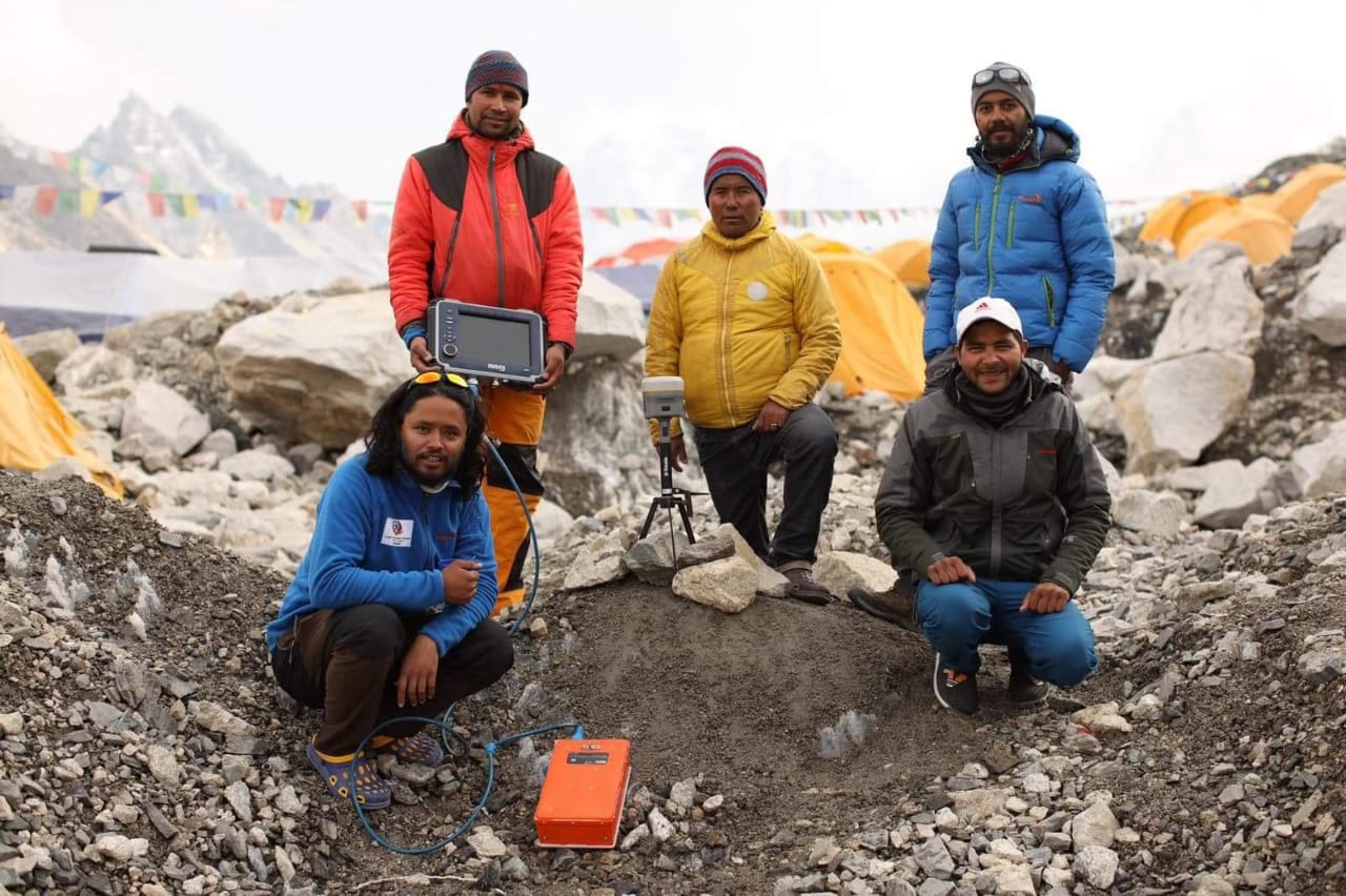
According to the department, the precise levelling is conducted to find height from the southern plains of Nepal to the selected control points. Trigonometric levelling is performed from selected control points (points to which height is carried by precise levelling); gravity survey is conducted to define the local geoid around the Everest; and GNSS based survey is conducted for determining locations of gravity points, benchmarks as well as the summit of Everest.
Nepal’s own survey team led by Khim Lal Gautam climbed Everest on May 22, 2019, and installed global positioning system equipment and ground-penetrating radar at the summit.
Chinese surveyors had reached the top of Everest on May 27, 2020 for their own survey.
The Chinese team used China’s BeiDou navigation satellite system and Chinese surveying instruments. This seventh round of survey in May achieved multiple technological breakthroughs, including the use of BeiDou Navigation Satellite System, and real-scene 3D technologies to obtain a reliable, accurate result and the status of natural resources on the mountain, according to Chinese media reports.
[Read: With Everest expeditions cancelled, guides and porters could carry down trash and dead bodies]
China's domestically developed BeiDou Satellite Navigation System, or BDS, and second-generation Geostationary Meteorological System, the Fengyun-4, as well as the Zhongxing-6A communication satellite also significantly contributed to the completion of the mountain quest. GNSS was also carried by the team to the peak, Chinese media reports said.
"In the 2005 quest, GNSS satellite measurement mainly relied on the US GPS system. But this year, we shall reference data from all four existing GNSS systems—the GPS, Europe's Galileo, Russia's GLONASS, and China's own BDS. And the BDS data will be at its centre," Li Guopeng, an official with the Ministry of Natural Resources, was quoted as saying in the Global Times report.
It was during Chinese President Xi Jinping’s visit in October last year that Nepal and China agreed to jointly announce the height and settle once and for all the decades-long debate over the height.
A total of 6,507 mountaineers have climbed Everest from the Nepal side since Tenzing Norgay Sherpa and New Zealander Edmund Percival Hillary first set foot atop the world's highest peak in May 1953.


 11.73°C Kathmandu
