Land classification delays force government to amend regulations for fourth time
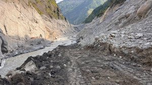
Subdivision of plots remains suspended in 333 local units as only 420 have completed classification, with local units citing a lack of funds and technical staff. The Mid-Hill HIghway runs parallel to paddy terraces in Melamchi, Sindhupalchok in this picture taken last week. RSS
The government is preparing to amend the Land Use Regulations 2022, for the fourth time, in an attempt to ease restrictions and allow transactions to resume temporarily in areas where classification remains incomplete.
Land plotting has been suspended in 333 local units as they have failed to classify land according to its designated use.
The Ministry of Land Management, Cooperatives, Federal Affairs and General Administration has already sent a draft amendment to the finance ministry for approval. “Once the finance ministry gives its consent, we will forward it to the law ministry. It will come into effect after the Cabinet approves it,” said Ganesh Prasad Bhatta, spokesperson for the Ministry of Land Management, Cooperatives, Federal Affairs and General Administration.
The government has repeatedly amended the regulations to allow temporary land plotting in the local units that have not completed classification. However, restrictions have been reimposed whenever the extended deadlines expire without the necessary work being completed.
According to the land ministry, only 420 of the country's 753 local units have classified their land into the prescribed categories. The Land Use Act, 2019, requires local governments to establish land-use councils and implement classification and land-use policies based on maps and data provided by the government.
Under the regulations, land must be divided into 10 categories, including agricultural, residential, industrial, forest, mining and mineral, and commercial areas.
Since the act and regulations came into force, the land plotting for transactions involving portions of land has been restricted in local units that have not completed classification. However, transactions involving entire plots, inheritance divisions, transfers of inheritance rights, court-ordered transactions and removal of land records are still permitted, according to Bhatta.
The latest disruption follows several rounds of restrictions. In August 2026, land plotting had stopped in 390 local units. In 2025, the process was suspended from July after 500 local units failed to complete classification. Only 253 had completed the full exercise at the time.
A similar situation arose in September 2024, when land administration services, including plotting, were halted in 620 local units because only 133 had completed classification.
The repeated disruptions reflect the failure of successive deadlines to produce the intended results. When the regulations were introduced in May 2022, local units were required to identify agricultural land by specifying its boundaries within six months. However, only a few local units had completed the task within the timeframe.
The government subsequently required classification into all 10 categories. In August, 2023, it amended the regulations to give local governments another year to identify agricultural land and specify its boundaries.
The first amendment also relaxed minimum plot-size requirements. It allowed residential and commercial land to be subdivided into plots as small as 80 square metres and agricultural land into plots of up to one ropani. Previously, residential plots could not be smaller than 130 square metres. For agricultural land, the minimum was 500 square metres in the Kathmandu valley and 675 square metres in the Tarai and inner Tarai.
Different standards apply to agricultural, residential and commercial land under the classification system. Commercial and residential development must also meet local road standards.
Despite extending the deadline by a year, the government found that many local units had not completed the work. The ministry amended the regulations for a second time in 2024. The law ministry had already advised against the second amendment, according to the land ministry.
A third amendment extended the deadline for identifying agricultural areas with clearly defined boundaries until mid-July 2026.
Progress has remained uneven. According to the land ministry's figures, 176 local units have prepared parcel-level details, while 130 have developed the required bases and criteria and updated their maps. Another 61 have prepared the bases and criteria but have yet to complete the remaining work. Eight have identified agricultural areas only, while 38 have not started the process.
The ministry is now preparing another amendment, largely to reopen land plotting in areas where classification remains incomplete.
Bhim Prasad Dhungana, president of the Municipal Association of Nepal, said many municipalities lacked the financial and technical resources to complete the exercise. Classifying land costs at least Rs1.5 million to Rs2 million, but neither the federal nor provincial governments have provided adequate funding, he said.
“Many local governments cannot afford the cost. There is also a shortage of technical personnel required to carry out the work,” said Dhungana.
The restrictions have affected not only property developers but also ordinary households that need to sell land to meet urgent expenses.
Bishnu Ghimire, president of the Nepal Land and Housing Development Federation, said the suspension had weakened property transactions, with individual landowners bearing the greatest burden.
“Ordinary people are facing more problems than we are. We can move our business to places where land plotting is permitted,” said Ghimire. “But what about someone who needs to sell a plot to pay for medical treatment or send their child abroad for education? They cannot do so.”
The Land Use Act was introduced in 2019, but the government issued its implementing regulations only in 2022, delaying the classification process.
The Office of the Auditor General has also highlighted the need to make land classification practical by ensuring that local governments have adequate resources. Its 62nd annual report said the government should coordinate with local units and provide the necessary support to classify land using the land-use map data transferred by the Department of Survey.
“To manage land subdivision effectively, all local governments should be equipped with adequate resources and supported in classifying land on the basis of the land-use map data,” the report said.




 10.12°C Kathmandu