Nepal is draining four glacial lakes. Scientists say it is not enough
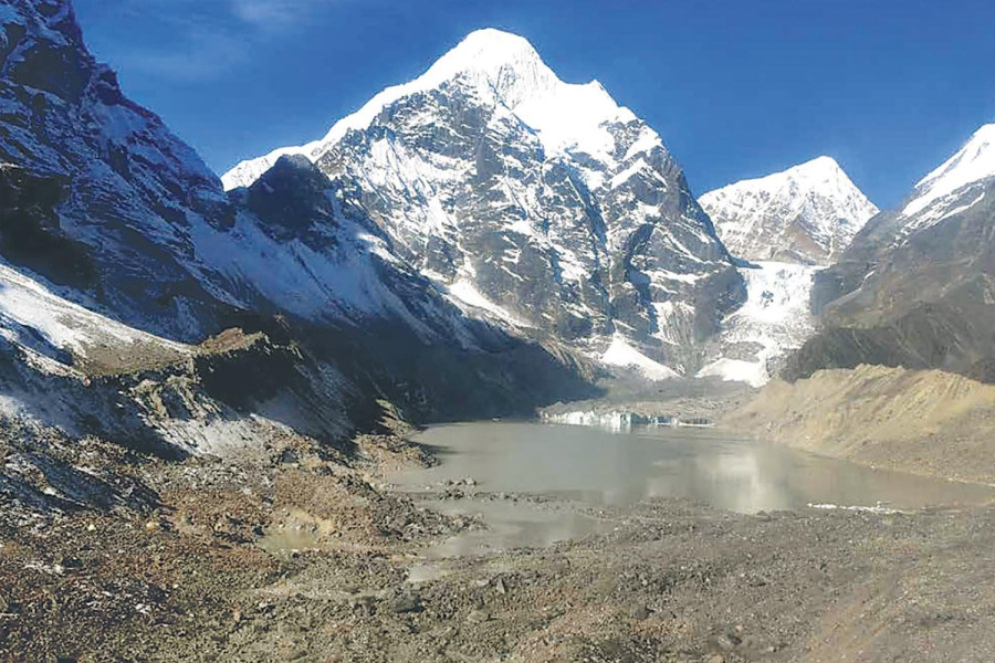
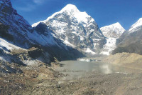
Risk assessment, early warning systems, outlet management and cautious building in the path of a potential flood matter just as much. The Barun glacial lake in the Makalu region. Photo: Courtesy of ICIMOD/UNDP
The August 26 catastrophic floods in the Bhotekoshi region caused loss of life and property at a scale the country is still finding hard to fathom. With the assessment of damage and rescue and relief operations underway, the cascading disaster has posed a hard question: What is Nepal doing about the rest of its mountains?
The answer, at present, is a roughly $50 million project to lower the water level of four glacial lakes in the Koshi and Gandaki basins. But scientists who have studied those lakes say the work, as currently conceived, will not make the downstream settlements safe.
The four lakes—Lumding Tsho and Hongu-2 in Solukhumbu, Lower Barun in Sankhuwasabha and Thulagi (Dona) in Manang—were identified as high risk in a 2020 report by the International Centre for Integrated Mountain Development (ICIMOD) and the United Nations Development Programme (UNDP).The report flagged 47 lakes across Nepal, Tibet and India at high risk of outburst. Twenty-one of them are in Nepal, eight of them newly identified, and 13 flagged in 2011.
Nepal has more than 2,000 glacial lakes. Two of them have been drained so far. The question of what the country does about the rest has taken on new weight since last week’s devastating floods. The country’s mountain region faces compound risk from climate change, earthquakes and geological instability. But as glaciers contract, the lakes forming in their place expand, and the glacial lake outburst floods (GLOFs) they can produce represent a herculean challenge.
The project—Protecting Livelihoods and Assets at Risk from Climate Change-Induced Flooding in Glacial River Basins of Nepal—is funded by a $36.16 million grant from the Green Climate Fund (GCF) under the UN Framework Convention on Climate Change. The government and partner organisations will raise another $13.8 million. The Department of Hydrology and Meteorology, which is running the project in partnership with UNDP, said roughly 2.3 million people living at risk in mountain areas stand to benefit from the project.
The government has named the effort the ‘GLOF Sanjeevani Project’. Rajan Bhattarai, its national programme director, said this year’s work involves appointing consultants and completing the environmental impact assessment, among other preparatory steps.
“Construction will not begin this year,” he said. “We will finish the refined design first.”
Asked how far the four lakes would be drained, Bhattarai said the study had yet to be done. “It will be somewhere around what was done at Tsho Rolpa and Imja,” he said.
That answer is the heart of the scientists’ objection.
The three-metre benchmark
Tsho Rolpa in Dolakha was the first lake Nepal lowered, in 2000, by three metres. Imja, in Solukhumbu’s Khumbu region, followed in 2016 and was lowered by about 3.4 metres. Both figures were set by budget rather than by hydrology.
“This idea of a three-metre reduction is based on Tsho Rolpa, and it is not sufficient,” said Alton C Byers, a specialist in mountain environments and climate change who has studied Nepal’s glaciers and glacial lakes for decades. “The original plan at Tsho Rolpa was to lower it by up to 20 metres, but for want of budget they stopped at three.”
Imja, he said, was lowered by only three metres using Tsho Rolpa as the benchmark.
Jeffrey S Kargel, an American scientist who has studied Imja, Lower Barun and Thulagi, said a lowering of at least 10 metres had been recommended at Imja, but the cost made it impossible.
“When resources are limited, engineered lowering has to be done within the available budget. So you do the best work you can with what you have.”
Binod Parajuli, chief of the flood forecasting section at the DHM, said scientists had advised lowering Imja by at least 20 metres, but the budget did not allow it.
Still, he defends the result. “Even a modest reduction lowers the risk of a natural burst,” he said. “Draining even a few metres of water across an area that size is no small feat.”
The physical difficulty explains part of the cost. Bulldozers and other equipment had to be flown to Imja by helicopter, Parajuli said. When the work was first put out to tender, there was little interest, and after three failed calls the job was handed to the Nepali Army.
“International contractors showed no interest at all,” he said. “Many of those who did, quoted very large sums. There simply wasn’t that much money.”
Byers said lake lowering in Nepal has already proved extremely complex, difficult and expensive. In Peru’s Cordillera Blanca, roughly 31 dangerous lakes were lowered between the 1950s and the 1970s.
But cost, Byers argues, is not a reason to proceed with a number that will not work. “If the lake-lowering programme under the GCF is to be implemented, it must rest on a sound scientific basis, and the level must be lowered far enough to actually reduce the risk,” he said. “Otherwise the work becomes a misuse of the fund, or simply unnecessary expenditure. There is a great deal to learn from Peru's experience.”
Nitesh Khadka, a postdoctoral researcher at the Centre for Water Resources Studies at the Institute of Engineering, Tribhuvan University, puts a threshold on it. “Spending millions of dollars to lower a lake by two or four metres achieves very little,” he said. “It does not reduce the risk downstream significantly. If lakes are going to be lowered, lower them substantially — enough to prevent at least 70 percent of the damage downstream.”
Each lake requires a separate study to understand how far it needs to be lowered, said Byers. “Nepal’s 21 potentially dangerous glacial lakes need new satellite and remote sensing work, field assessment, depth measurement and volume calculation,” he said. “Then you model the floods that would result from low, medium and high discharge, and choose the appropriate measure — lowering the lake, strengthening the terminal moraine dam, or establishing an early warning system.”
Lowering is not the whole job
Neither Tsho Rolpa nor Imja is now entirely safe, scientists say, and the reasons have little to do with depth.
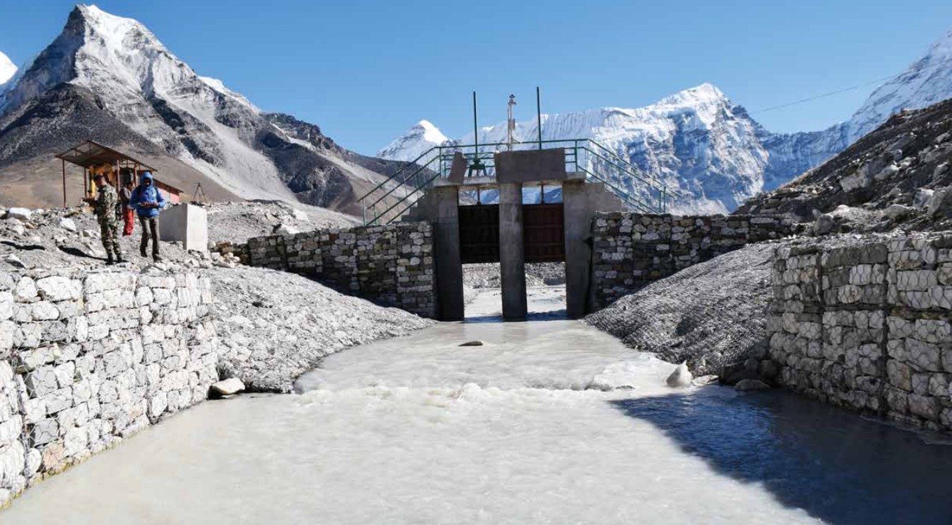
Kargel said arrangements to regulate outflow are also necessary. “It helps you manage the situation when flows increase, and it helps when there is ice inside the moraine and that ice melts, and the lake’s outlet naturally migrates downward,” he said. “Imja has such a flow regulation arrangement."
The construction of an artificial open channel helped lower the water level in Imja Lake by 3.4 metres.
Stabilising the outlet structure at Tsho Rolpa and lowering it by three metres, he said, had proved effective.
The larger gap is downstream. “Along with lowering the water, you have to reduce the exposure of the communities and the infrastructure that face the hazard,” Kargel said. “A great deal of thought is needed when building infrastructure near the likely path of a glacial flood. There is no sense in building expensive infrastructure, having a flood destroy it, building it again and watching it get destroyed again. In my view, sufficient caution has not been taken on this in some valleys in Nepal and India.”
Hydropower investors, he said, should avoid high-risk sites and choose comparatively safer ones.
Parajuli agrees on where the priority lies. No amount of lowering removes the danger if an ice avalanche strikes the lake, he said. “Lake lowering reduces the damage, but how far you lower depends on many things — how much budget there is, what the terrain is like,” he said. “But the single most important thing is the early warning system. And a great many of these lakes need to be observed in the field.”
Rijan Bhakta Kayastha, a professor at Kathmandu University and a specialist in glaciers and glacial lakes, said it is a mistake to assume only large lakes are dangerous.
“Lowering a lake is not the same as removing the risk,” Kayastha said. “Nepal has more than 2,000 glacial lakes. A majority have not even been studied.”
Khadka makes the same point about the list itself. “ICIMOD classified 21 as dangerous using its own method and process. That is not the final word,” he said. “Various peer-reviewed and scientific studies have shown that hundreds of other lakes in Nepal are also at risk. The others need continuous study.”
Size is not a reliable guide. Byers cites the Langmale outburst: the lake is smaller than 0.01 square kilometres, but in 2017 roughly 1.1 million cubic metres of ice, rock and debris fell from Saldim peak into it in the Barun valley, producing a major flood.
The new project has been tasked with assessing lakes beyond those ICIMOD and UNDP identified. “It is not only the large lakes — small ones are at risk too,” Bhattarai said. “We have been asked to complete the risk assessment of all glacial lakes and prepare a report within this year.”
Studying them is its own obstacle. “It is not just the lowering. Studying these lakes is hard environmentally and geographically,” Khadka said. “If we can study them in the field rather than through remote sensing, we can adopt far more effective risk reduction measures.”
Assessments built on old evidence
Risk reduction built on old reports will no longer serve, Kargel said. “The hazard and risk assessments are out of date. They need to be revised on the basis of the events happening now. We also have to work out how to assess the risk from complex events. Government policy, financial investment and infrastructure development planning all have to change on the basis of updated assessments.”
He said the 2021 Chamoli event closely resembled the Bhotekoshi flood. On February 7 that year, an ice avalanche and rockfall in Chamoli, Uttarakhand, triggered a flood that killed more than 200 people.
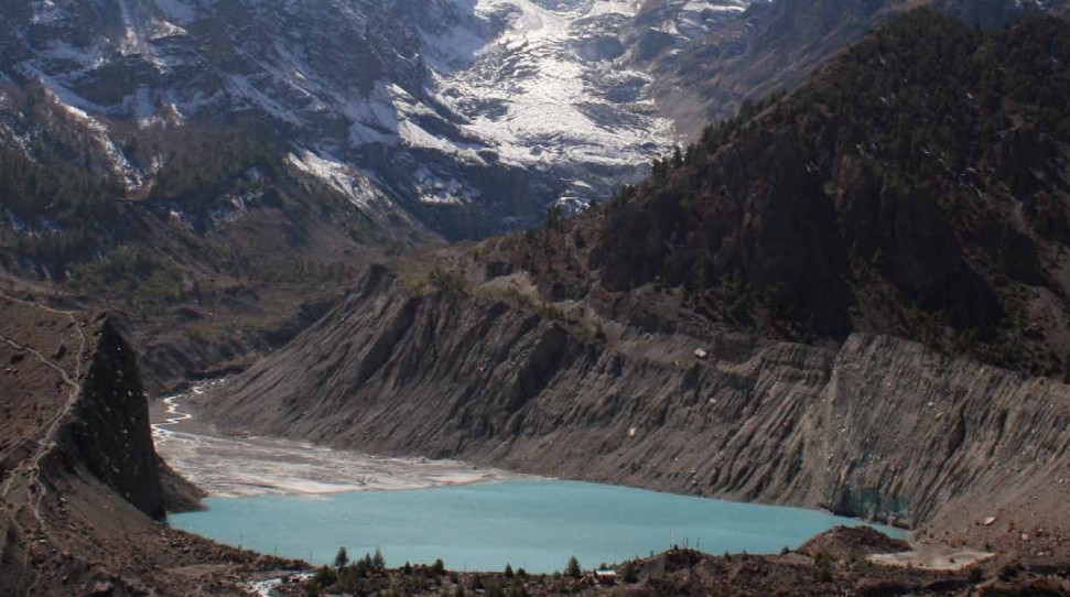
Gangapurna glacier and glacial lake in Manang Valley.
“Scientists carry a large responsibility too,” Kargel said. "The August 26 event, the Chamoli disaster in Uttarakhand in 2021 and the Seti flood in Nepal in 2012 all show the risk is rising. These events are hard to forecast. But scientists need to understand the processes behind such complex events, and how to assess the risks they produce, far better than we do."
The Rapid Situation Analysis Report: Trishuli Catastrophic Flood, prepared on the Bhotekoshi–Trishuli disaster, made a similar point: that a holistic understanding of risk requires integrating knowledge from climate science, glaciology, geology, hydrology, meteorology and river science. Prepared by researchers including Mohan Bahadur Chand, Professor Kayastha and Sanat Adhikari, the report stresses the need to strengthen the link between science and disaster risk reduction.
Kayastha said the Bhotekoshi flood is a lesson in how much research remains undone.
“You cannot confine yourself to a single study and conclude that only glacial lakes pose a risk,” he said. “The glaciers are just as dangerous. Far more research is needed on risk assessment.”




 23.05°C Kathmandu