Construction boom pushes Nepal’s mountain settlements into flood-prone areas
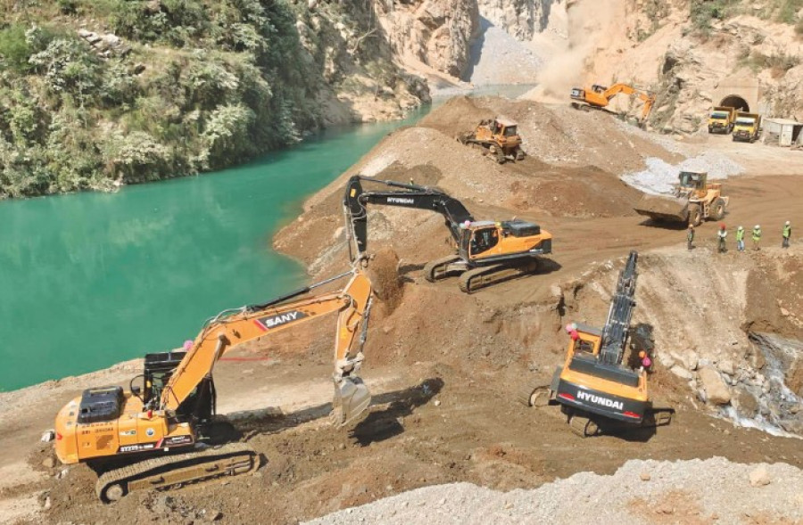
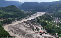
A new study finds at least 108,500 people in Nepal are exposed to potential flooding, as hydropower development, road expansion and unplanned urbanisation increase risks in vulnerable mountain regions. Hydropower projects, road expansion and unplanned urbanisation are pushing settlements into high-risk areas, while disaster preparedness and land-use planning remain weak. RSS File Photo
At least 108,500 people in Nepal are exposed to flood risks as settlements in the country’s high mountain regions expand into vulnerable areas, with the number of buildings in potential flood zones increasing by 78 percent between 2016 and 2023, a new study has found.
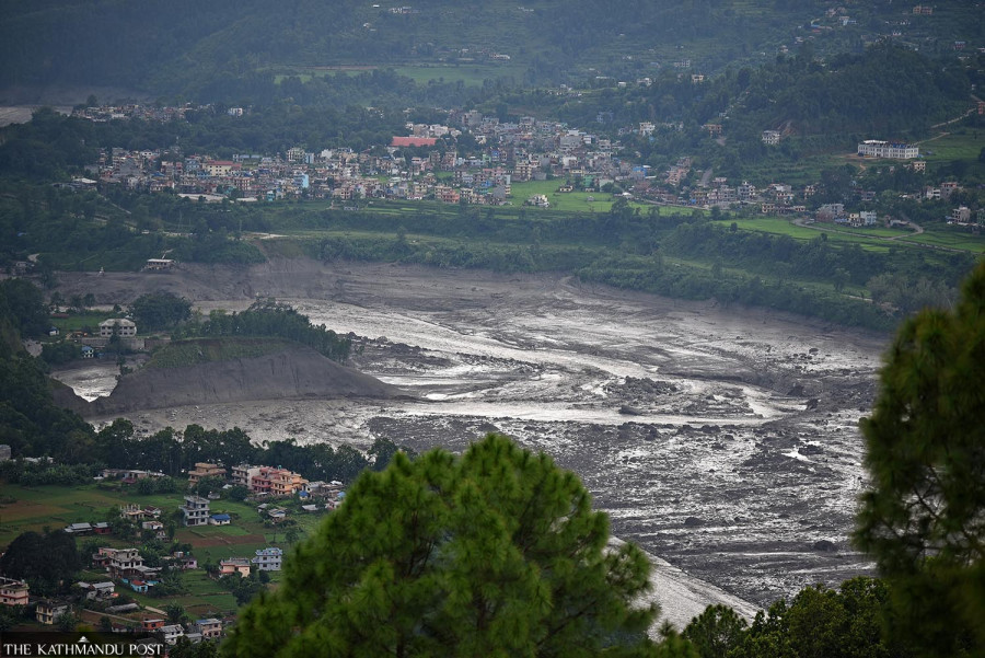
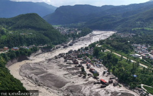
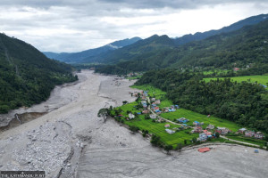
These findings are especially critical for Nepal following the devastating Rasuwa-Bhotekoshi flood, that reached settlements as high as 82 meters above river level, leaving 1,455 dead and 5,285 unaccounted for. With the rise in global temperatures, cascading and compounding hazards like Rasuwa-Bhotekoshi floods are likely to become increasingly frequent.
Given the steep mountain terrain, even small changes in temperature or rainfall can have disproportionate impacts on glaciers and rivers downstream, the study, published in the Nature Portfolio journal, noted. But recent studies have shown that temperatures in the Himalayan region have risen by 3 degrees Celsius in individual winter months, compared with global average warming of 1.4 degrees Celsius since preindustrial times; and that glaciers in the Hindu Kush are melting at twice the rate. Only six years ago, Nepal had identified 21 potentially dangerous glacier lakes across the Gandaki, Koshi, and Karnali river basins. Both their number and size are likely to have increased since then.
Mohan Bahadur Chand, a researcher in the paper who is also an assistant professor at the Department of Environmental Science in Kathmandu University, said they wanted to understand how many buildings and people are exposed to floods coming from higher up in the mountains.
“First we identified buildings and populations located within 50 meters above the existing river level,” he told Kantipur. “Second, we simulated glacier lake outburst floods (GLOF) to understand how far the floodwaters could reach and which buildings would be affected.”
For the study, they used publicly available building and population data, including Nepal’s census. The report revealed that in the entire study region, the total area occupied by buildings within 50 meters of riverbeds had grown by 46 percent between 2016 and 2023. Meanwhile, the number of buildings constructed directly in the paths of inundation from potential GLOFs had increased by 78 percent. It estimated that around 300,000 people across the high mountain regions of Nepal, China and India are exposed to potential flood risks. Of them, at least 108,500 are in Nepal, including over 23,000 living in areas less than 10 meters above riverbeds, where flood exposure is particularly high. More than 80 percent of the structures exposed to potential flooding across the study region are also in Nepal.
The devastating Bhotekoshi floods exposed the dangers, with 1,455 people dead and 5,285 still unaccounted for. Post file Photo
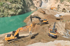
Aggressive hydropower development, rapid construction of border and trade routes along river channels, unregulated tourism infrastructure such as lodges and hotels, and rapid unplanned urbanisation in floodplains were major drivers for the building boom, the study noted.
Basanta Raj Adhikari, director at the Centre for Disaster Studies at Tribhuvan University, said that settlement patterns in Nepal’s mountains have changed significantly in recent decades mainly because of road expansion, changing livelihoods, and internal migration.
“Most roads are built along river corridors where construction materials are readily available,” he told the Post. “But we did not adequately assess flood risks. As we built bridges, hospitals, and other infrastructure, more people moved into hazard-prone areas, increasing their exposure to risks.”
But the study’s findings also raise questions about whose vulnerabilities are being considered in discussions around mountain development and disaster risks.
Shankar Limbu, an advocate, said the study, like the government of Nepal, has failed to prioritise indigenous populations. Pointing to how the construction of hydropower plants in Rasuwa had upended the indigenous ways of life of the Tamang community, uprooting them from what he described as “safe areas” of settlement, he said, “Those who lost their lives in the Bhotekoshi floods did not die, they were murdered.” He added, “People were self-sufficient—they raised cattle, collected herbs, and worked in agriculture. But their lands were forcefully seized for hydropower projects, leaving them with little choice but to work next to the river as laborers for meagre wages.” Limbu also raised concerns about the hydropower project in Bhotkhola, where 192,000 tonnes of explosives and 188,000 detonators are planned to be used to carve out tunnels.
“There are 26 glacier lakes upstream. If explosions trigger an outburst in those lakes, it can destroy entire settlements downstream,” he said. “Yet the government never conducted a proper environment assessment or feasibility study, instead using an environmental impact assessment from Gorkha district, putting indigenous communities at direct risk of disasters.” Although Nepal’s National Disaster Risk Reduction Policy, 2018 calls for risk-sensitive land-use planning based on local assessments of multiple hazards, the study found that these measures remain largely limited to paper. Adhikari said local governments lacked skilled human resources needed to put these plans into practice. He also pointed out that the federal government neither strictly enforced the requirements nor held anyone accountable for failing to implement them. Acknowledging the limitations of the report, particularly that its building data were based on publicly available information, Chand said he hoped the government would use the findings to conduct its own field assessments and implement learnings from the scale of recent disasters. To reduce people’s vulnerability, Adhikari outlined several steps: identifying disaster hotspots using remote sensing in high mountain areas where physical monitoring is difficult, installing ground based sensors to strengthen early warning systems, limiting the expansion of settlements in high-risk areas by offering incentives for relocation, and running campaigns to raise awareness of disaster risks among political leaders and communities.
Similarly, Limbu called on the government to give equal importance to indigenous knowledge in addressing climate change and invest in retaining indigenous ways of life.
“Community members who are working in hydropower plants must not abandon their safe settlements,” he said.




 22.59°C Kathmandu