 20.13°C Kathmandu
Sun, Jul 26, 2026
Weather
Rain disrupts daily life, brings cold, and damages harvest-ready paddy
Heavy rain forecast today in Koshi, Madhesh, Bagmati and Gandaki provinces.
bookmark![]()
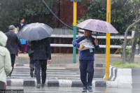
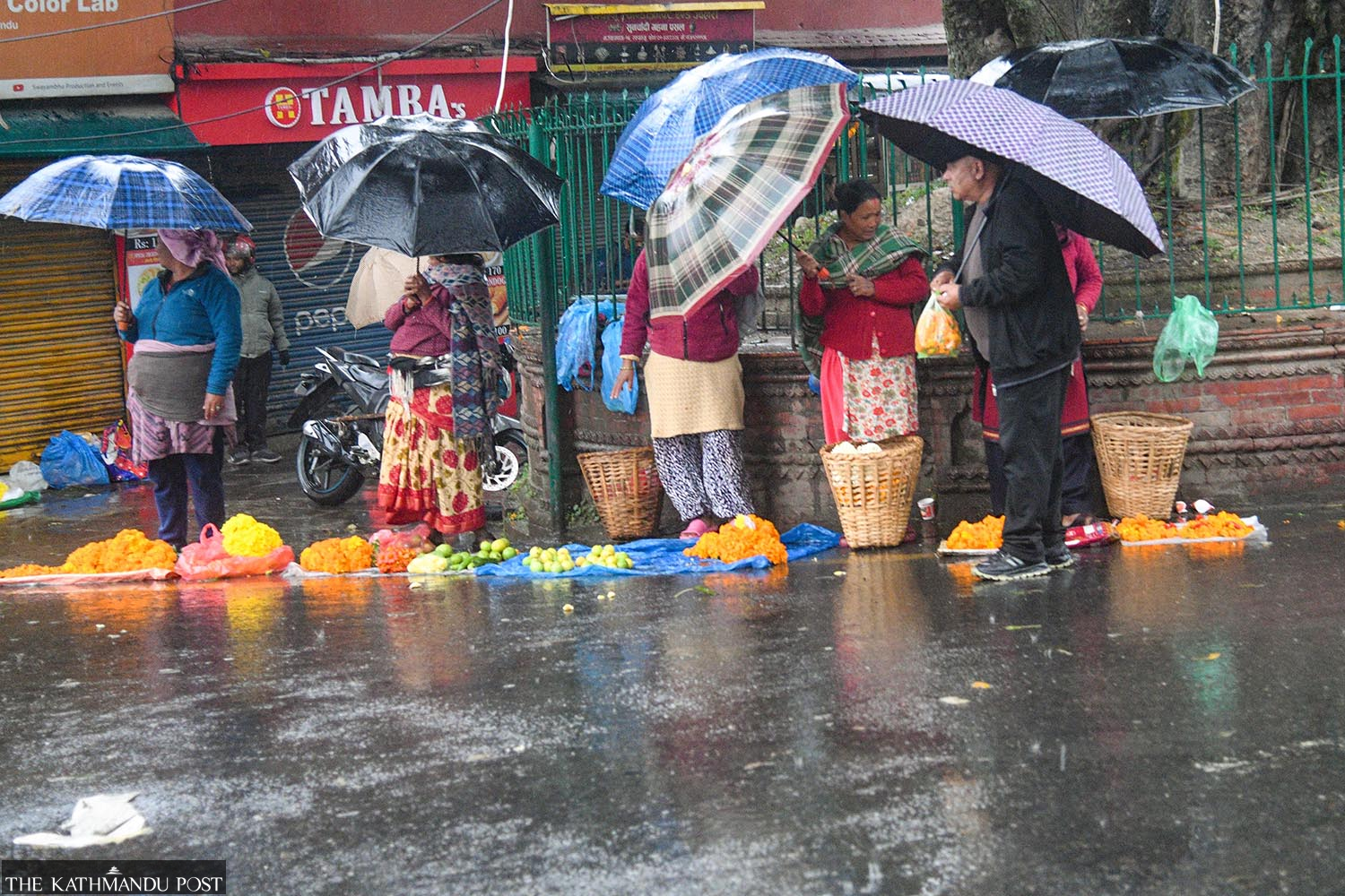
Roadside vendors selling flowers and vegetables wait for customers in the rain at Swayambhu on Thursday morning. Deepak KC/TKP
Arjun Poudel
Published at : October 30, 2025
Updated at : October 31, 2025 07:06
Kathmandu
Throughout Thursday, most parts of Nepal witnessed light to moderate rainfall triggered by Cyclone Montha. The cyclone originated in the Bay of Bengal, made landfall in India’s Andhra Pradesh on Tuesday night, and formed a low pressure system near Nepal.
The country, which had been receiving rainfall since Monday due to westerly winds triggered by a depression in the Arabian Sea, has come under indirect influence of Cyclone Montha’s weather system since Thursday.
Continuous rainfall that started around midnight on Wednesday in some places and early Thursday morning in others not only disrupted everyday life, but also brought an early chill and damaged ready-to-harvest paddy crops in most districts.
Commuters, office workers, and school students were affected by the rain and cold weather.
Several domestic and international flights were diverted due to bad weather conditions.
According to officials at the Tribhuvan International Airport, several Kathmandu-bound domestic flights were forced to return to their respective airports of origin. International flights en route to Kathmandu, including those operated by Nepal Airlines, IndiGo, and Air India were diverted to New Delhi, the Indian capital, and Lucknow, due to adverse weather.
Commuters were stranded due to obstructions caused by rain in the Daunne section on the Naryanghat-Butwal stretch of the East-west Highway.
Tourists, trekkers, and those already in mountainous areas have been affected by the adverse conditions—rain, snowfall, and cold.
With the peak rice harvesting season underway, farmers in most places across the country are busy collecting crops. Many farmers had already been affected by rain since Monday evening.
Most places of Koshi, Madhesh, Bagmati, Gandaki and Lumbini provinces and some in Karnali Province witnessed light to moderate rainfall throughout the day on Thursday.
Meteorologists say the intensity of rainfall will increase at night, which could trigger flooding and landslides especially in the districts of Bagmati, Madhesh and Koshi provinces.
“Intensity of rainfall will increase tonight, and heavy rain is expected tomorrow [Friday] in Koshi, Madhesh, Bagmati and Gandaki provinces,” said Madan Sigdel, associate professor at the Central Department of Hydrology and Meteorology, Tribhuvan University. “There could be landslides in multiple active landslide-prone areas of Koshi Province, which also witnessed landslides in the first week of October.”
The Department of Hydrology and Meteorology on Thursday morning issued orange and yellow flood warnings for the Koshi, Kamala, and Kankai river basins.
“The flow in major rivers in Koshi, Madhesh and Bagmati provinces has started to rise and could reach or cross warning levels tonight and tomorrow,” said Binod Parajuli, senior hydrologist at the Flood Forecasting Section under the Department of Hydrology and Meteorology. “We urge everyone to follow our flood alerts. We will also send SMS warnings to people in risk zones once river levels approach danger marks.”
The department has issued an orange alert for Madhesh and Bagmati provinces and for Gorkha, Nawalpur, Nawalparasi and Rupendehi district for Thursday; all districts of Koshi, Madhesh, and Bagmati provinces, and Gorkha district for Friday; and Sankhuwasabha, Panchthar, Taplejung, Ilam and Jhapa for Saturday.
An orange warning indicates moderate risk. Experts say severe situations due to extreme weather events are likely in the aforementioned districts. For the general public, this serves as a message to make preparatory plans for potential emergencies. As the probability of extreme weather events is high, it is also a request not to travel in risky zones—landslide-prone roads and riverbanks, among others.
Yellow alerts have been issued for several districts in Gandaki, Lumbini, and Karnali provinces.
A yellow warning signifies that serious consequences are possible, though the likelihood is low. Bad weather conditions could still disrupt daily life.
Nepal is one of the world’s most vulnerable countries to the climate crisis and has witnessed extreme weather events over the past decade and a half. The weather has turned more unusual and destructive in the past couple of years.
Evidence suggests that the maximum temperature in Nepal is rising at a faster rate (0.056 degrees Celsius per year) than the global average of 0.03 degrees Celsius per year.
Experts say extreme weather events—excessive rainfall in a short period, continuous rains for several days after the monsoon, dry spells, droughts, below-average precipitation, and above-normal winter temperatures—have become more frequent in recent years.
Arjun Poudel
Arjun Poudel is a health reporter for The Kathmandu Post. Before joining the Post, he worked for Sagarmatha Television, Naya Patrika, Republica and The Himalayan Times.


Editor's Picks

Proposed ‘Romeo and Juliet’ law may spare boys, but what about girls?

Three prime ministers, 10 premierships. Why is Sudurpaschim still Nepal’s poorest province?

Inside the strange, disciplined, unreachable world of Nepal’s Prime Minister

Three credit booms in three decades ended in economic downturn

How Nepal could lose a generation of footballers due to FIFA’s suspension
E-PAPER | July 26, 2026
×