Gandaki Province
972 places in Gandaki Province at risk of monsoon-induced disasters
The study included those places that the administration offices of the respective districts identified as flood/landslide-prone areas.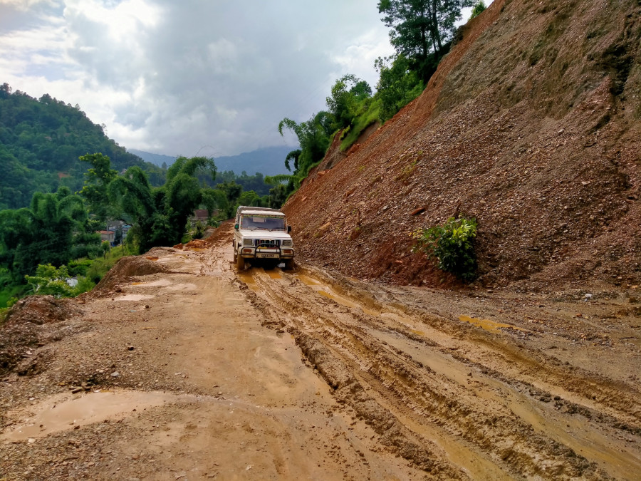
Pratiksha Kafle
As many as 972 places in Gandaki Province are at risk of floods and landslides, a study report says.
A geological study conducted by the provincial government showed that 972 places in 11 different districts of the province are at high risk of monsoon-induced disasters, according Suman Bhattarai, an officer at the Disaster Management Division of the provincial Ministry of Internal Affairs and Law
The study, which was conducted in 2018, made public its report in 2019. According to the report, 385 places are at risk of floods, of which 136 have been categorised as high risk areas. Likewise, 587 places are at high risk of landslides.
The report was prepared in collaboration with the district administration office and the local government.
Tanahun district is at the top of the list with 111 places at risk of floods and landslides. The report shows that 69 places in the district are at risk of landslides while 42 others are at risk of floods.
A total of 106 places in Kaski, 102 in Syangja, 101 in Gorkha, 88 in Baglung, 80 in Lamjung, 67 in Nawalparasi (East), 53 in Myagdi and 52 in Parbat have been identified as areas at risk of floods and landslides. Similarly, 33 places in Manang and 29 in Mustang are prone to monsoon-related disasters.
The report says that the main reasons behind the monsoon-induced disasters are the areas’ close proximity to rivers and streams, earthquakes and unplanned construction activities—mainly the haphazard construction of rural roads. The use of dozers and excavators in the opening of tracks without conducting proper surveys has increased the risk of landslides in many places, says the report.
Though the report categorises 972 places as areas at risk of floods and landslides, Minister for Internal Affairs and Law Hari Bahadur Chuman estimates that nearly 1,500 places in the province are at risk of water-induced disasters at present.
“The study was conducted soon after the formation of the provincial government in 2018. Many landslides occurred in Kaski, Myagdi and Baglung, among other districts, this rainy season. So many places in these districts have yet to be added to the list of flood/landslide-prone areas,” said Chuman.
The study included those places that the administration offices of the respective districts identified as areas prone to floods and landslides. According to Bhattarai, the district disaster management committee headed by the chief district officer of each district keeps the record of such disasters and sends the report to the provincial ministry.
The provincial Ministry of Internal Affairs and Law in the current fiscal year has allocated Rs 10 million to install an early information system in 11 districts of Gandaki Province. The ministry informed that Rs 1 million each was disbursed to nine districts while Rs 500,000 each was allocated to Manang and Mustang. According to the ministry, the budget is mainly spent on organising rescue drills, providing rescue training, buying disaster management goods and providing rescue goods to security agencies.
The provincial government said efforts are underway to relocate the disaster-prone settlements to safer locations but the relocation process is yet to begin. Only the residents of the villages ravaged by floods and landslides this year have been moved to temporary shelters in safe locations.
According to Minister Chuman, an additional Rs 20 million is allocated to the natural disaster fund each year. Efforts are underway to relocate the disaster-prone settlements to safer locations and mitigate the risk of such disasters, he added.
The ministry has also identified 92 places as areas at high risk of lightning while 121 areas are at risk of hailstones.


 12.12°C Kathmandu
.jpg)
