Heavy to very heavy rainfall likely across Nepal from Thursday
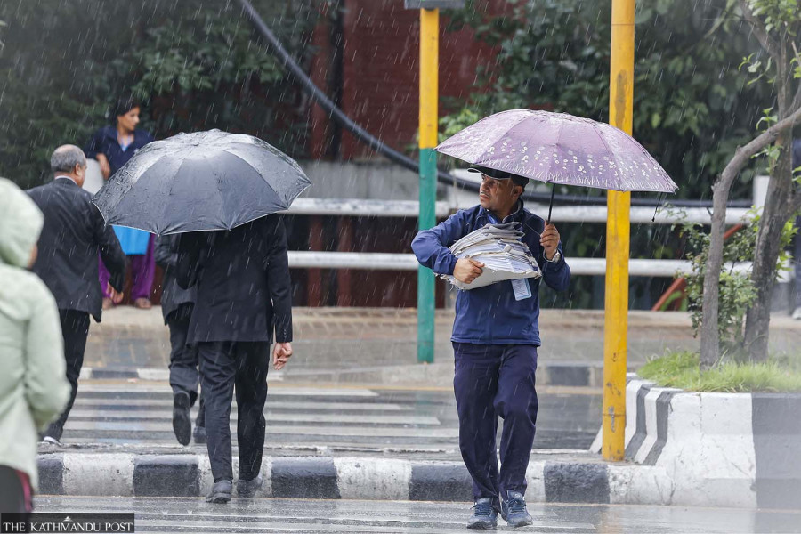
Weather systems developing over the Andaman Sea and Bay of Bengal could bring prolonged downpours across Nepal from September 24-28. The heaviest rainfall is expected in western and central areas. Post file photo
Meteorologists have warned of potentially heavy to very heavy rainfall across Nepal for five days starting Thursday and urged people to remain alert.
The warning comes less than a month after a flash flood in the Bhotekoshi corridor killed more than 1,400 people and left over 6,000 missing in Rasuwa and Nuwakot districts. The August 26 torrent triggered by a glacial collapse destroyed roads and bridges, buried settlements and damaged hydropower projects. Further heavy rain could hamper ongoing relief and recovery efforts.
The Bay of Bengal in the northeastern Indian Ocean is currently generating a low-pressure system that may bring extremely heavy rain to Nepal from September 24 to 28, according to the Meteorological Forecasting Division of the Department of Hydrology and Meteorology.
Nepal is currently under a partial influence of both the monsoon and westerly winds. The monsoon trough, an elongated low-pressure area that acts as the steering mechanism and primary rain-producing zone of the summer monsoon, remains south of its normal position.
According to meteorologists, a low-pressure area has formed over the northern Andaman Sea and adjoining areas and is expected to strengthen and move northwest.
If the two systems reinforce each other, rainfall could become more intense as moisture is drawn towards Nepal.
Binod Pokharel, an associate professor at the Central Department of Hydrology and Meteorology at Tribhuvan University, said several forecast models point to the possibility of “exceptionally” heavy rain starting Thursday.
“I've shared the forecast for the potential heavy to very heavy rainfall expected this week through a video. This post isn't meant to spread fear, but to encourage preparations and awareness,” Pokharel wrote on X.
“Some models show more than 400 millimetres of rain. One shows as much as 741 millimetres,” Pokharel said. That is an enormous amount of rain. It could fall across many parts of Nepal or in just a few places, but the consequences could be serious either way, he suggested.
741 mm is an extremely high amount of precipitation, typically representing seasonal or monsoon totals rather than a single storm event.
The volume of rain forecast by some models could pose a major risk of flooding, landslides and waterlogging, particularly if rainfall persists and drainage systems become overwhelmed.
“Many people are asking me to confirm if this is going to be a severe downpour. I hope to be wrong, because if it doesn't rain, that would be great. But the forecast has been the same—just the locations differ,” Pokharel wrote. “I've only noted it after looking at many models; the probability seems high. I've posted it so that it helps with timely preparation.”
Its influence could increase weather activity over the Bay of Bengal and send more monsoon moisture towards Nepal, meteorologists say.
According to Indian media reports, rainfall is expected to increase in north Bengal, which borders eastern Nepal, from September 22. Heavy rain is likely in Jalpaiguri and Darjeeling on September 23 and 24. On September 25, Jalpaiguri could receive heavy to very heavy rain of 70-200 mm, while heavy rain is likely in Darjeeling, Kalimpong, Alipurduar, Cooch Behar and North Dinajpur.
Sanjib Adhikari, a meteorologist at the Meteorological Forecasting Division, said the eastern system could interact with the weather system to the west.
“Based on the initial track, there is a possibility of very heavy rainfall in Sudurpaschim and central Nepal,” Adhikari said. He urged people to monitor weather information and take precautions as the situation develops.
Whether or not a cyclone forms over the Andaman Sea, the system could still affect Nepal, Adhikari said.
Pokharel likewise said it remained uncertain whether the system would develop into a cyclone, but the threat of heavy rain in Nepal remained. He said many areas could receive repeated spells of heavy rainfall from east to west.
If the weather system moves slowly, the rain could continue for an extended period, he said.
The Department of Hydrology and Meteorology classifies rainfall of less than 10 mm in 24 hours as light, 10 mm to less than 50 mm as moderate, 50 mm to less than 100 mm as heavy, 100 mm to less than 200 mm as very heavy, and more than 200 mm as extremely heavy.
Nepal’s monsoon normally withdraws around October 2.
Pokharel said the current weather pattern could keep the monsoon active until around that date.
Last year, the monsoon withdrew from Nepal on October 10, eight days later than the normal date.
This year, the monsoon entered Nepal on June 19, six days later than the normal onset date.
Pokharel said heavy rain has become a recurring feature of October over the past five years. Heavy rainfall in October 2022, 2024 and 2025 caused significant losses of life and property.
Meteorologists also expect El Niño to alter rainfall patterns this year. The World Meteorological Organisation says El Niño is now firmly established and is expected to strengthen into a very strong event. Its latest assessment gives a near-100 percent probability that the phenomenon will persist through February 2027.
For September-November, the agency expects El Niño to drive significant shifts in rainfall and temperature patterns worldwide. It has also warned of increased risks of extreme weather, including floods, drought and extreme heat.




 19.56°C Kathmandu