National
Panel on Nepal-China border issues calls for bilateral intervention
Government committee suggests joint inspection team of experts from both sides to deal with the dispute, if any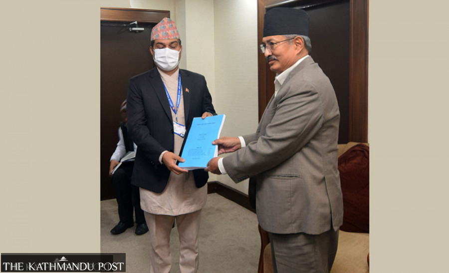
Anil Giri
A panel formed by the Ministry of Home Affairs has concluded that there are some issues along the Nepal-China border in Humla district and suggested that the government resolve those issues by forming a joint inspection group of experts.
The Sher Bahadur Deuba government on August 21 had formed the panel led by Jaya Narayan Acharya, joint-secretary at the Ministry of Home Affairs, to study the boundary issues along the Nepal-China border from Limi Lapsa to Hilsa of Humla.
The six-member panel had representatives from Nepal Police, Armed Police Force, National Investigation Department and the Department of Survey.
At least two members told the Post that the panel found that some boundary pillars in Humla were repaired and fenced without the knowledge of the Nepali side.
“We could not ascertain who fenced the boundary pillars with wire and who repaired them. To address those issues, we have suggested formation of a joint inspection team comprising experts from both countries—Nepal and China,” said Acharya. “The issue needs to be pursued diplomatically.”
The panel on Sunday submitted the report to Home Minister Bal Krishna Khand.
That there were some border issues between Nepal and China in Humla district first surfaced when some local representatives reported that China had encroached upon Nepali territory between border pillar numbers 11 and 12 by changing the alignment of pillar number 12.
The land between pillars 11 and 12 falls in a high-altitude area and the people from both sides were using it as a grazing site.
The report has been kept confidential and Home Ministry officials said they “have not gone through it yet”.
“I have not seen the report,” said Phanindra Mani Pokhrel, spokesperson for the Ministry of Home Affairs.
The panel, according to Acharya, conducted a field visit and interacted with local people and stakeholders before preparing the report.
“We have also included geographical and socio-cultural issues and physical infrastructure built in the area in the report, along with our findings,” said Acharya. “We have also included what we found during our interactions with the local people.”
The panel, according to Acharya, has found some problems in the area, but in the report, it has not categorically called it encroachment.
“Whether there indeed is encroachment can be established only after an inspection and a thorough study by a joint team,” said Acharya. “There is a need to first investigate who carried out repairs of some boundary pillars and who fenced them. These activities, however, are against the Nepal-China Boundary Protocol of 1961.”
Nepal and China concluded the first ever boundary talks in 1961 and signed the boundary protocol. Later in 1963, the two sides completed the demarcation and agreed to install 79 major pillars and 20 sub-pillars.
Later Nepal and China renewed the boundary protocol in 1979 and 1988.
“We had conducted a joint inspection in 2007 and agreed to sign the third boundary protocol in 2010 and fixed a meeting in Xi’an of China, but later it was cancelled,” said Madhusudan Adhikari, former director general of the Department of Survey.
According to Adhikari, as per the joint boundary protocol between Nepal and China, if one side reports any issue in the boundary or any issue surfaces regarding the boundary pillars, such matters should be resolved jointly.
“No side can repair, maintain, colour or fence the boundary pillars unilaterally. It should be carried out through a joint meeting following correspondence between the two sides. Such activities can be carried out in the presence of officials from both sides,” said Adhikari. “As per the boundary protocol, both sides should conduct a joint inspection every 10 years.”
According to the sources at the Department of Survey, before the joint announcement of the height of Mt Everest, Nepal had proposed a joint inspection of the border.
Nepal and China jointly announced the height of Mt Everest on December 8 last year, declaring the world’s tallest peak’s height at 8,848.86 metres.
“We have not received any response to our proposal for joint inspection of the border yet,” said Adhikari. “Now we have to fix the issue of boundary pillar No 57 as well.”
Nepal and China earlier had a dispute over the alignment of pillar No 57 in Dolakha and the height of Mt Everest. The pillar was found missing and there was an issue of marking while China did not recognise the snow height of Mt Everest that measured 8,848 metres.
The border issue with the northern neighbour recently surfaced after Jeevan Bahadur Shahi, a Nepali Congress provincial lawmaker, reported that China had changed the alignment of boundary pillar No 12. He had presented his field study report at the Karnali Provincial Assembly in November last year. He had also called on the Karnali provincial government and the federal government in Kathmandu to carry out a detailed inspection by a joint team of Nepal and China.
After Shahi’s report made it to public domain, on December 4 last year, then foreign minister Pradeep Gyawali had said there was no encroachment by China in the Limi area of Humla.
“Similar issues had surfaced four years ago and the government had sent a team to carry out a study. But it was found that the buildings in the bordering area were actually built within Chinese territory,” Gyawali had said.
But before the issue died down, the Chinese embassy in Kathmandu wrote to the Nepali Congress regarding Shahi’s report on border issues in Humla, much to the chagrin of the party, which was then in opposition. The Congress party took exception to the embassy letter, saying it breached the diplomatic protocol.
In his recent blog post, Buddhi Narayan Shrestha, former director general of the Department of Survey, who is considered an authority on boundary issues, has said that between pillar 11 and 12, there were some issues in 2021 BS [1964 AD] also. The aerial distance between these two pillars is about 35 kilometres but the actual distance on land is bigger. The Tibetan side is also paying land revenue tax so China has rights over this piece of land.”
But the Nepali side in 2021 BS claimed that Nepali people living in the bordering area used to set up sheds near the Nepal-Tibet area and had been paying taxes to the Tibetan authorities for using the land for grazing their cattle for a long time.
“So the Chinese side claiming that Nepali people are paying land tax to Tibetan officials is wrong. They are not paying land tax but they are paying the rent for using the land as pasture. So it does not establish China has its claim over the Limi area,” writes Shrestha.
Later the issue of land dispute in the Limi area landed in Nepal’s Cabinet, according to Shrestha. “China was not ready to initiate talks and later it established its right over that piece of land. The Cabinet then agreed not to hold talks and decided to conduct a joint survey on the basis of the watershed principle.”
“The committee did not particularly indicate any dispute or evidence of the encroachment but it has suggested some lapses on the part of the Nepali side on border administration,” said another member of the panel. “We have suggested that the government take necessary steps to protect our own land and resolve issues, if there are any, diplomatically while conducting a joint inspection of the area.”
Asked when the report would be made public, Pokhrel, the spokesperson for the Home Ministry, said since the study team was formed by the Cabinet, it is up to the government to take a decision.
“We are not authorised to share the report or disclose its content in part or in full to the media or anyone else for that matter,” Pokhrel told the Post. “We will follow the Cabinet’s instructions.”
This article has been updated to correct 21st para. An earlier version misstated that Nepal and India jointly announced the height of Mt Everest on December 8 last year.


 10.12°C Kathmandu
