 22.25°C Kathmandu
Sun, Jun 21, 2026
National
Drone used to study glacier in Manang
For the first time, a group of experts from Nepal have successfully carried out the survey of a glacier located in Manang district using drone, also famously popular as unmanned aerial vehicle (UAV) among the global scientific community.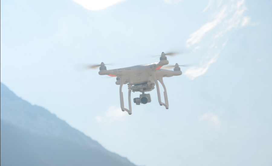
bookmark
Published at : March 29, 2016
Kathmandu
A group of scientists from Nepal have successfully carried out the survey of a glacier located in Manang district using drone, also popular as unmanned aerial vehicle (UAV), for the first time.
Early this month, the researchers from the Himalayan Cryosphere, Climate and Disaster Research Center (HiCCDRC) under the Kathmandu University led by by Rijan Bhakta Kayastha visited Ponkar glacier covering an area of 28.51 square kilometer located at Bhimtang in Manang to carry out glaciological and hydro-meteorological studies, to measure the rate of melting of glacier over a certain period of time.
 “We surveyed a portion of the glacier using UAV and the data obtained from it will be used to create a high resolution topographic map to help find out the total ice melt between two survey periods when they repeat the UAV after 6-7 months,” said Kayastha, coordinator of HiCCDRC, adding, “The studied glacier is one of the nearest and accessible to carry out study on impacts of climate change,”.
According to him, this successful mission has encouraged the Nepalese experts to use UAVs for glaciological studies on other glaciers. The Ponkar Glacier lies in the headwaters of Dudh Khola, a tributary of Marsyangdi River, and the study will help to know the climate of Dharapani to Bhimthang area and contribution of snow and ice melt water to total discharge in Dudh Khola and then in Marsyangdi River.

The study will further focus on the distribution of discharge of Dudh Khola in future using glacio-hydrological model and projected climate data of that area derived from regional climate model. “All these data will be helpful to know the impacts of climate change on Dudh Khola and then Marsyangdi River that feeds to run three hydro power plants,” Kayastha added.
During their study carried out in March this year, the team installed sensors for measuring temperature and rainfall at different altitudes from Dharapani and moving up to Ponkar Lake in order to know the altitudinal variations of these parameters. The team has measured discharge of the Dudh Khola and put a water level sensor there for hydrological study.
The study was funded by the USAID through the University of Colorado, Boulder in U.S.


Most Read from National

NEB publishes Class 12 results, 64.13 percent secure grades

Sudan Gurung returns as home minister, Mahabir Pun gets technology ministry

Beijing raises concerns over US initiatives in Nepal
Nepal, India to operationalise cross-border digital payments

BBC documentary puts Bardiya’s tigers in global spotlight
Editor's Picks

Inside the mission of Everest’s first mountain rangers
Weak arbitration defence costs government billions

Nepalis making treacherous trip to Europe through the Balkan route

Women are often at the centre of Nepali films. Why are men still telling most of their stories?
What old newspapers reveal about Kathmandu’s World Cup fever in the 80s and 90s
E-PAPER | June 21, 2026
×