What triggered the Rasuwa flood? Scientists piece together a complex chain of events
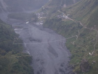
Experts explain how the Bhotekoshi river got blocked and a sudden release of water combined to produce the devastating flood — and what they still don’t know. Image: Courtesy of Google Earth
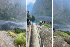
Three days after a flash flood in the Bhotekoshi river in Rasuwa, a district bordering Tibet, resulted in 579 deaths as of Friday evening, scientists are still piecing together how a chain of cascading events unfolded, the scale of the disaster, and precisely where it originated.
Bodies have been recovered as far downstream as Nuwakot, Dhading, Chitwan, Gorkha, Tanahun, and both East and West Nawalparasi, according to Nepal Police — a spread that traces the flood’s path through the Trishuli and Narayani river systems, hundreds of kilometres from where it began.
Initial reports on the morning of August 26 suggested that an earthquake had triggered an avalanche that blocked the Lhende Khola, forming a temporary dam that later burst. Lhende Khola is a transboundary high-altitude river that originates in Gyirong County in Tibet and flows south into Nepal, where it acts as a tributary to the Bhotekoshi and Trishuli river systems.
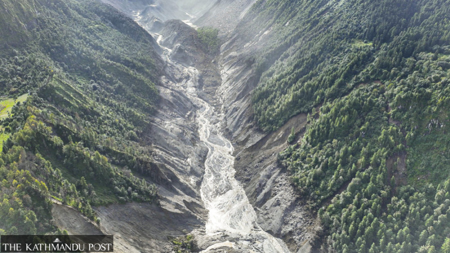
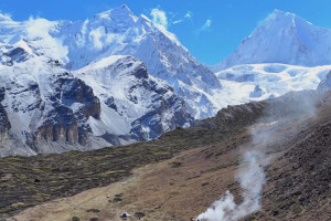
The United States Geological Survey at first suggested that a 4.4 magnitude earthquake triggered the floods. But satellite imagery from Planet Labs found that a large section — about 600 metres (2,000 feet) wide — of glacier and rock had collapsed from an altitude of 5,200 metres, falling 1,200 metres into the valley. The USGS later revised its assessment, concluding that the massive collapse of the glacier itself had generated a seismic signal of 5.2 magnitude.
Scientists believe a glacier and rock collapse sent ice and debris into the Lhende valley, blocking the river before a massive surge of water and debris travelled downstream into the Bhotekoshi and Trishuli.
Nepal’s Department of Hydrology and Meteorology, drawing on satellite images shared by the Chinese side, reached a similar conclusion. Binod Parajuli, a senior divisional hydrologist at the department’s Flood Forecasting Division, said the imagery pointed to a combination of an ice avalanche, permafrost movement and a rockslide.
“The avalanche originated on Nepali territory, but after it came down it crossed the Nepal-China border, causing extensive damage on both sides,” he said. A full technical assessment is still pending — Parajuli said the department’s immediate focus remained on rescue operations, with a field team being readied to travel to the affected area for further study.
Even for climate and environmental scientists, the magnitude of the flash flood in Rasuwa and downstream is shocking, who describe it as the worst disaster in Nepal since the 2015 earthquake.
Nepal’s Department of Hydrology and Meteorology, drawing on satellite images shared by the Chinese side, reached a similar conclusion. Angad Dhakal/TKP
What happened in Rasuwa?
Dr. Mohd. Farooq Azam, a cryosphere specialist at the International Centre for Integrated Mountain Development (ICIMOD) who studies glaciers, snow and ice, said the flood was triggered by a bedrock failure. “When the bedrock gave way, the glacier on top also got swept,” he said.
“The glacier collapse was 100 to 200 million cubic meters in size and hit the valley 1000 meters below,” he added. The size Azam is referring to is roughly 40,000 to 80,000 Olympic-sized swimming pools.
But identifying the immediate trigger does not fully explain how the event turned into such a massive flood. To understand that chain of events, Dr. Upmanu Lall, director of the Columbia Water Center and an expert on water, climate and flood, placed the Rasuwa disaster in the broader context of how glaciers, unstable slopes and water interact in a warming Himalayan environment.
“The conditions were potentially developing for quite some time, maybe even months,” he told the Post in an email interview. Explaining how such disasters develop, Lall said glaciers can melt at higher-than-usual rates because of persistent warming, or because of rainfall rather than snow. The additional water can saturate the slopes below the glacier, destabilising them as water seeps between rock and soil. The slope can eventually fail, sending ice, rock, and debris into the valley.
In the case of Rasuwa, it appears to have happened much as Lall explained — the collapsed glacier blocked Lhende Khola, allowing water to accumulate behind a temporary natural dam before it gave way, releasing a sudden surge downstream.
Because sudden floods are often associated with Glacial Lake Outburst Flood (GLOF), scientists initially wondered whether it was another GLOF. Flooding in the same Bhotekoshi River exactly a year ago in July had also left scientists searching for answers about what could have caused such a disaster, especially because the region had not recorded any rainfall before the disaster. The Department of Hydrology and Meteorology and ICIMOD later concluded, based on satellite imagery, that the flooding was due to GLOF from a supraglacial lake (lake sitting on top of a glacier) in Tibet.
This distinction matters because a GLOF and a rock-ice avalanche may produce similar destruction downstream, but they begin in very different ways. In Rasuwa, the question is not simply whether there was a glacial collapse, but how the collapse generated a tsunami-like disaster.
Recalling last year’s flood because of a GLOF, Sunwi Maskey, a cryosphere researcher, said another disaster was expected. “Such a massive block does not generally just fall, and we are also shocked by its magnitude,” Maskey said.
But identifying the type of event does not fully explain why it became so destructive.
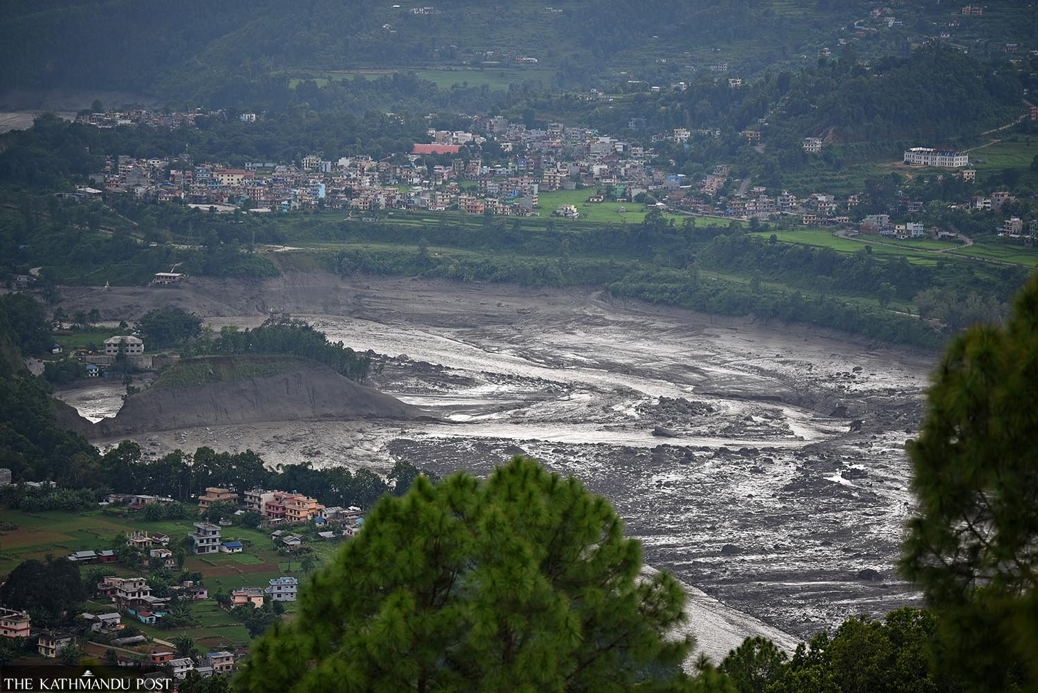
Maskey explained that while ice-rock avalanches are frequent in Nepal, they generally occur at higher altitudes, in uninhabited areas, and do not tend to induce disaster on this scale. But in this case, she said, the friction caused glacier ice to melt into water as it travelled downhill. The mass also swept soil, rocks and sediments along the way, adding water to an already enormous mass of rock and debris hurtling downhill. When it blocked the river, water accumulated behind the temporary dam until it ultimately burst, sending torrents downstream that swept away villages.
But the avalanche alone does not explain the scale of the flooding. What happened after the river was blocked was crucial.
According to Lall, a river blocked by an ice-rock avalanche can transform its normal flow into a catastrophic flood. As water continues flowing into a river but cannot escape, it accumulates behind the temporary dam, and when all the water is released almost instantly, it can turn into a violent flash flood.
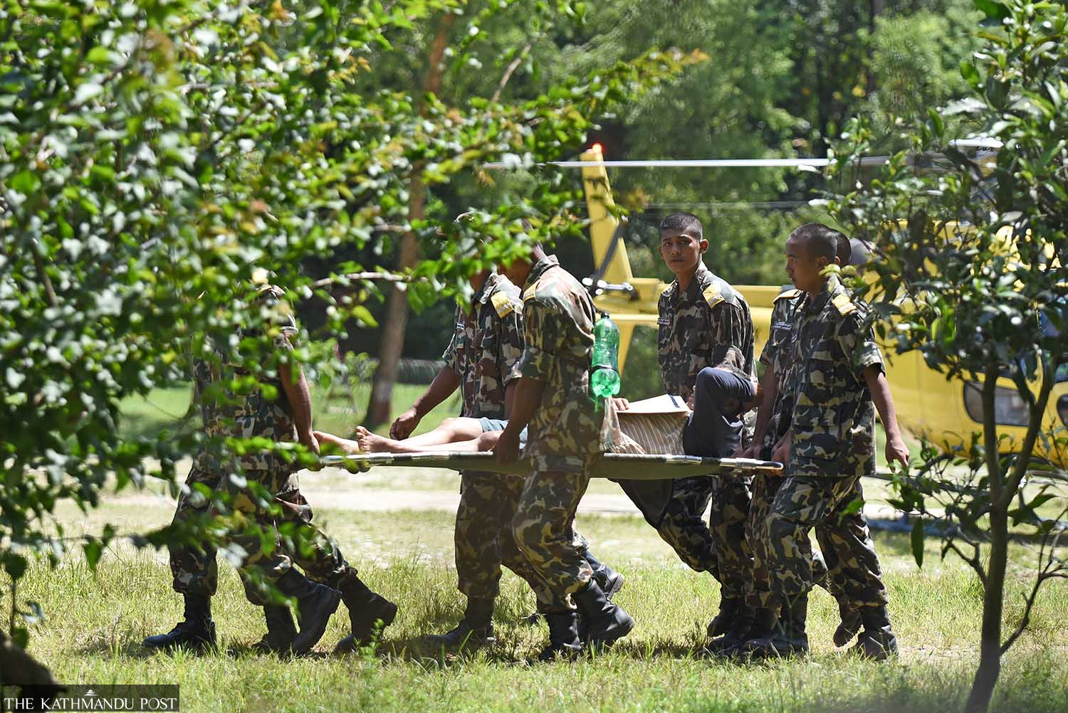
Nepali Army personnel carry an injured flood survivor on a stretcher after evacuating them by military helicopter to Bidur, Nuwakot district. Security forces launched extensive emergency airlifts following devastating flash floods along the Bhote Koshi River corridor. Angad Dhakal/TKP
Did climate change play a role?
The recurrence of the extreme floods in mountain rivers has worried environmentalists, who have long warned that rising temperatures are contributing to changes in the Himalayan cryosphere and increasing the risk of more disasters.Butwhether this flood — or last year’s — in the same river can be linked to climate change is a question scientists say requires further analysis.
Though some experts say it is too early to establish a direct connection with climate change, Lall said warmer conditions could have contributed to increased glacier melting. He suggested comparing temperatures in the weeks preceding the collapse with historical averages to determine whether conditions were unusually warm.
“We are looking at the strongest El Niño in a long time that could also lead to significant regional warming, possibly lower rainfall in the area,” he said. “If the rain had come down as snow rather than rain, the glacier would not be melting.”
But a warmer climate does not automatically mean that every individual glacier collapse can be attributed to climate change.
Dr. Jeff Da Costa, disaster risk expert, University of Reading, UK, said, “Warming is changing glaciers, permafrost, slope stability across the Himalayas, so it’s an important background risk. But we cannot, at this stage, attribute this individual collapse to climate change without further analysis.”
While scientists caution against drawing an early conclusion and a direct link between this particular collapse and climate change, the broader changes taking place across the Himalayas are harder to dispute.
Maskey said they need to analyse a range of factors before making such a connection, but that the background trend is unmistakable. “Himalayan glaciers that would historically have taken much longer to change are visibly retreating within human lifetimes,” she said.
According to ICIMOD, Hindu Kush Himalaya glaciers lost about 12 percent of their total areas and 9 percent of ice reserves between 1990 and 2020.
Research suggests Himalayan glaciers have lost ice ten times more quickly over the last few decades than on average, while Hindu Kush Himalaya glaciers are losing ice at double the rate since 2000.
The Rasuwa extreme flooding is not without precedent in the Hindu Kush Himalaya. The Chamoli floods in 2021 in Uttarakhand, India, were also linked to a bedrock failure, which triggered a massive flow of ice, rock and debris downstream.
The similarity raises a broader question: could an event like this be detected early enough to warn people downstream?
The recurrence of the extreme floods in mountain rivers has worried environmentalists, who have long warned that rising temperatures are contributing to changes in the Himalayan cryosphere and increasing the risk of more disasters. RSS
When minutes, not hours, matter
According to Lall, events such as these could have been detected early with soil moisture sensors on vulnerable slopes, infrared drone imager, and satellite data to assess the changing risk of glacier melt-induced landslides.
But detecting the hazard is only the first step. The bigger challenge is turning that information into a warning that reaches people in time.
Authorities say they had sent SMS alerts as the flood threat emerged on August 26. But sending a warning is not necessarily the same as giving communities enough time or information to react. In Rasuwa, experts say two factors may have limited the usefulness of the alerts: the speed at which the flood moved downstream and the limitations of relying on SMS alone.
Maskey cautioned that technology alone cannot ensure preparedness. “Communities need to be prepared as well. They need to know where to run, which routes are safe, where elderly people and children should be taken. And where first aid or emergency supplies are located,” she said.
“Unless we practice, we wouldn’t know.”
An account from Rajendra Dhungana, chief customs officer in Rasuwa, helps illustrate the scale and speed of Wednesday’s flood. He told Kantipur that his first thought was that an earthquake had occurred when he felt the earth shake in the morning. When he ran outside, he said, he saw a wall of water, trailing what looked like a massive plume of smoke, about 100 meters high, crashing down from upstream.
He said he immediately ran for safety. “The Timure bazar was wiped out in a jiffy,” he said.
His account illustrates why, for an event of this scale, the warning window may have been measured in minutes rather than hours.
Reiterating the urgency of communication, Costa said, “For an event of this magnitude, we’re talking minutes, not hours or days,” he said. He suggested that any investigation should understand when the information first became available, who received it, how quickly it travelled, and how much time communities ultimately had to act.
“There was very little usable time for warning communities close to the border. We need to understand where the warning time was lost,” he said. “You don’t really need to know whether a signal represents an earthquake, a glacier collapse or a landslide before communicating that something extraordinary has happened far upstream.”




 15.88°C Kathmandu