The Flood Forecasting Division’s technical report says authorities received information at 9:05am that a major flood had entered the Bhotekoshi from the Tibetan side.
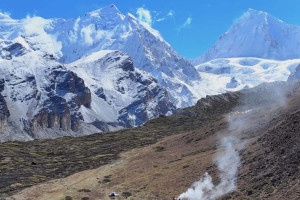
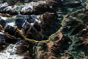
An initial technical assessment has found that the devastating flood that hit the Bhotekoshi river in Rasuwa on Wednesday entered Nepal as a major surge from Tibet. The flood then travelled downstream through the Bhotekoshi and Trishuli rivers before reaching the Narayani river.
According to a technical report prepared by the Flood Forecasting Division of the Centre of Hydrology and Water Resources Research, authorities received information at 9:05am on that day that a major flood had entered the Bhotekoshi from the Tibetan side. The surge then moved downstream through the Bhotekoshi into the Trishuli river and gradually spread to downstream areas.
The division said it issued early warnings and alerts to people in the affected districts, river corridors and other high-risk settlements based on available river-level data, the flood’s movement and information received as the event unfolded.
The report says a magnitude 4.4 earthquake was recorded at 8:37am. About 13 minutes later, at 8:50am, the water-level monitoring station in Syabrubesi, Rasuwa, stopped transmitting data. Its last reading showed the river at 1.62 metres at 8:40am. The station’s warning level is 6 metres and its danger level is 9 metres, according to the report.
About 15 minutes later, authorities received information that a major flood had entered the Bhotekoshi river from Tibet. Between 9:15am and 9:16am, SMS alerts were sent to residents in riverbank areas of Rasuwa, Nuwakot, Dhading and Chitwan, urging them to remain on high alert. More than 600,000 messages were sent.
At 9:20am, the Betrawati water-level monitoring station also stopped transmitting data. Its last recorded river level was 3.55 metres.
By 10:28am, the flood was expected to reach the Dhading-Galchhi area and pass Muglin within a few hours. Authorities then sent further warnings to people along the Prithvi Highway, the Muglin-Narayanghat road and settlements along the Trishuli river.
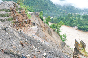
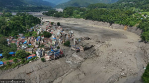
At 11:26am, the river level at the Phurke (Malekhu) monitoring station had risen above the danger mark. Seventeen minutes later, at 11:43am, the flood swept away the Phurke river bridge and other structures. By 11:50am, floodwaters had reached the Malekhu area.
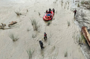
At 1pm, authorities received confirmation that the flood had already passed Muglin and urged people living along the river as far as Devghat to move to safer areas. The river level at Devghat reached 4.76 metres at 1:30pm. The initial estimate was that the main flood surge would reach Devghat at about 3:30pm, with the river level potentially rising to around 8 metres.
At 2:14pm, the water level at the Kalikhola monitoring station rose above the danger mark. The station recorded a peak level of 12.3 metres, according to the report.
By 3:20pm, the flood had reached the Narayani-Devghat area and the river level was still rising. At 4pm, the water level at Devghat peaked at 6.57 metres before beginning to fall.
By 6:30pm, the water level at Devghat had fallen back to about 4 metres. The initial technical assessment estimates that the flood brought an additional volume of about 20 million cubic metres of water, the report said.
From the earthquake recorded at 8:37am until the river level at Devghat began to recede at 6:30pm, the flood travelled from the Bhotekoshi through the Trishuli to Muglin, Malekhu and Devghat in roughly 10 hours.
The report shows that data transmission from several river-monitoring stations was disrupted as the flood moved downstream, while authorities continued issuing advance warnings and alerts to people living along the river corridors.




 15.34°C Kathmandu