Lalitpur
Lalitpur Metropolitan City pilots metric street addressing system
Under the system, houses are to be given numbers, and streets names so that navigation becomes easierAnup Ojha
In a bid to make navigating through the city easier, Lalitpur Metropolitan City launched a metric street addressing system for one of its wards on Tuesday.
Under the pilot, streets in Ward No. 3 are being named and 1,000 households receiving house numbers. Each household has been asked to pay a Rs1,000 fee to be included in the metric system.
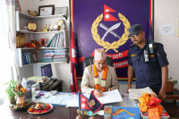
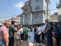
“This is a pilot project. By this year, we will expand the service to all wards in the metropolis,” said Mayor Chiri Babu Maharjan, who unveiled the new system in the presence of ward representatives, local residents and city officials.
Metric street system, also known as block number-based roads network, provides a logical and understandable system to identify the geographical location of each household using a system of maps. The new system, once implemented, will help create maps of the city and maintain databases.
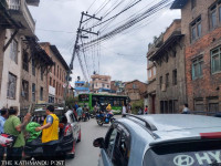
In the absence of such a system, locating a neighbourhood or house in the city, especially for outsiders and even postmen, has been difficult.
“We have used new technology to track each household with a number and given a name based on the original name of the tole (neighbourhood), alley or the chowk (junction). This method will help us to preserve ancient names associated with various places,” said Maharjan.
The city, for example has named the road adjacent to St Mary's School, Jawalakhel, Bhanimandal-Ekantakuna Marg, while the two-kilometre stretch from Pulchowk to Patan Durbar Square and Gwarko has been named Satya Mohan Joshi Marg.
The Municipal Assembly of the city, in its budget for fiscal year 2018/19 allocated Rs50 million to implement the system in all of the 85,000 households in its 29 wards. According to Mayor Maharjan, the city aims to complete the job within a year. Talking to the Post, Maharjan said that from households and business enrolled in the system will have to mention the new name of their toles on their official documents as well.
The city hired three a consortium of three companies, Geo-Nest-Indeco, to prepare a database of each household using stereo satellite images by employing the photogrammetry technique.“We have used drones to sketched maps. All the database will be collected in three months,” said Suresh Shrestha, head of GeoSpatial Systems, one of the consultant companies.
Shrestha said the company has already taught officials at the Lalitpur Metropolitan City to track 1,000 houses.
Shree Gopal Maharjan, chairperson of Ward No 3 said he was happy with the new system. “This is a basic requirement for a metropolitan city and the latest metric system will help us reach out to any house in the ward without any hassle because the house numbers and the location of the houses will be tracked through Global Positioning System,” said Maharjan.


 20.12°C Kathmandu
.jpg)
