Journalist Kunda Dixit on a young, fragile Himalayas—and the risks Nepal is ignoring
Dixit, who has written about climate and environment for decades, says Nepal must rethink how it builds and plans for disasters in a rapidly changing mountain landscape.Journalist Kunda Dixit during Kantipur TV’s Fireside interview, which airs on Monday night. Kantipur TV
For generations, Nepal’s folk culture, literature and collective imagination have portrayed the Himalayas as immovable and enduring. When introducing ourselves to the world, Nepalis proudly invoke Mount Everest, the world’s highest peak. Songs and school textbooks have reinforced the image of remaining “as steadfast as the Himalayas”. That has also encouraged the belief that the mountains are inherently stable and will remain largely unchanged for centuries. Geologically, however, the reality is very different, journalist Kunda Dixit says in an interview with Kantipur’s Rupesh Shrestha. The Himalayas stand on an exceptionally young, fragile and dynamic geological foundation, he adds. Dixit is a former editor and current publisher of the weekly Nepali Times. Dixit has written about the environment and the climate for decades. He is the author of ‘Dateline Earth: Journalism As If the Planet Mattered’, published in 1997. Dixit is also a media educator and chair of the Centre for Investigative Journalism Nepal.
Following is an edited excerpt of the conversation.
On the cultural idea of an ‘immovable’ Himalayas
The Himalayan range is the youngest major mountain system on Earth. Its formation began only around 20 million years ago, and it remains highly active geologically. Its rocks are relatively weak, and the mountains are still rising and being reshaped by tectonic activity.
Scientists have been warning for three or four decades that the Himalayas are geologically fragile and exposed to major natural hazards. Yet we have often ignored those warnings, guided by the cultural idea of an “immovable” Himalayas. Whenever a devastating landslide, flood or other disaster strikes the mountains, we react with surprise. We now need to understand the physical reality of the landscape and draw serious lessons for development planning and infrastructure construction.
On the Bhotekoshi-Trishuli disaster and the danger that lies ahead
When a devastating disaster hit the Bhotekoshi and Trishuli river basins on August 26, Nepal’s prime minister Balendra Shah described it at the United Nations General Assembly as a “Himalayan tsunami”. The disaster caused enormous damage to settlements, roads and hydropower projects downstream.
There has, however, been considerable confusion about what actually happened at the source. Many initially assumed that the disaster was caused by a glacial lake outburst flood (GLOF).
By the following day, August 27, my study of remote-sensing data and Landsat satellite imagery had already made it clear that this was not a conventional glacial lake outburst. There are no such large glacial lakes in the watershed north of Langtang, near the Tibetan border.
Studies by scientists from Canada, the Netherlands and China, as well as geologists at the International Centre for Integrated Mountain Development (ICIMOD), in Kathmandu, confirmed that a huge section of mountainside had collapsed in the Lhende Khola area on the northern face of Langtang Lirung.
Analysis of drone footage recorded by Chinese scientists and satellite imagery showed that an entire mass of rock, together with a huge glacier above it, had broken away and crashed into another glacier below. It was a massive dry landslide of rock and ice. In one sense, the mountain itself had collapsed.
When that enormous mass struck the glacier below, the friction generated heat that rapidly melted a large quantity of ice. The meltwater mixed with water in the Lhende Khola and rushed downstream at such a speed that it reached Rasuwagadhi within seven or eight minutes.
In scientific terms, a landslide consisting of a mixture of ice and rock is known as an ice-rock avalanche.
The local Tamang community even has an ancestral term for this kind of disaster, which translates roughly as “a flood like a king cobra”. People living in the mountains have long understood the difference between an ordinary monsoon flood and a flood caused by the collapse of a mountain.
This is what happens when geological fragility and the climate crisis interact.
About 15 years ago, when the Dikcho glacial lake in the Khumbu region burst, I first used the term “Himalayan tsunami” in a newspaper. The Bhotekoshi disaster was many times larger and more devastating. But it may only be an early warning of much greater risks ahead.
If an earthquake of magnitude 8.5 were to strike southern Tibet or the Himalayan region, dozens of glacial lakes could be at risk of bursting simultaneously. According to an ICIMOD study, 50 of the thousands of glacial lakes in the region are considered highly dangerous. Twenty-one of them are in Nepal and the rest are in Tibet.
Even if the lakes on the Tibetan side burst, the resulting floods could enter rivers such as the Arun, Bhotekoshi, Tamakoshi and Trishuli in Nepal.
Twenty-seven years ago, I drew a cartoon showing the Khumbu Icefall on Everest melting and becoming a “Khumbu Waterfall”. At the time, it seemed like a joke, or something almost impossible. Today, streams of water are beginning to flow across the ice at Everest Base Camp, at an elevation of around 18,000 feet.
When Tenzing Norgay and Edmund Hillary climbed Everest 75 years ago, the base camp was about 50 metres higher than it is today. Our mountains are gradually turning into exposed rock, while melting glaciers and glacial lakes are contributing to rising sea levels.
Twenty-five years ago, I also drew a cartoon suggesting that the Maldives could one day be submerged. Then-President Mohamed Nasheed held a cabinet meeting underwater to draw global attention to the climate crisis. Nepal’s then prime minister later held a cabinet meeting at Kala Patthar for a similar purpose.
But such symbolism is no longer enough. Nepal needs concrete international advocacy and regional mechanisms for climate and disaster security, working with India, China and other Himalayan countries.
On what our ancestors knew about living with rivers
In the name of modernisation, we have gradually forgotten much of the traditional knowledge accumulated by our ancestors. They were not trained scientists, but they possessed generations of practical experience and environmental knowledge.
Historic settlements and fortifications such as Gorkha Durbar, Kalikot, Silgadhi in Doti and sites in Dhankuta and Nuwakot were generally built on high ground. Strategic defence was one reason, as was protection from malaria. But there was another reason for settling on hills: protection from floods.
Our ancestors did not establish permanent settlements along steep riverbanks or on unstable slopes. River plains were mainly used for agriculture. People would build temporary shelters during planting and harvesting seasons, then return to their homes on higher ground after bringing in the crops.
Place in Nepal known as Lamatar is typically 150 to 200 metres above nearby rivers. Geologists say that enormous floods reached such elevations in the past, and that communities learned from those events and moved their settlements to higher ground.
Modern infrastructure development, however, has often ignored such lessons.
Roads have frequently been built along riverbanks because that appears cheaper and easier from an engineering and construction perspective. Once roads arrived, markets, settlements and industries followed them.
Consider the Dolalghat-Jiri section of the Araniko Highway, built about 40 years ago. Because the road was routed higher up the hills, it has not been washed away by major floods and landslides in the way many riverside roads have.
Had we built roads slightly above river valleys, used tunnels or accepted somewhat longer routes, the initial costs might have been higher. But our infrastructure would have been considerably safer over the long term.
On why development cannot be separated from the environment
In Nepal, those who raise environmental concerns are often accused of being “anti-development” or obstructing progress. But the environment cannot be separated from the economy or politics.
The environment is nature itself, and development that destroys the natural systems on which it depends cannot be sustainable development.
There is little disagreement that hydropower is a central pillar of Nepal’s economic future. But the way we have concentrated hydropower projects along river corridors carries enormous risks.
The recent Bhotekoshi-Trishuli floods alone affected or damaged around 1,500 megawatts of electricity generation, roughly half of Nepal’s total installed generation capacity at the time.
We should have learned from the disaster on the Teesta River in Sikkim three years ago. A massive hydropower dam associated with a 12-megawatt project and built at a cost of around $1 billion was swept away within five minutes by a flood originating from a glacial lake upstream.
In Nepal’s Arun basin, we are developing four major projects, each costing around $1 billion, in cooperation with India. If a similar mega-flood were to come from Tibet, all four projects could face catastrophic damage.
The first step, therefore, should be to decentralise hydropower development. Instead of concentrating large projects on a single river, projects should be distributed across different geographical areas and smaller river systems.
I have also argued that Nepal should explore pumped-storage hydropower. I am not an expert in the technology, but this view is based on discussions with experts and researchers.
Instead of relying entirely on conventional dams directly across rivers, water can be pumped during the daytime using solar power or surplus electricity into secure reservoirs at higher elevations, and electricity can then be generated during peak-demand periods.
Our powerhouses and tunnels should also be moved underground wherever feasible and protected from floods by massive, reinforced steel gates. The tunnels involved in the Bhotekoshi disaster might have remained safe, but they could have been designed to withstand an event of such magnitude had the risk been properly anticipated. The powerhouses, however, were above ground and suffered major damage.
It is also time to reduce our dependence on hydropower by increasing investment in solar and wind energy.
A wind-energy structure was built in Mustang about 40 years ago, but the project failed after the structure was damaged by extremely strong winds. The mistake was that we looked for wind without identifying locations where the wind regime was suitable and consistent.
Today, with better data and modern technology, we can identify locations with appropriate wind speeds and develop wind power more effectively.
On the Himalayas as an interconnected ecosystem
It is wrong to think of the Himalayas simply as snow-covered peaks. The Himalayas are an interconnected ecological system encompassing the Tarai, hills and mountains.
Changes in the mountains directly affect the farms of the Tarai, while rising temperatures in the lowlands also affect the mountains.
The climate crisis and rising temperatures are creating new problems. Diseases and pests are moving to higher elevations. Mosquitoes and venomous snakes traditionally associated with the Tarai and warmer areas are moving uphill. Dengue, cholera and other infectious diseases have already reached higher Himalayan areas and even mountain base camps.
As temperatures rise, the habitats of the common leopard and the snow leopard are also beginning to overlap.
In dry Himalayan districts such as Manang and Mustang, where annual rainfall was historically only around 200 to 300 millimetres, extreme rainfall of more than 800 millimetres has been recorded during a single monsoon season, triggering unusual floods and landslides.
People living downstream have already learned from what they have witnessed with their own eyes. They are beginning to leave riverbanks and move 10 to 50 metres higher, towards terraces and hillsides.
The irony is that policymakers, planners and political leaders in Kathmandu have yet to fully absorb the same lesson.
Look at the election manifestos of Nepal’s political parties and climate change and disaster management are often relegated to points 80 or 90 on long lists of priorities. Politicians campaign on good governance, prosperity and GDP growth, but often overlook the environment, which is a fundamental basis for sustainable development.
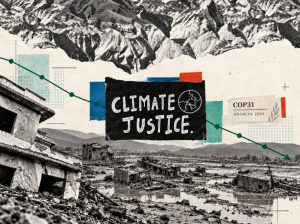
At international forums such as the United Nations and the Conference of the Parties (COP), Nepali prime ministers and ministers often make strong arguments for climate justice and access to loss-and-damage funding. Nepal has a legitimate case for seeking compensation and support because the country is bearing the consequences of historical carbon emissions from industrialised countries, which have been emitting carbon for around two centuries. But we cannot simply wait for international assistance.
Of the $100 billion in climate finance that developed countries have pledged, what reaches vulnerable countries often amounts to only a fraction of what was promised. Nepal has already suffered more than $5 billion in damage from the Bhotekoshi-Trishuli disaster alone, while securing even $20 million from international funds can take years.
We therefore need to strengthen domestic resources and preparedness.
Every major river flowing down from the Himalayas should now have an automated early-warning system. We are already too late.
I understand that work is under way to lower water levels in four high-risk glacial lakes, including Thulagi Lake in Manang, following the examples of Tsho Rolpa and Imja Tsho. We need to assess the risks posed by other lakes as well.
We also need long-term plans to relocate communities living in high-risk areas to safer locations.
On why forests need protection and management
There is another important issue. Forests cover around 45 percent of Nepal’s territory. This has been made possible partly by the success of community forestry and partly by rapid migration from the hills to the Tarai.
But the expansion of forest cover has not been matched by adequate management.
With fewer people living in villages, dead trees, dry wood, firewood and fallen leaves accumulate in forests. Soon after winter ends, even a small spark or lightning strike in spring can trigger major forest fires.
Last year, forest fires were the main reason the Kathmandu Valley was blanketed in smoke for days.
We therefore need a model that combines forest conservation with managed use. Local governments should be given responsibility for allowing communities to collect dry wood, branches and leaf litter without damaging forests, while strengthening monitoring and prevention of forest fires.
On the need for a regional response
The climate and geological crisis unfolding in the Himalayas is not a problem for Nepal alone.
The rivers originating in the mountains flow through China and then into Nepal, India, Pakistan and Bangladesh. If a major earthquake in Tibet triggers the collapse of dozens of glacial lakes, the destructive consequences could travel through Nepal into India and Bangladesh.
Nepal, China, India, Pakistan and Bangladesh therefore need mechanisms for regional data-sharing and joint disaster preparedness.
ICIMOD, a regional scientific institution headquartered in Kathmandu, could provide a platform for such cooperation. Political differences should not prevent countries from working together on a common threat.
We need to understand natural laws and the limits of the natural environment before designing infrastructure and development plans.
Only by combining the revival of traditional knowledge, modern science, safer and more decentralised hydropower, and regional diplomacy can we protect the future of Himalayan communities and the country as a whole.




 19.17°C Kathmandu