



 13.27°C Kathmandu

Wed, Oct 28, 2026
Columns
Drones came after Lirung. Nepal needs them before the next collapse
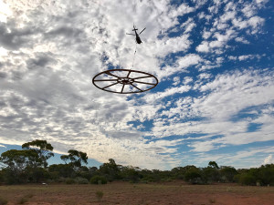
In Nepal, researchers still need permission for each project to use drones that monitor dangerous slopes before they fail.
bookmark
Niti B Mishra
Published at : October 27, 2026
Updated at : October 28, 2026 00:42
A drone filming mountain views on August 26 captured the onset of the Bhotekoshi disaster. Its pilot, intent on the shot, did not notice. Far off in the frame, a plume of ice and rock dust rose as about 132 million cubic metres of rock and glacier ice broke from the north face of Langtang Lirung. According to ICIMOD’s preliminary reconstruction, the debris surge reached the Nepal-China border corridor in about seven minutes. Existing warning systems, built around rainfall and river levels, were not designed to detect it, and text alerts reached people only 38 minutes after the collapse. As of mid-October, at least 1,451 people in Nepal have been killed, and 5,745 remain missing.
That same day, the cabinet decided that drones could fly without permission for rescue in the six districts declared disaster areas, asking operators to coordinate through a hotline. Within hours, the Nepal Drone Association mobilised more than 50 pilots and mapping specialists, using thermal cameras to search for survivors and LiDAR to measure the depth of mud and debris. Over the next few days, drones carried food and medicine to places roads no longer reached. Three days after the waiver, the National Disaster Risk Reduction and Management Authority warned that unauthorised drone flights were hampering helicopter rescues and told operators to get prior approval again.
Both decisions made sense. Drones proved their worth in the Himalaya that week, and the disruption to rescue helicopters showed why they must be coordinated. The disaster authority already knows how to arrange this in advance. In July, six weeks before the collapse, it signed an agreement with a drone operators’ association to supply drones and licensed pilots when disasters strike. Yet research drones that watch dangerous slopes before they fail still seek permission for each project.
The Home Ministry and the Civil Aviation Authority of Nepal (CAAN) should give hazard monitoring the same kind of advance arrangement: a standing, multi-year authorisation for vetted institutions to fly repeat surveys over a listed set of high-risk slopes and glaciers.
I know what the current system asks of researchers. In 2019, my team planned to map a glacier on Annapurna III with two small consumer quadcopters. We began the application in January. A colleague at Tribhuvan University carried it from office to office: CAAN, the Home Ministry, the Annapurna Conservation Area Project and the District Administration Office. Permission arrived at the end of May, just before we reached Manang. In late 2024, to fly a LiDAR drone over forest at Khumai Danda near Pokhara, we hired a local drone operator to steer the application through the same four offices. It took three and a half months. Each permit covered two field seasons, and the second lasted about nine months.
That is workable for a single project. It is a poor fit for monitoring, which works only if the same slopes are surveyed repeatedly, on a schedule and again quickly when something changes. A decade-long record of one slope could mean seeking approval every year, and in my experience, each approval took three to four months. A follow-up flight after a worrying observation cannot wait that long.
None of this means drones could have saved Rasuwa. Later analysis of radar satellite data found up to 40 centimetres of movement on the slope, measured along the satellite’s line of sight, in the 48 days before it failed. ICIMOD’s researchers caution that this could not have told anyone when the collapse would come. No drone would have told them either. What scientists can now do, says ICIMOD’s Qianggong Zhang, is “identify where closer monitoring is needed.” Walter Immerzeel, a mountain hydrologist at Utrecht University whose team first flew research drones over Langtang’s glaciers in 2013, has said it is not feasible to watch every risky rock face. He proposes using satellites to find hotspots, then on-site sensors, repeated radar surveys and drones to watch them.
Such an authorisation could work like this. ICIMOD and governments across the region are now identifying the Hindu Kush Himalaya’s highest-risk glaciated hotspots, and the authorisation could start with Nepal’s share of that list. A vetted Nepali institution and its research partners would apply once, through one joint review by the four offices researchers already deal with. In return, they would notify every flight in advance so helicopter operators and security agencies know who is in the air, submit results on a fixed schedule, and report significant changes immediately. The Home Ministry would keep the right to inspect and revoke.
Someone must also act on what the flights find. The Department of Hydrology and Meteorology and the disaster authority could review the results. Their findings could determine where permanent sensors go, prompt an expert assessment of a changing slope, and inform the preparedness plans that districts such as Rasuwa and Nuwakot approve before each monsoon. A permit does not create a monitoring programme; that still needs funding, consistent methods and people to analyse the data. A standing authorisation removes only the avoidable delay.
The Home Ministry has good reason to be careful near the northern border, where this disaster struck, and flights there will always need security review. A standing authorisation keeps that review but does it once, carefully, instead of every year. Nor are drones a warning system. Getting alerts to people before the water arrives is a separate and more urgent job.
On the day Lirung fell, the cabinet waived permission to fly because the danger was in plain sight. The hotspot list now being drawn up will show where the next dangers are. Nepal should grant permission to watch those slopes before the next monsoon, not after the next collapse.
Niti B Mishra
Mishra is an environmental scientist and professor at the University of Wisconsin–La Crosse, USA.


Most Read from Columns




Editor's Picks
What to know about the US trial over Mamta Kafle’s disappearance
NPL returns with bigger ambitions and global recognition
What’s new in the Nepal Premier League’s third season?
After Nepal’s recent disaster, it wants to test whether COP31 can deliver climate justice
Why does an hour long flight to Dhangadhi cost more than a flight to New Delhi?
E-PAPER | October 28, 2026

×