Drones deployed to search for survivors and assess Rasuwa flood damage
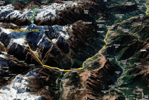
Operators are using thermal cameras to help locate people and LiDAR technology to assess damage as damaged roads and communications hamper access to affected areas. Officials say a landslide may have blocked a river in Tibet before the swollen river burst through. Handout Photo
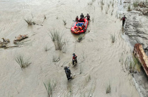
The Nepal Drone Association has mobilised its members to support search, rescue and damage assessment in flood-hit Rasuwa and other areas affected by Wednesday’s flash floods.
The association has asked drone operators to keep their batteries fully charged and equipment ready for deployment as needed. In a notice posted on social media, it urged operators to work together and coordinate with authorities to provide timely assistance.
Bal Kumar Lamsal, vice-president of the association, said some drone pilots had already been deployed to flood- hit areas including Rasuwa, Nuwakot and Dhading to support search and rescue operations and carry out preliminary damage assessments.
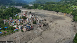
“Drone flights can be particularly effective in geographically difficult mountainous and Himalayan areas,” said Lamsal, who is also chief technology officer at Geovation Nepal. “We are using LiDAR technology to make preliminary assessments of where and how much damage has been caused by floods and landslides, and to determine the depth of mud and debris flows.”
Drones equipped with thermal cameras have also been sent to the field to help rescue teams locate people who may be trapped or stranded, he said.
The association is also planning to use drones equipped with loudspeakers to relay information from the air in areas where telephone and internet services have been disrupted, Lamsal said.
If required, drones could also be used to transport emergency medicines and relief supplies to isolated locations. The association will assess the situation on the ground before deciding whether to expand such operations, he said.
The disaster has caused loss of life and damaged physical infrastructure and communications networks in Rasuwa and other affected areas. The association issued the call as demand grows for emergency search and rescue support in areas where access and communications have been disrupted.
Drone technology can be particularly useful during disasters for assessing conditions in dangerous and remote areas, conducting aerial surveys and providing rescue teams with real-time information. The association has therefore asked its members to remain on high alert and ready for deployment.
The association had reached an agreement with the National Disaster Risk Reduction and Management Authority on July 15 to provide drone-based assistance during disasters.
More than 50 drone pilots, along with mapping and data-analysis specialists, are currently involved in the effort through the association. Established a year ago, the association has more than 20 member companies.




 17.5°C Kathmandu