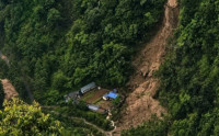
Streams and springs in many villages have dried up in recent years. Experts attribute the problem to unregulated development activities. The dry riverbed of the Telpani stream pictured during the recent winter. Until a decade ago, the stream would have water throughout the year. Nawaraj Subedi/TKP
Golatar village, which lies in the Chure region in ward 3 Mechinagar Municipality, was once fertile and self-sufficient in water resources. Nestled between the Ninda and Telpani streams, the village with around 150 families has been witnessing an alarming decline in water availability over the past decade.
A drinking water crisis now looms large in Golatar village. Both the streams, which until a few years ago flowed year-round, have all but dried up, leaving nearby farmlands parched and fallow.
Until about eight years ago, the village located in northern Jhapa had no shortage of water. The monsoon brought ample rain for paddy cultivation while various crops like maize, mustard and wheat were grown in the winter. The Telpani stream was a dependable irrigation source, ensuring green fields throughout the year.
“After the 2015 earthquake, the water springs began disappearing. I have 1 bigha of land (around 0.677 hectares) that once yielded abundant mustard and wheat. But it’s been lying uncultivated for more than eight years now,” said Prem Acharya, a local farmer of Golatar.
According to Acharya, the village's lifeline used to be the natural spring at Bhalukhop, on the border of Rong Rural Municipality’s wards 5 and 6 in neighbouring Ilam district. It provided drinking water and fed the Telpani stream. Now both the spring and the stream have dried up. As a result, over 50 bigha of farmland (around 34 hectares) along the stream banks have turned fallow and disputes over water have become common.
Locals like Khagendra Poudel recall using Telpani’s water for winter farming. “There’s no water in the stream from mid-December until the monsoon. Without water, farming isn’t even an option,” lamented Poudel, pointing to the dry riverbed.
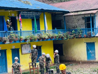
According to experts, the decline of water sources is widely attributed to unregulated development activities—road construction, bulldozing of hillsides and deforestation. The Madan Bhandari Highway, which passes through the southern edge of the village, caused massive environmental disruption during its construction, including the felling down thousands of trees and repeated use of heavy machinery. Experts and villagers alike believe these activities disturbed the natural springs that once sustained the area.
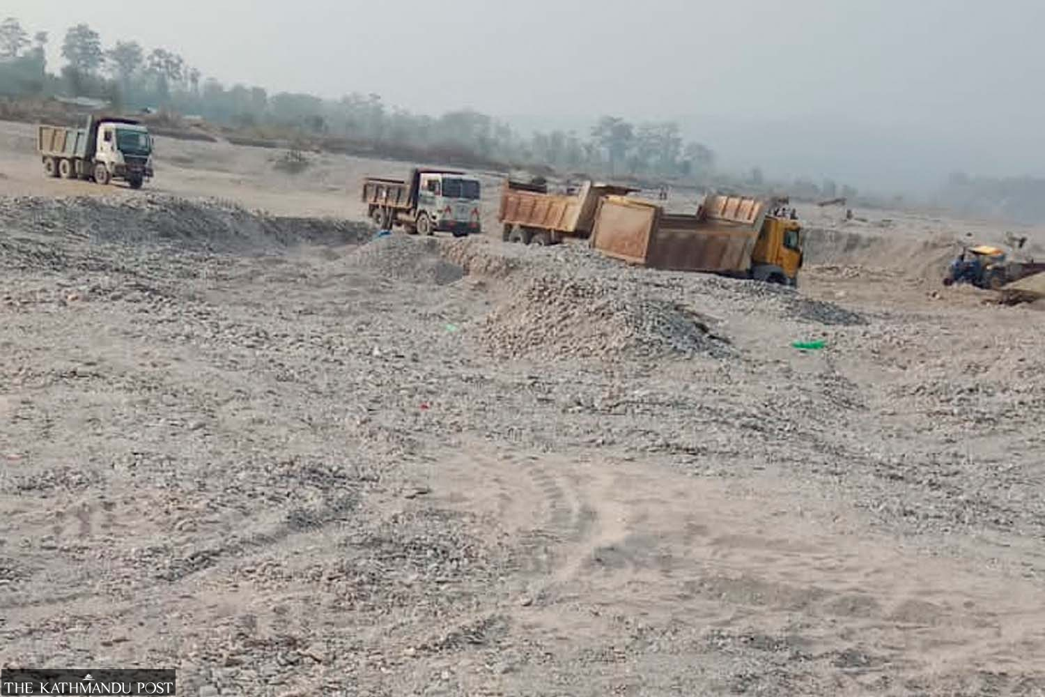
Extraction of riverbed material has been ongoing on the banks of Timai stream, as seen in this recent photo. Nawaraj Subedi/TKP
Now, the village relies on a small-scale water supply managed by Govindapur Drinking Water and Sanitation Consumer Group. “We get water only once a day, between 7 and 8 in the morning. We have to collect everything we need during that window. But even this supply is uncertain. If this continues, we don’t know where we’ll have to go next year to find water,” said Poudel.
Villagers remember a time when natural springs, like the one in the middle of the village, provided ample water for drinking and washing. That land, once the heart of the community, now lies barren.
A similar crisis is unfolding at Jhodai village of Buddhashanti Rural Municipality-4, Jhapa. The area has 13 settlements, all located within the Chure region. A decade ago, there was no need for boring water pumps. The Timai stream, fed by springs about five kilometers north in the hills, provided both drinking water and irrigation. “But as the excessive extraction of stones and gravel from the Timai began, the streambed deepened and the overexploitation of the Chure hills dried up the springs,” said Prakash Samsohang of Jhodai. “Now, the village relies entirely on boring wells and even those are running low.”
The once-thriving villages of Mangalbare, Banjhokhet, Sattabharna, Guransabasti and Panighatta in ward 4 of Buddhashanti Municipality are now severely affected by water shortage. Likewise, settlements in ward 5 of Buddhashanti, such as Kingring Danda, Ayabari and Babaritar are also in crisis. The locals have submitted applications to the district administration office, demanding urgent intervention to halt the exploitation of the Chure, but to no avail.
The problem exacerbates during the dry winter months, when the streams run completely dry. Ironically, these same streams bring dangerous floods during the monsoon, washing away land and property due to the fragile terrain. Experts point out that haphazard construction activities involving bulldozers and steamrollers have loosened the soil in the upper Chure hills and surrounding mountain areas.
The Chure range’s Nepal section features a string of low hills stretching from Mechi in the east to Mahakali in the west along the south of the Mahabharat hills. The section is around 20-30 km wide and 1,000 km long. Natural sources of water originating from the foothills of Chure are gradually drying up in the last few years, causing depletion of the first layer of the underground water in Bhawar (the area between Chure and the Tarai) and Tarai, experts say.
In recent years, the Chure has faced rampant deforestation, unregulated mining of riverbeds, and environmental degradation. These practices have seriously undermined the region’s water storage and agricultural sustainability, affecting millions of people who depend on it for survival.
Although the Nepali government has launched several initiatives for Chure conservation, their impact remains limited. The growing water scarcity, shrinking farmland productivity, and drying rivers across the region highlight an environmental crisis that demands immediate and sustained action.
 21.67°C Kathmandu