National
Nepal has been measuring Everest for two years, but China will join in announcing its new height
Officials at the Land Reform Ministry and Survey Department said they were unaware of the agreement between Nepal and China regarding the joint announcement.
Anil Giri
For the first time since Mount Everest was recognised as the highest peak in the world, Nepal has been working diligently for two years to measure the height of the mountain. But now that the process is almost complete, China will join in announcing the height of Everest, much to the surprise of officials at the Ministry of Land Reform and Management and the Survey Department.
During the recent state visit of Chinese President Xi Jinping, Nepal and China agreed to recognise that “Mount Sagarmatha/Zhumulangma is an eternal symbol of the friendship between Nepal and China” and that they would “jointly announce the height of Mount Sagarmatha/Zhumulangma and conduct scientific researches”, according to the joint statement between the two countries.
However, officials at the Ministry of Land Reform and its Survey Department who have been measuring Everest, told the Post they are unaware that China will be involved in announcing the height. Ten days since the signing of the joint agreement, neither the ministry nor the department has received any official communication from the Prime Minister’s Office or the Ministry of Foreign Affairs regarding China’s involvement in the process, according to top officials at both entities.
While Rajan Bhattarai, foreign relations adviser to Prime Minister KP Sharma Oli, told the Post that Minister for Land Reform Padma Aryal and Secretary Surya Prasad Gautam were very much aware of the proposal prior to the agreement, Gautam provided an evasive response.
“I am also in the process of being briefed by officials from the ministry and the Survey Department. I cannot say anything about this at the moment. Please contact the ministry spokesperson,” Gautam told the Post.
Spokesperson Janak Raj Joshi, however, said that he was unaware of what the agreement with China entails.
“We do not know how this agreement was made and since the agreement was signed, there has been no communication from the Ministry of Foreign Affairs,” said Joshi. “What we do know is our Department of Survey is conducting the measurement of Everest and has completed its data collection. The data analysis is currently ongoing and it will take another two months to reach a preliminary conclusion.”
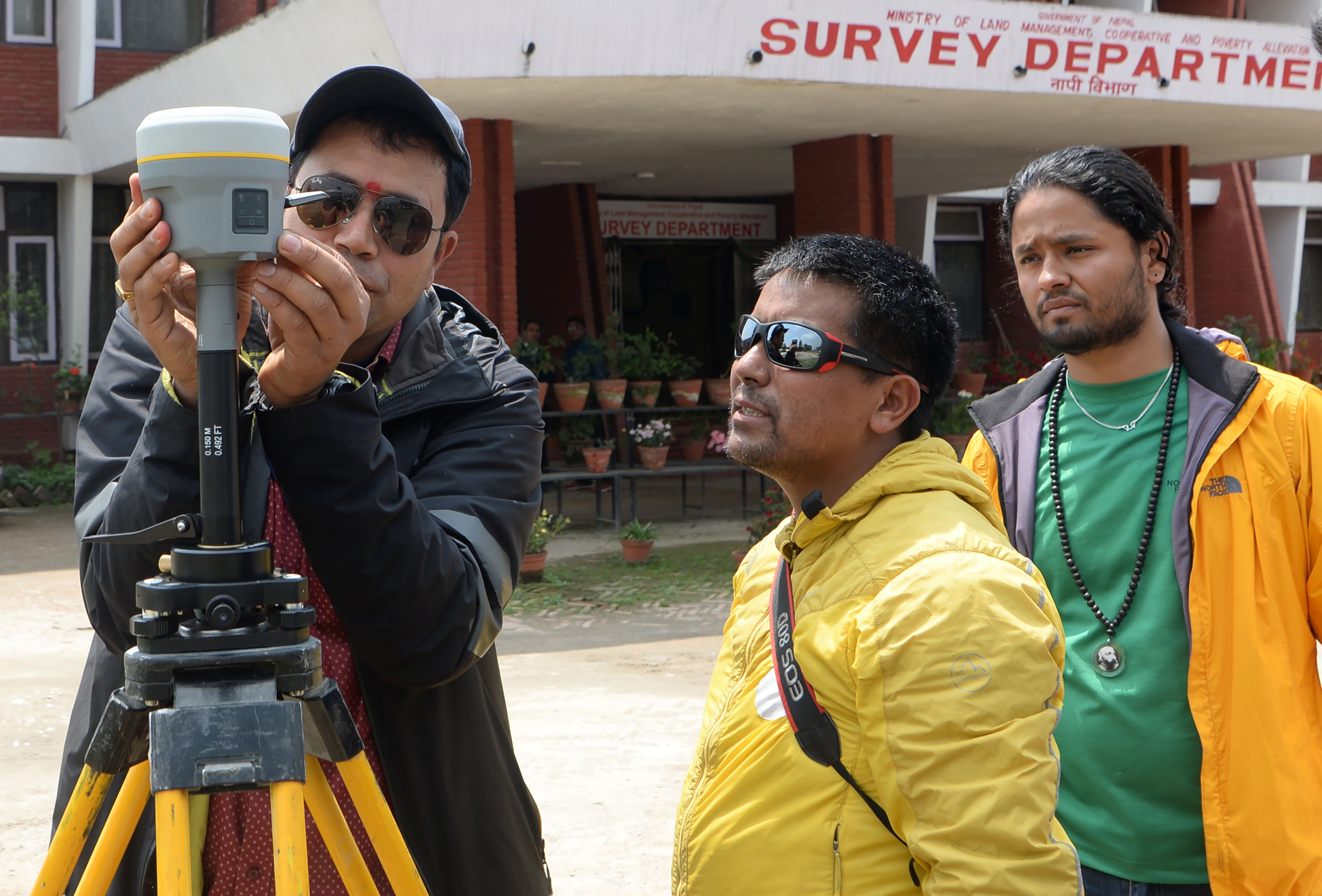
The Survey Department had initiated the measurement of Everest’s height around two years ago, using sophisticated methodology including readings from ground-penetrating radar and a Global Navigation Satellite System from the top of the mountain. A team of officials from the department reached the top of Everest on May 22 to take the measurements. Those readings will be corroborated with nearly 300 readings from a gravimeter, which measures the gravitational force of the earth at various points, and a traditional trigonometrical survey, the method that was used in the 1950s to calculate the height. The department has spent $1.3 million dollars in this endeavour, working alongside six international firms.
But the Survey Department, too, said it had yet to be contacted by the Foreign Ministry about a joint announcement of the height with China.
“We do not know about the details of the agreement and are waiting for formal communication from higher authorities,” said Prakash Joshi, director-general at the department.
Joshi said that his department had a difficult time setting up measurement stations at heights of above 5,000 metres in the absence of experts and instruments. A Swiss company donated various scientific instruments and technology worth Rs80 million, which greatly helped Nepali surveyors conduct the measurement, he said.
Chinese officials were also invited to Nepal before the measurement began and they have fully cooperated with the Nepali endeavour, said officials.
“When we reach a conclusion, we will conduct a workshop for experts from several countries and announce the new height, Baburam Dhakal, spokesperson for the Department of Survey, told the Post.
When the Post contacted the Foreign Ministry, officials said that Foreign Minister Pradeep Gyawali, Foreign Secretary Shankar Das Bairagi, Head of the China Division Kali Prasad Pokharel, or Spokesperson Bharat Raj Poudyal would know better. However, as all four officials are currently abroad, the Post was unable to reach them for comments. Minister for Land Reform and Management Aryal is also on a trip to China.
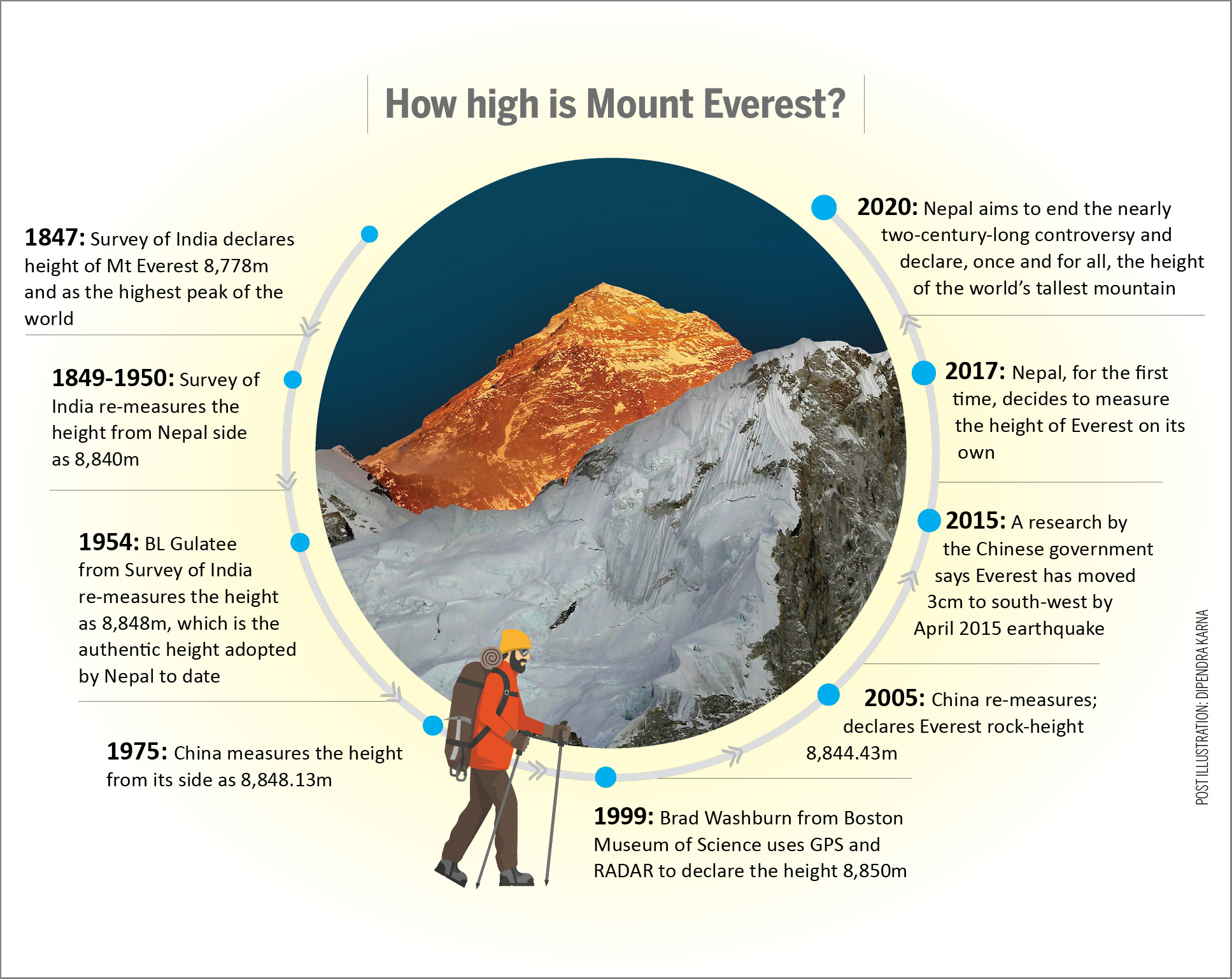
There is, however, a hope that China’s participation in the announcement of the new height will conclusively determine Everest’s height and Beijing will drop its competing claim of 8,844.43 metres as the height of the mountain. In 2005, the Chinese State Bureau of Surveying and Mapping re-measured the peak and declared 8,844.43 metres as the Everest rock height. Chinese and Nepali officials have since disagreed over the height of the iconic peak. The universally-accepted height of Mt Everest is 8,848 meters.
But after the 2015 earthquakes, geologists believed that the mountain may have shrunk. Several international institutions and India had expressed their interest in measuring the height of Everest. However, Nepal decided to perform the survey on its own, for the first time in history, designating the plan a ‘national pride’ project.
“This measurement is important to us,” said the Survey Department’s Dhakal. “We are measuring it with our own resources and the world is keenly watching its final outcome.”


 10.12°C Kathmandu


