Money
New adventure trekking route explored in central Himalaya
The walking route from Gorkha to Ganesh Kunda and Ganesh Himal is expected to increase tourist arrivals in the region.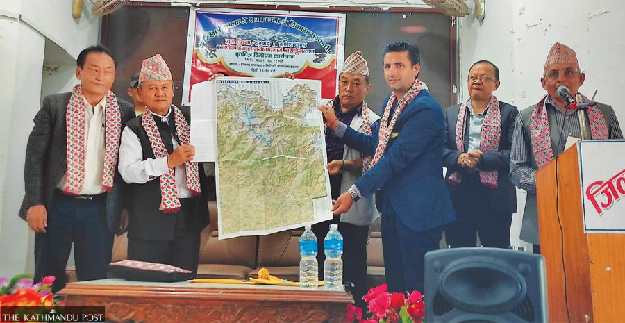
Hariram Upreti
Official scouts have explored a new trekking trail in the central Himalaya that offers excellent hiking and camping opportunities for adventure lovers who want to get away from the usual itinerary.
The walking route from Gorkha to Ganesh Kunda and Ganesh Himal has been published with the objective of increasing tourist arrivals in the region which is well-known for the Manaslu Circuit trek, officials said.
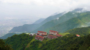
Gorkha, a historical town in central Nepal, is perched on a hilltop and presents a panoramic view of the Himalaya to the north.
Sane Gurung, president of the Manaslu Tourism Development Committee, said that a 19-day itinerary from Kathmandu to the new destination provides mesmerizing views of the snow peaks and enriches trekkers with the fascinating culture and adventure of the region.
A map of the trekking trail has also incorporated a 7-day trekking route from Ganesh Himal to Singla Pass at the altitude of 4,050 metres.
Scenic trekking destinations are everywhere in Nepal, from the most popular Everest Base Camp, Annapurna Circuit, Annapurna Base Camp and Upper Mustang trails to off-the-beaten-track spots like Pikey Peak, Tsum Valley and Narphu Valley.
But motorable roads now connect most of these destinations, and they are no more isolated like before. So adventurous travellers are always on the lookout for fresh routes that provide the wilderness feeling.
Tourism entrepreneurs say unexploited trekking trails need to be developed to increase the length of stay of tourists. The best seasons to trek in Nepal are September-November and March-May.
The adventure route connecting Ganesh Kunda was identified in 2017 by a team of technicians. The team had conducted a site study of the Ganesh Himal Hichampa Trekking Trail.
Gurung says the destination is perfect for tourists who are interested in a camp trail as there are no human settlements from Yarubagar at Dharche Rural Municipality-1 to the base camp. Bridges and 14 camping sites need to be built to operate the trekking trail, he said.
According to the committee, wooden bridges need to be built in six places up to Ganesh Himal base camp, besides handrails on steep and difficult paths.
There is a need to place information boards and erect shelters to help visitors.
Requests have been sent to the rural municipality, tourism board and the government of Gandaki province to build the necessary infrastructure.
"We will be focusing on building infrastructure for a year," said Gurung.
The earthquake of April 2015 damaged the trekking trail. Since then, the routes have been deserted as visitors stopped coming.
According to Gurung, a map has been published showing the route from Manbu to Yarsa and Kashigaon. The trail then goes from Birimdanda to Ganesh Kunda and on to Kalo Pokhari, Runchet and Hulchok and ends at Ganesh Himal Camp.
Gurung says that nature lovers can travel in the area by staying in tourist camps. "We are in the process of piloting the trail by camping in different places," he said.
As the country's road network has been spreading to tourist destinations, places for camping trails have become smaller in recent times. Experts say the new trekking trail will delight tourists as an alternative to overused paths.
Ganesh Kunda, which is located at an elevation of 4,400 metres above sea level, lies on the border of Gorkha and Dhading districts. The route also passes through Kalo Pokhari at a height of 3,150 metres.
This superb trail has remained in the shadows for lack of promotion and publicity. Except for shepherds in the highlands, even locals have not reached the area.
Tourism entrepreneurs claim that musk deer, Himalayan goral, snow leopard, bharal and other wild Himalayan animals are found in the area, which makes the trail an attractive destination for tourists.
Valuable herbs such as yarsagumba, niramsi (delphinium species), pachaule (dactylorhiza hatagirea), jatamansi (spikenard) and red and white rhododendrons are also found in this area.
Gurung said that since the route map has been published, they will have to urge the concerned offices and organizations to construct the infrastructure. Along with the map, a 25-minute documentary has also been produced to promote tourism.


 12.12°C Kathmandu
.jpg)
