Erratic monsoon frustrates forecasters and farmers alike
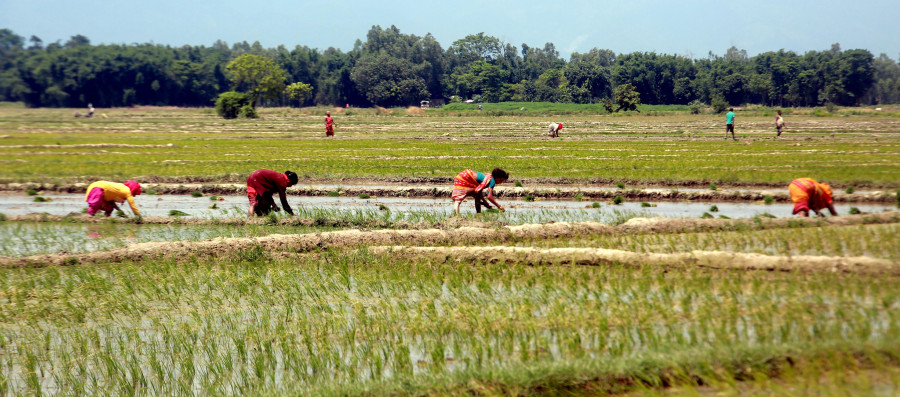
Earlier forecasts predicted above-normal rainfall, but the Met department now expects below-average rains in the Tarai. Farmers transplant paddy in ward 9 of Inaruwa Municipality, Sunsari. According to the Agriculture Knowledge Centre, only 24 percent of paddy plantation has been completed in the district so far due to insufficient rainfall. RSS
Every day, an elderly man from Kapilvastu district dials the landline number of the Meteorological Forecasting Division to inquire about rain updates. The office had forecast above-normal rainfall for the ongoing monsoon.
The man shares his worries with officials about withering paddy saplings in the seedbeds and expresses fear of an impending food shortage for his family.
“Almost every morning, he calls us and asks us where the rain is,” said Pratibha Manandhar, a senior meteorologist at the division. “He reminds us of our seasonal forecast, which stated that there would be above average rainfall in the western parts of the Lumbini province, and asks us how long it will take for the rain to arrive.”
It has already been around six weeks since the monsoon entered Nepal. However, several places, especially in the Tarai regions of Lumbini, Madhesh, and Koshi provinces, have not witnessed sufficient rainfall, depriving hundreds of farmers of an opportunity to plant rice.
Rice is Nepal’s major staple food, and its cultivation is water-intensive. Like most farmers in the country, those in the Tarai region depend heavily on rains to grow rice.
“In the past, it was relatively easy to forecast monsoon weather, which followed a regular pattern,” said Mandndhar. “But in recent years, shifting weather patterns have made accurate prediction difficult.”
Met officials say the current weather pattern is similar to the pre-monsoon pattern, in which isolated heavy rainfall takes place in particular areas for a few minutes, causing landslides and flooding.
“We have not seen the kind of continuous rainfall we used to witness during the monsoon season,” said Shanti Kandel, another meteorologist at the division. “Some places have witnessed isolated heavy rainfall and flooding, while others are facing drought-like conditions.”
In recent years, the country has been getting more rainfall in short durations—an abnormal phenomenon that is slowly becoming the new normal. Experts say changes in rainfall patterns, which have become increasingly severe and erratic due to climate change, contribute to extreme weather events like floods and landslides.
This year, the Met Office had forecast above-average rainfall during the monsoon. The prediction aligned with the regional climate outlook jointly prepared by all nine National Meteorological Services of South Asia, which projected above-normal rain for the 2025 monsoon.
However, the officials said that the department recently revised its outlook, which stated that the Tarai region of Koshi, Madhesh, and Lumbini Province will most likely witness below-average rainfall in the monsoon season.
Below-average rainfall in the Tarai region directly affects rice cultivation and puts additional strain on the country’s struggling economy.
The monsoon normally enters Nepal around June 13 and lasts until September 23. This year, it entered the country on May 29, 15 days ahead of the usual schedule. In the four months of the monsoon—June, July, August, and September—the country receives an average of 1,472 mm of rainfall.
Nepal is one of the world’s most vulnerable countries to the climate crisis, and for over a decade, it has witnessed multiple extreme weather events.
Evidence suggests the maximum temperature in Nepal is rising faster, at 0.056 degrees Celsius a year, compared to the global average of a rise of 0.03 degrees Celsius a year.
Experts say extreme weather events such as excessive rainfall in a short span, prolonged rains after the monsoon, droughts, and above-average winter temperatures have become more common in Nepal.
Arjun Poudel is a health reporter for The Kathmandu Post. Before joining the Post, he worked for Sagarmatha Television, Naya Patrika, Republica and The Himalayan Times.
 24.58°C Kathmandu