Climate & Environment
Forest cover may have increased but agricultural land is shrinking
Farmlands have shrunk by 2.1 percentage points with the expansion of built-up area from 2000 to 2019, latest data suggest.
Pawan Pandey
While the forest area of Nepal increased by 1.7 percent, the agricultural land shrunk by 2.1 percent with the expansion in built-up area from 2000 to 2019, according to the latest data released by the Forest Research and Training Centre (FRTC), a government body under the Ministry of Forests and Environment.
The National Landcover Monitoring System (NLCMS), a web-based application, developed with support from SERVIR-HKH, a joint initiative of the United States Agency for International Development (USAID), the National Aeronautics and Space Administration (NASA) and the International Centre for Integrated Mountain Development (ICIMOD) uses satellite data to monitor geography.
“ICIMOD had already developed a land cover monitoring system for the Hindu Kush region,” said Yam Prasad Pokharel, director general of the FRTC. “We used the platform to develop a system specific for Nepal.”
The forest area covered 41.69 percent (6,166,766 hectares) of the total area of Nepal in 2019 compared to 39.99 percent (5,915,518 hectares) in 2000, as per the latest data.
Similarly, the agricultural land was spread over 26.31 percent (3,891,500 hectares) in 2000 compared to 24.21 percent (3,581,047 hectares) in 2019.
While the grasslands declined to 1,963,286 hectares from 2,064,046 hectares, the built-up areas expanded from 25,487 hectares to 78,296 hectares in between 2000 and 2019. And the increment in built-up, which refers to artificial structures such as towns, villages, industrial areas and airports, among others, was exponential after 2017, according to the data.
The land cover area has been divided into 11 categories. Besides forest and cropland, 13.27 percent of land is covered by grassland, 6.29 by snow, 5.64 by bare rock, 3.62 by Other Wooded Land (OWL), 3.14 percent by glacier, 1.11 percent by riverbed, 0.53 percent by built-up area, 0.48 percent by water bodies and 0.03 percent by bare soil, the data shows.
“The data shows that we are on the path of fulfilling the commitment of increasing the forest cover to 45 percent by 2030,” said Pokharel. “A land cover needs to fulfil three criteria—more than 10 percent crown cover, more than 0.5 hectare area and at least 5-metre tall trees–to be a forest,” Pokharel said.
According to Pokharel, OWL, which covered 3.62 percent of the total area in 2019, will ultimately grow into a forest over time.
However, Manjeet Dhakal, head of Least Developed Country (LDC) Support Team at Climate Analytics, said the Other Wooded Land cannot be considered a forest.
“The nature of the land cover included under OWL is different from that of the forest cover,” said Dhakal.
According to FRTC’s report, OWL refers to: “Land not classified as forest spanning more than 0.5 hectares, having at least 20 metre width and a tree canopy cover between 5 and 10 percent. Or the canopy cover of trees less than 5 percent but the combined cover of shrubs, bushes and trees more than 10 percent; includes the area of shrubs and bushes where no trees are present.”
According to Pokharel, it cannot be determined if a forest area observed through satellite images lies in a private or public property.
“The data of forest area generated by the NLCMS includes those located in the private land as well,” he said.
Despite an increase at the national level, the forest areas decreased in Madhes and Karnali provinces during the period. Latest data show Province 1 has the highest share of the forest area while Madhes Province has the least.
Of the total, 18.8 percent forests lie in Province 1, 18.7 percent in Bagmati, 16.2 percent in Lumbini, 16.1 percent in Sudurpaschim, 13.6 in Karnali, 12.8 percent in Gandaki and 3.9 percent in Madhes.
Similarly, forest and agricultural areas decreased by 4.76 and 1.18 percent, respectively, in Madhes Province and by 2.55 and 1.13, percent respectively, in Karnali.
In terms of physiographic region, the data have been collected under five categories–Tarai, Siwalik, Middle Mountain, High Mountain and High Himalaya.
While forest area in the Tarai region, also known as the bread-basket of the country, increased by 5.09 percent between 2000 and 2019, the agricultural land, however, decreased by 2.31 percent during the period.
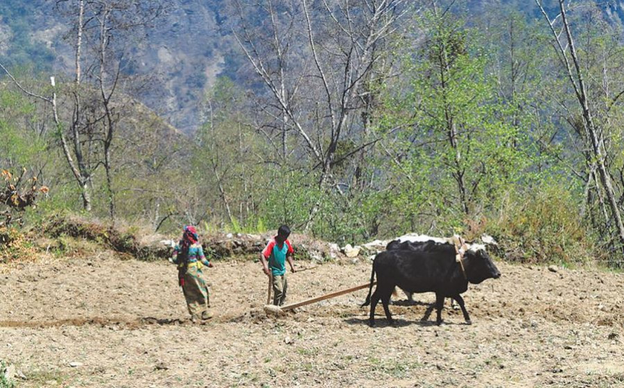
Uncontrolled land development is one of the main reasons for reduction in the agricultural land, according to Hari Dahal, former secretary at the Ministry of Agriculture and Livestock Development.
“Urbanisation and infrastructure development in the cultivable land have also led to loss of agricultural land,” Dahal told the Post.
According to Pokharel, the director general of FRTC, while floods and landslides, and rapid urbanisation cause reduction in agricultural area, the abandonment of agricultural activities can also be one of the reasons for increment in forest area.
“Agricultural fields have been abandoned due to migration and shortages of labour,” said Pokharel. “Over a period of time, such fields can turn into a forest or Other Wooded Land. However, it needs to be further researched.”
Madhukar Upadhya, a watershed practitioner and climate change expert, seconds Pokharel’s view.
“Agricultural lands left behind by people who migrate to urban areas or foreign countries turn into forests in course of time,” said Upadhya. “At a place in Panchthar district, people abandoned farming because of drought and later migrated to another area. Now the place has become a pine forest.”
According to Upadhya, natural disasters, floods and landslides, and rapid urbanisation lead to reduction in agricultural lands.
The report says while the major land cover’s conversion to forests was from cropland and OWL, a major part of the cropland was converted to forest, grassland and built-up area.
New data also shows that nearly 9.53 percent of agricultural land in 2000 have turned into a forest area in 2019.
Of the 3,891,500 hectares of agricultural land in 2000, 3,420,253 hectares (or 87.89 percent ) have remained the cropland, 370,805 hectares (or 9.53 percent) have been converted into forests.
Similarly, 1.12 percent of cropland became built-up area, 0.99 percent an OWL, 0.24 percent grassland, 0.17 percent water bodies, 0.05 percent riverbed, in 2019, according to the report.
While 94.49 percent of forest area remained intact from 2000 to 2019, 2 percent of forest area converted into cropland, 1.84 percent into OWL and 1.61 percent into grassland, the data shows.
“The NLCMS will significantly contribute in the formulation of policies in the coming days,” said Pokharel. “The data will help to make policies to improve land-related management practices.”
“We will soon release the land cover data of 2020 and 2021 as well. The NLCMS will enable us to make observations and prepare reports of land cover annually,” he added.


 9.12°C Kathmandu


