National
Task force suggests dialogue as basis for reclaiming areas disputed with India
Nine-member panel recommends strategies that Nepal can use during negotiations with India.
Anil Giri
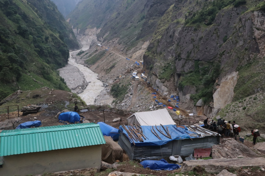
A team of experts commissioned by the government to collect evidence, historical facts, and documents to support Nepal’s claim to Kalapani, Lipulekh and Limpiyadhura has concluded that there is no alternative to holding talks with India to bring back the land occupied by India stationing its forces for decades.
Following a boundary row with India, the government had formed a nine-member team some three months ago led by Bishnuraj Uprety, executive chairman of the Policy Research Institute, a government think tank, and tasked it with gathering evidence and suggesting a strategy that would be instrumental in holding talks with New Delhi.
With renewed tension at the India-China border, the recent road construction by India in the Lipulekh area, the boundary issue between Nepal and India is complicated and demands skilled negotiation by Nepali officials, at least two members of the panel said.
After the boundary dispute emerged with India last November when New Delhi released a new political map incorporating the territories claimed by Kathmandu, Nepal too issued a new political and administrative map on May 20 showing Kalapani, Lipulekh and Limpiyadhura within the country’s borders.
The constitution was subsequently amended to give the new map legal status, and the government sought diplomatic talks with New Delhi to resolve the boundary issue. But the fate of the talks still remains uncertain.
Officials in Kathmandu are of the view that foreign secretary-level talks, at the very least, should be convened immediately to resolve the decades-long dispute. But India has been reluctant to hold dialogue citing the Covid pandemic.
The report was to be submitted to Prime Minister KP Sharma Oli as the panel was formed by the Cabinet but the Uprety-led committee submitted the report to Foreign Minister Pradeep Gyawali on Sunday after dozens of officials at the prime minister’s residence tested positive for Covid-19.
“Basically, we have gathered evidence and suggested strategies on five thematic areas,” Uprety told the Post. “We have provided historic pieces of evidence, what international laws and practices say and what domestic legal provisions we have, the cartographic evidence available to us, hydrological facts on the origin of the river, and strategic considerations.”
Initially, questions were raised why the government formed the task force when the map had already been released and approved by the Cabinet. Even though India claims the disputed territories as its own, Nepal says it has enough evidence to prove that they belong to Nepal.
Until 1962, the Nepal government conducted census, collected land revenue and issued land registration certificates in the areas now controlled by India. Following India’s war with China, New Delhi set up military bases in Kalapani, which remain there until now.
Though the report is kept secret because it guides the government on Nepal’s strategy for holding the boundary talks, sources said the Ministry of Foreign Affairs is likely to release an executive summary of the report later.
“The report is for our internal use and considerations,” Foreign Minister Gyawali told the Post. “The report will help us while we’re at the negotiating table.”
“After establishing territorial sovereignty that east of Limpiyadhura belongs to Nepal as per the Treaty of Sugauli, we can discuss the modalities on what to do on Kalapani where India has its military base,” a member of the task force told the Post.
“We have provided some undeniable evidence and what strategy Nepal should adopt while sitting for talks with India,” said Uprety, the coordinator.
On historical facts and evidence, the committee has gathered documents signed between the two countries on boundary matters, old treaties, agreements, understandings, correspondence and letters exchanged between the two sides in varoius periods particularly after 1816.
The Uprety-led committee has gathered information to prove that the origin of the Kali river is Limpiyadhura. They also studied the tributaries of the Kali river for fixing the boundary, one member of the team said. Nepal and India have adopted the fixed boundary principle in river areas.
As per the fixed boundary principle, the demarcation of boundary along the river when it was agreed in first delineation is considered the boundary line.
This is useful when a river changes its course and new claims and counterclaims emerge, the member said.
The team has collected old and historic maps as evidence. The Treaty of Sugauli and other boundary protocols that Nepal and India signed in the past would be presented as evidence, the second member said.
Some of the evidence was sourced from the British Library, the member said. “We have collected evidence enough to prove our claim,” the member said.
The team also furnished evidence related to land taxes that people living in the villages of Kuti, Navi and Gunji paid to the government of Nepal until 2030 BS, along with various government reports, directives of successive governments, administrative orders, court orders, land certificates possessed by the people living in the disputed areas, and documents related to land certificate and land tax.
A senior government official said since Nepal issued a new map showing the three areas within the country’s borders, Kathmandu has few options considering Kalapani’s strategic importance for New Delhi, especially when it is embroiled in a bitter territorial dispute with China.
Surya Prasad Subedi, professor at University of Leeds in the United Kingdom; Ramesh Dhungel, a historian; Bipin Adhikari, a senior advocate; Jagat Bhusal, water expert; Toyanath Baral, former director-general at the Department of Survey; Himalaya Thapa, a retired Nepal Army general, and Apsara Chapagain, a community forestry activist, are members of the committee. Ram Prasad Subedi, joint-secretary at the Ministry of Foreign Affairs, is member-secretary.


 18.12°C Kathmandu


