Climate & Environment
Met office predicts low rainfall and temperature rise ahead
Nepal is among the countries most vulnerable to climate crisis as extreme weather events have become common.
Arjun Poudel
Nepal is most likely to witness below-average rainfall in the upcoming monsoon season, according to a forecast by the Department of Hydrology and Meteorology.
The department’s Climate Section, which forecast weather conditions on Thursday for four months between June 1 and September 30, said that most parts of the country are likely to experience above-average maximum temperature due to the El Nino conditions, a climatic pattern that generally brings dry weather.
“There is a 35 to 55 percent chance of both conditions—below-average rainfall and above-average maximum temperature,” the department said in a statement.
Nepal is one of the world’s most vulnerable countries to the climate crisis and has witnessed extreme weather events over the past decade and a half.
Evidence indicates that the maximum temperature in Nepal is rising at a faster pace (0.056 degrees Celsius per year) than the global average (of 0.03 degrees Celsius per year).
The department, however, said that the central and northeastern parts of Koshi Province, south-eastern parts of Bagmati, and almost all parts of Madhesh Province could witness average rainfall (with 35 to 45 percent chance).
Central parts of Sudurpaschim province, central-west areas of Karnali, northern parts of Bagmati and Gandaki, eastern and western parts of Lumbini, and the eastern part of Madhesh could also witness average temperature (with 35 to 45 percent chance).
The met office had predicted hot and dry months last winter.
Experts say extreme weather events—excessive rainfall in a short span of time, continuous rain for several days in the post-monsoon period, dry spells and drought, below average precipitation and above normal temperature in winter—have become more frequent in Nepal in recent years.
The met office also said that multiple weather systems—westerly trough, moisture from the Arabian Sea, a low-pressure area formed in several parts of India and the local weather systems—are responsible for the rainfall that has persisted since Saturday.
Most districts across the country witnessed rainfall, which helped bring down the maximum temperature, cut pollution levels and put out forest fires.
“The rainfall will stop from tomorrow [Friday],” said Barun Paudel, a meteorologist at the division. “Hilly areas of the districts of Bagmati, Koshi and Gandaki provinces and some districts of Tarai region witnessed rainfall today [Thursday].”
The met office said the districts in the mountainous region—Darchula, Manang, Dolpa and Mugu—witnessed snowfall due to the continuous rain over several days.
Paudel said while people living in the mountainous region have been affected by the chilly weather conditions due to the snowfall, those residing in other parts of the country, especially in the Tarai region, got relief from scorching heat.
The pre-monsoon rainfall has helped cool some Tarai districts whose temperatures had crossed 40 degrees Celsius only about two weeks ago.
The maximum temperature had risen by 3 degrees Celsius in most parts of the country, higher than the average for this time of the year.
The mercury had soared to more than 40 degrees Celsius in many districts of the Tarai, including Kapilvastu, Rupandehi, Parsa, Bara, Sarlahi, Dhanusha, Saptari and Siraha. Hot air started blowing at around 10 am, disrupting daily life.
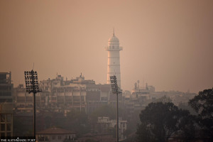
The met office had earlier forecast mild to moderate heat waves in some districts and extreme heat waves in other places. But the lack of rainfall for a long time triggered incidents of forest fires last month across the country, which led to a general deterioration in the air quality. Smoke and haze covered the Kathmandu Valley and a few other places.


 20.5°C Kathmandu


