Climate & Environment
Pre-monsoon rains came late but were abundant to end months-long drought
Cyclones Tauktae and Yaas helped the country meet its pre-monsoon rainfall, meteorologists say.
Chandan Kumar Mandal
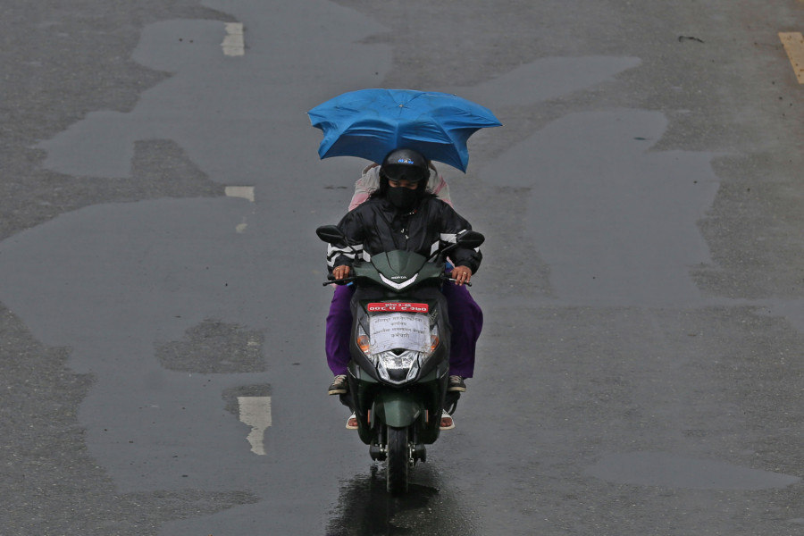
Nepal has received a significant amount of rainfall in the last phase of the ongoing pre-monsoon season, helping the country cross its average rainfall mark for the season.
As per the rainfall data compiled by the Department of Hydrology and Meteorology, an average precipitation of 291.7 mm was recorded during the pre-monsoon of 2021. The amount of rainfall the country received during this season, a period of three months between March and May, is 29 percent higher than the seasonal average.
The national average for pre-monsoon precipitation, based on 20 major weather stations, is 226 mm.
The surge in seasonal precipitation has been attributed to the back to back cyclones that affected the country in the last two weeks before the pre-monsoon season would come to its end.
According to Indira Kadel, a senior meteorologist with the department, the country could receive above normal rainfall, thanks to the two cyclones—Tauktae and Yaas.
“Both the cyclones impacted the country and caused rainfall. Rainfalls induced by Tauktae in the Arabian sea and Yass in the Bay of Bengal helped many of our weather stations cross their seasonal average,” said Kadel, who is also the chief of the Climate Analysis Section of the department. “Before those two spells of rain, it was mostly dry.”
In the third week of May, a powerful tropical Cyclone Tauktae, which was the strongest storm ever to make landfall on the western coast of India, had left behind a trail of destruction in India. The cyclone that mainly hit the northwestern region of India, causing floods and storm surge to areas including Mumbai, had killed over 100 people. It also brought light to moderate rainfall in different parts of Nepal
Likewise, Cyclone Yaas, which battered India’s eastern coastal states, mainly West Bengal and Odisha, also brought nationwide rainfall to Nepal.
“While Tauktae brought more rainfall to the western parts of the country, effects of Yaas could be felt across the country, from east to west. Eastern parts of the country and districts of Bagmati and Gandaki provinces were disturbed more,” said Kadel. “The rainfall due to the two back to back cyclones even went on to affect the seasonal outlook. The last two weeks of May when we saw the impact of the cyclones, which can cause massive rainfall and windstorm, contradicted the seasonal forecast. Otherwise, everything was going on as predicted.”
The climate outlook for the pre-monsoon, prepared by various agencies of the World Meteorological Organisation based on climate models, had predicted a rather hot and dry pre-monsoon for Nepal.
As per the forecast, the probability of the eastern parts of Province 1 and Province 2 receiving more than average rainfall was between 40 and 50 percent. Likewise, the probability of the Sudurpaschim Province witnessing less rainfall was around 40 to 50 percent while there was no clear prediction for the remaining provinces.
The cyclones-induced precipitation, although delayed and uneven across the country, however, put an end to the six to seven months of a drought-like situation in the country.
According to another set of data, the eastern districts of the Lumbini Province like Kapilvastu, Arghakhanchi, Rupandehi and Nawalparasi (west) and the southern districts of the Gandaki Province like Nawalparasi (East), Tanahun and Syangja had recorded more than 200mm of rainfall due to the cyclones.
“Even until the first week of May, major stations, except Simara, had reported a dry pre-monsoon season,” said Kadel. “Although on average the pre-monsoon rain improved, places like Pokhara, Kathmandu, Okhaldhunga and Jiri still recorded a below normal rainfall this season.”
The 2020 monsoon was followed by back to back comparatively dry seasons.
The post-monsoon had received only 25.6 percent of the normal rainfall whereas winter rains also dried up recording only 25.3 percent of the normal rainfall.
Two dry seasons meant the country experienced a long dry spell and a severe drought-like situation, increasing the possibility of drying up of springs, fire incidents and wildfires across the country.
Eventually, impacts of dry weather were observed across the country.
The country witnessed one of the worst wildfire seasons in its recorded history, leaving various places including the Kathmandu Valley and other major cities, shrouded in toxic smog and the general public gasping for clean air.
“The country went through a long drought season. There were reports of water crises and a reduction in the yields of winter crops. We saw massive forest fires across the country which could not be doused for weeks as there was no rain,” said Kadel. “There was a dangerous spike in air pollution in the last week of March and then in April, causing a drop in visibility which led to flight cancellations. Had only there been rain during that time, it could have washed away the pollution.”
With the last moment spike in rainfall in the pre-monsoon season, the country is likely to see ‘an above-normal rainfall’ this monsoon season, which mostly begins on June 10, giving a much-needed boost to the economy battered by the Covid-19 pandemic.
Meanwhile, the pre-monsoon rains do have their benefits, even if they came much later than they were supposed to be.
“Although late, the pre-monsoon rains came as a relief to the monsoon crops, which are planted this time around, and the skies are mostly clear and the air pollution has come down,” said Kadel, the senior meteorologist. “Most of all, these are good signals for the approaching monsoon.”


 20.12°C Kathmandu


