Latest in the Lipulekh dispute explained in six points
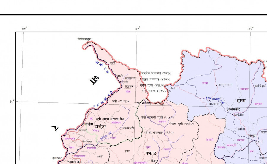
Nepal has long objected to India and China making bilateral arrangements over Lipulekh, having previously protested in 2015 and 2020. The political and administrative map of Nepal issued on May 20, 2020 includes Limpiyadhura, Lipulekh and Kalapani within Nepali territory. Photo: Courtesy of Survey Department
The latest dispute over Lipulekh resurfaced after India’s National Security Advisor Ajit Doval and China’s Foreign Minister Wang Yi, during their boundary talks in New Delhi, agreed to reopen three traditional border trade routes, including Lipulekh, without consulting Nepal.
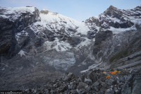
The Lipulekh Pass is known as Pulang-Gunji in local Tibetan dialect. Gunji is one of three villages located in the Kalapani area. Though currently under Indian control, Nepal has consistently asserted its claim over the area.
Nepal has long objected to India and China making bilateral arrangements over Lipulekh, having previously protested in 2015 and 2020. The renewed agreement has reignited concerns about Nepal’s sovereignty and placed pressure on Prime Minister KP Sharma Oli to raise the issue during his upcoming visits to Beijing and New Delhi.
Reacting on the latest development of Lipulekh Pass, Nepal’s Ministry of Foreign Affairs reaffirmed that the official map of Nepal, as incorporated in the Constitution of Nepal, includes Limpiyadhura, Lipulekh, and Kalapani—located east of the Mahakali River—as integral parts of Nepali territory.
Earlier in May, 2020, when India’s Defense Minister Rajnath Singh inaugurated a ‘link road’ to Lipulekh, the Ministry of Foreign Affairs had expressed ‘regret’ and reiterated that as per the Sugauli Treaty of 1816, all the territories to the east of the Kali (Mahakali) River, including Limpiyadhura, Kalapani and Lipulekh, belong to Nepal.
Commenting on Nepal’s territorial claims, Randhir Jaiswal, spokesperson for India’s Ministry of External Affairs said that the claims were “neither justified nor based on historical facts and evidence” He described them as untenable. “Border trade between India and China through Lipulekh pass commenced in 1954 and has been going on for decades,” Jaiswal said.
 23.72°C Kathmandu