Columns
Improve the wards
The life of citizens living in villages is more difficult than the life of those in municipalities.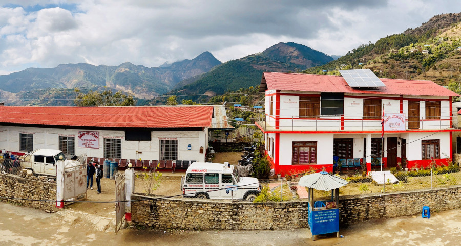
Khim Lal Devkota
The Constitution of Nepal, 2015 has instituted a three-tier government: One federal, seven provincial and 753 local governments. Of the local governments, there are 293 municipalities and 460 rural municipalities. The six metropolitan and 11 sub-metropolitan cities fall under municipalities. There is no difference in the functional rights of a municipality or a rural municipality, a metropolitan city or a sub-metropolitan city. Wards form the smallest local government unit in the country, comprising 6,743 wards. Most former village development committees (VDC) have now been converted to wards.
New power centres
In the past, citizens received services from VDCs. It is necessary to understand the ward as an essential service delivery centre. In some places, two or three VDCs have been transformed into wards. For instance, Chapakot and Bhadaure VDCs of Kaski are now Ward 23 of Pokhara Metropolitan City.
The services previously provided by two VDCs (each with nine wards) are now confined to a single ward. Looking at this aspect, the services that citizens receive from the state have gone far away. Even so, citizens should receive services from the current ward according to their expectations. However, the situation is quite different. Most of the resources are centralised in the municipality, and even a kilometre of road has not been blacktopped in Ward 23. As services are not provided through the ward, people must travel 20 kilometres to the municipal office in Pokhara. If this is the situation in Pokhara, which ranks third after Kathmandu and Lalitpur in the Human Development Index (HDI), what can be expected of remote areas?
In the constitution, the rights of Kathmandu (Singhadurbar) have reached the villages, but new power centres have been created at the local level. People have yet to be able to get adequate services from the ward-level offices. There are problems with the staff at the ward-level offices. People are compelled to visit the local centres to obtain housing maps, pay taxes, and receive payment for implementing programmes and projects.
In addition, there is also the grievance that the allocation of programmes and projects at the local level is lopsided. Mainly, programmes and projects are concentrated in power-centric areas. As mentioned earlier, ward 23 of Pokhara, with an area of 48 square kilometres, lacks even one kilometre of blacktopped road. If the two VDCs (Chapakot and Bhadure) had not been merged into wards and remained VDCs, they would have received direct fiscal transfer.
If we compare the structure of the unitary system, people have received fewer services and facilities, including buildings and construction of physical infrastructure, among others, than they should get from the ward level. In the past, it would have taken a half an hour's walk to get any recommendation letters, but now, they have to walk for two days. The people living in the hills and the mountains have suffered the most.
Bigger than districts
Based on the 2011 census, the average population and area of the local government ward are 3,892 and 20 square kilometres, respectively. However, at some local levels, the average geographical area of their wards is larger than that of some districts. For instance, the average ward area of Namkha Rural Municipality in Humla is 403 square kilometres, which is about 3.5 times more than that of Bhaktapur district. The area of Bhaktapur is only 119 square kilometres. Not only Bhaktapur, but the average ward area of Namkha is more than that of Kathmandu and Lalitpur.
The southern part of Lalitpur district is so remote that it takes almost a day to reach there, even by vehicle. How difficult it must have been for the residents of Namkha ward, which is bigger than Lalitpur district! It has yet to reach our attention. There are around a dozen local levels with an average ward area of more than 200 square kilometres.
The average area of the wards of Khumbu Pasang Lhamu Rural Municipality in Solukhumbhu district is 308 square kilometres. About 2,000 people live in a ward there. Similarly, the average area of the wards of Kanda Rural Municipality in Bajhang district is about 300 square kilometres. As the areas of the wards are bigger, it becomes difficult to provide basic services for people. So there is a need to increase access to basic services such as drinking water, schools, health post, security, banking and communication. But the government has failed to provide enough staff not only at the ward level but at the local government level as well.
All local governments should not be looked at and treated equally. The average area of the wards of Bhaktapur, Lalitpur, Madhyapur Thimi, Kirtipur, Kathmandu and Tokha municipalities is less than two square kilometres. Bhaktapur is less than one square kilometre. There is a big difference between the services these local governments provide to the citizens and those offered by the local governments of mountain districts, for instance, Namkha.
The life of citizens living in villages is more difficult than the life of those in municipalities. Among municipalities, smaller ones have more problems than large ones. Further, geographically speaking, the life of the people in the mountains is more difficult than in the Terai or the hills.
The average geography of the local level of the mountain region is 360 square kilometres, while that of the Terai is 110 square kilometres. The average area of the mountain region's local government wards is about 50 square kilometres, while it is 10 square kilometres in Terai. There is little problem with resources, including the availability of officials at local government offices; the problem lies with remote-based local governments. Therefore, from the point of view of service delivery, we need to make policies and laws with special attention to the wards, pay attention to the citizens living in the mountain region, and consider the wards as the basis when making every policy decision for the distribution of resources, among others.


 13.12°C Kathmandu

