Culture & Lifestyle
Mapping mountains and trails
Man Bahadur Khatri, a former mountaineer and trekking guide, shares his journey, from climbing peaks to making detailed travel maps.
Mahesh KC
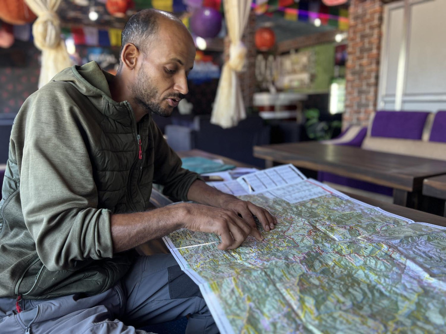
An old laptop, a trusty GPS device, a withered compass, meticulously detailed topographic maps, a worn-out tent, and an array of guidebooks and trekking manuals. One can find all these in Man Bahadur Khatri’s backpack, alongside other essentials like clothes, roasted gram flour, sugar, salt, and gundruk (fermented leafy greens). With this steadfast companion hugging his shoulders, Man Bahadur Khatri, who had just finished a trip, tells me about his exciting escapades in a cosy cafe in Musikot.
A sip of steaming coffee initiated the cascade of narratives from his most recent journey. He began pulling out documents, including various trekking guides and mountaineering certificates. “I’ve brought paperwork—just in case you question my tales,” says Khatri excitedly. His enthusiasm was palpable, his zest for storytelling infectious.
Thirty-nine-year-old Khatri introduces himself as a “mountain leader and instructor.” Born in Harlabot-4, West Rukum, the foundations of his journey were set in 2002, when he triumphantly earned his School Leaving Certificate (now SEE) from his village before moving to Nepalgunj for further studies. He worked in a hotel there to save money for his education. Many tourists visited the hotel and he was intrigued by their lifestyle.
Amidst the political turmoils of the 2000s, when the country was embroiled in the Maoist conflict, Khatri met a French woman while working in the hotel. Her mission: to glean insights about the insurgency. Circumstances conspired, and an opportunity arose for him to accompany her to Rukum. “After a few days of travelling together, I developed an interest in learning the French language and being in the company of foreigners. I spent around 15 to 20 days with her,” he reminisces, adding that after their journey to Rukum, they travelled to Kathmandu, where Khatri began learning French and working as a tourist guide with the help of the French woman.
By 2009, his passion spurred him to get a trekking guide licence. After studying English and French rigorously for two years, he began working as a tourist guide in 2011.
While training to become a mountain guide and instructor, he climbed around half a dozen mountains above 6,000 metres. Island Peak in Solukhumbu, stood as his first triumph—a 6,160-metre testament to his perseverance. Following that, he climbed Mera, Thorong La, Pisang, Chulu East, and Chulu Far East peaks. He recounts, “At first, these peaks felt like a distant fantasy. One after another, as I climbed mountains, it felt like I was fulfilling a long-cherished dream.”
A pause and a shift in Khatri’s narrative’s cadence signalled a monumental zenith: the summit of Mount Everest. On May 19, 2012, he stood atop the world. “A surge of self-assuredness radiated within me after that. I believe I am the first person from Rukum to embrace Everest,” he says in a voice tinged with pride. He was also a participant in the 2012 International Everest Expedition.
Eager to share his next chapter, Khatri recounts the ascent of Mount Sisne, a lesser-known peak at 5,911 metres. An eight-member team journeyed alongside him. “Climbing Sisne wasn’t a professional quest; it was to boost tourism in our district and introduce this peak to the world. As far as I know. we were the first to climb that peak and no one else has climbed after us,” he explains, adding the reason for Sisne’s obscurity is because it misses the popular mark of 6,000 metres by a fraction.
Khatri’s ascent of Mount Sisne painted the culmination of his summits, a finale with an unanticipated encore. Guided by his fascination with mapping, he shifted to surveying trekking paths with precision. He relied on tools like GPS devices, compasses, and maps, each step on unfamiliar trails guided by technology and nature’s cues.
After taking up the task of creating trekking maps for tourist routes, Khatri spent almost two years, from 2014 to 2016, preparing maps for Dhaulagiri and Kanjiroba regions. Starting from Mugu, he covered Dolpa, Jajarkot, Rukum, and Dhorpatan, finally reaching the base camp of Mount Dhaulagiri. Following this, he also created maps for the Sisne round trek and the Dhaulagiri trail map. Through meticulous detailing, he chiselled pathways that blended local wisdom and safety. “Maps,” he affirms, “are the compasses that guide trekkers. They instil confidence, enabling adventurers to travel with a sense of direction.”
To honour his efforts in promoting tourism and exploration in the Western part of Nepal, Khatri was inducted as a member of the Peak Profile Committee of Nepal Mountaineering Association. Shortly afterwards, he was also appointed as a member of the Destination Research and Promotion department of the Trekking Agencies Association of Nepal (TAAN).


 29.22°C Kathmandu


