Opinion
Reinventing Kathmandu with a metro
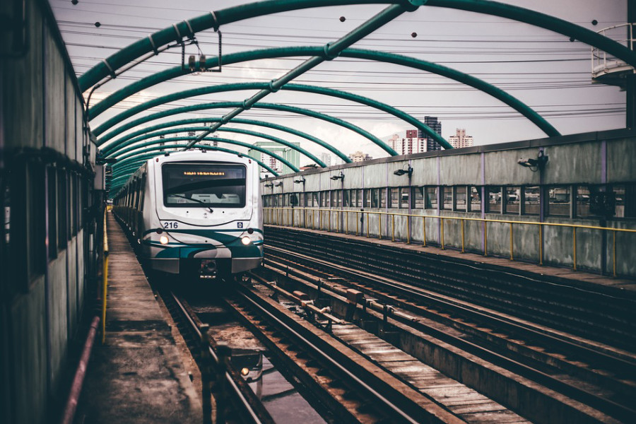
The proposed line is about 34 km long, out of which 12 km would be underground.
Binod L Amatya
The state of public transport services in Kathmandu Valley is very poor. The city’s urban transport is barely coping with demand. Nowadays, during peak hours, the average speed of vehicles can be as low as 7 kmph. The metropolitan authority has realised that immediate solutions are necessary to keep urban transport moving. Therefore, public transport company Sajha Yatayat is increasing the number of green coloured buses on major routes or operate these buses on newly added routes. Investment Board Nepal is working to operate a bus rapid transit system on the Ring Road. If the plan goes ahead, bus rapid transit could offer a midterm solution for the valley in the next few years.
These solutions, however, would not be sustainable to keep the city moving in the long term. The valley is in desperate need of a mass rapid transit system, that is a metro rail system, which could carry thousands of passengers every hour in each direction and operate without any interaction with other street vehicles. Mobility networks would need to be planned over long periods, stretching forward beyond the next five to 10 years. In this regard, the early planning of a metro rail system in the valley would be timely and essential.
Patan line metro route
The Patan line metro is proposed as the cross rail of Kathmandu giving a north-south connection. It will integrate at least four municipalities of the valley, such as Godavari, Lalitpur, Kathmandu and Budhanilkantha. The Patan line will connect Bhrikuti Mandap with Satdobato in the south and Bansbari in the north. This line would be further extended outwards from the city core area to Chapagaun and Godavari in the south and to Budhanilkantha in the north.
The current effort of the Department of Railways to prepare a detailed project report for the Satdobato-Ratna Park-Narayan Gopal Chowk elevated metro is a short-sighted vision. The newly proposed metro line should not be confined to the urban core area only. It should, rather, reinvent and rejuvenate the city by adding more connectivity with suburban areas. In this regard, the Patan line is proposed to be extended, ultimately, to the edge of the valley.
Studies show that, in general, the sub-surface ground conditions underlying the northern section of the route are silty sand-dominated, while beneath the southern section the subsoil is dominated by Kalimati clay. The bedrock in the central section is anticipated to be very deep (possibly greater than 100 metres). An understanding of these subsurface features is important to enabling the building of robust rail infrastructure such as tunnels, viaducts and underground stations.
The call for expressions of interest recently issued by the Department of Railways for consulting services for the detailed project report of the Satdobato-Ratna Park-Narayan Gopal Chowk line has major limitations. This expression of interest has neither explored any alternative options in terms of horizontal alignment nor sought the possibility of an underground option. The Department of Railways’ intention to build an elevated metro system along the whole route could have catastrophic impacts on urban mobility. An elevated metro rail along the route will certainly cause chaos with traffic flows in the core area during construction and the subsequent operation phase creating more congestion on the route and will destroy urban aesthetics with elevated rail tracks at the building terrace level.
An elevated metro system will permanently occupy at least one-lane width of the current road given over to erect piers required to support the railway viaduct. During construction, two-lane widths of roadway will be temporarily required for construction equipment. The railway viaduct width would be as wide as 8 to 10 metres over the existing road. As most of the roads along the route are barely four lanes wide such as at Lagankhel, Pulchok/Hariharbhawan, Tripureshwor, Jamal and Lazimpat, this would lead potentially to land and building acquisition issues at many locations and thus result in additional time and cost. For ease and smooth running of transport mobility during construction and operation of the metro line, and to preserve the aesthetics of the city, it is essential that the Satdobato-Bansbari section of the Patan line be built underground.
The construction of an elevated metro system will not come cheap. Narrow roads and prevailing weak ground conditions along the route and risk of earthquake occurrence in the valley will require complex and expensive foundations. In this regard, an underground metro system would be a robust, space-saving form of construction. Tunnels of 5.8 metres internal diameter at between 15 to 30 metres depth would be appropriate for the core area. For the remaining sections, further south and north, and where space limitations are less onerous, an elevated rail system would be viable. It is also recommended that the route adopt a major underground station/interchange at Bhrikuti Mandap benefiting from the availability of the existing public open space which could, in turn, be developed to create a transport hub in the future.
New town centres
The Patan line would be a model for a future Kathmandu metro rail network. Therefore, every effort should be made to exploit the benefits this route can offer to the valley. Metro rail stations could function as a catalyst for the transformation of urban space. A metro rail station should not just be viewed as a transport station. It could attract retail, leisure and commercial activities to focus at one place. In this regard, the proposed principal stations along the route may be developed as future transport hubs. Also, opportunities for the urban regeneration and development of new town centres should be explored such as at New Thecho, New Harisiddhi and New Badegaun, to name a few. In addition, this route could offer a development possibility for a sports hub in the suburban area; the valley is lacking a 21st-century stadium and sporting facility.
The proposed Patan line is about 34 km long, out of which about 12 km would be underground and about 22 km elevated. Considering the local scenario and based on metro rail development around the world, the construction cost of this line could be in the range of $1 to $2 billion.
It is vital to get right the alignment and form of construction for the Patan line at the start, and it will set the scene for the development of a metro rail network in the valley. The introduction of an underground metro for the core section of the proposed route would improve the capacity of the existing roads, ease congestion during construction and operation of the line, and offer better facilities for commuters. Therefore, it is urged that the Department of Railways review its expression of interest for the Satdobato-Ratna Park-Narayan Gopal Chowk elevated metro, and explore the underground option and reroute the alignment via the major transfer junction at Bhrikuti Mandap. The introduction of the Patan line could show how to trigger redevelopment and regeneration of the core as well as suburban areas to finance the metro rail project.
Amatya is a chartered civil engineer and principal ground engineering consultant currently practising in the UK.


 20.12°C Kathmandu


