Climate & Environment
Aerial inspection ties Thame flood to glacial lake outburst
Experts and officials say Friday’s Everest region disaster came after two small bodies of water burst their banks.
Binod Ghimire
An unusual flooding in the Everest region that swept a village downstream on Friday was an incident of glacial lake outburst, according to the government and an international organisation working in the Hindu-Kush mountain region.
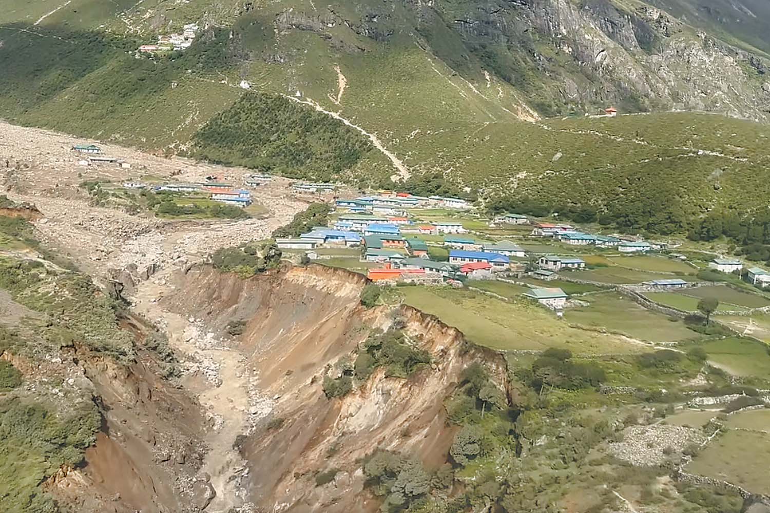
The flooded Thame river brought down Himalayan slopes mud, gravel and boulders, destroying 20 houses, an elementary school, and a clinic in ward 5 of Khumbu Pasang Lhamu Rural Municipality. As many as 135 people have been displaced as the Thame riverside settlement has been carpeted by mud and stones. Thame is a prominent village in the Namche region of Solukhumbu district.
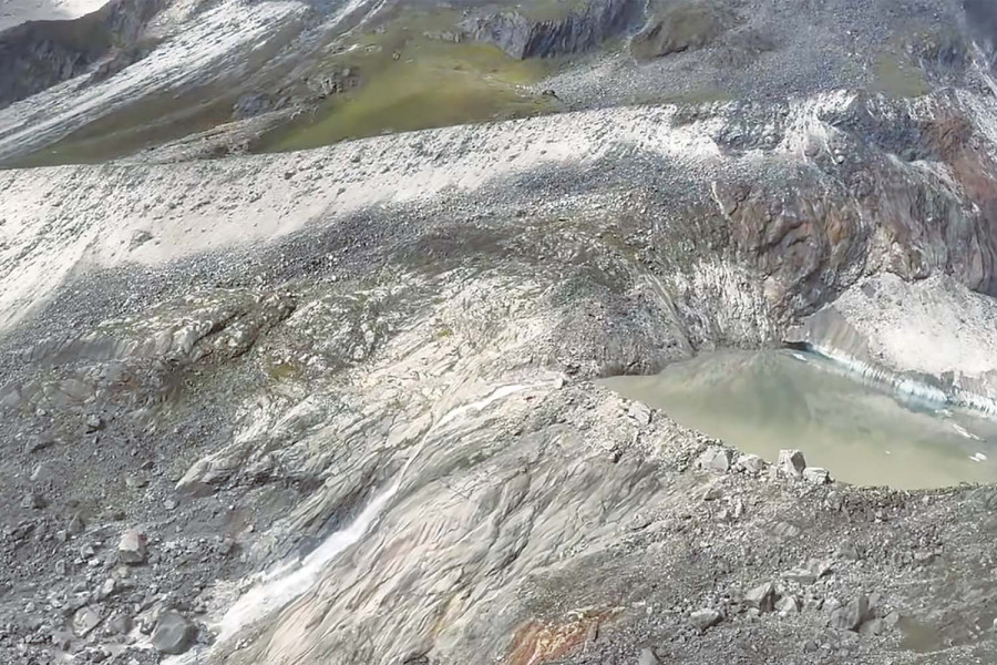
Defence Minister Manbir Rai on Saturday reached the affected area with a team comprising senior government officials, security officers, and experts. After inspecting the flood-hit areas and the upstream region on a helicopter flight, they concluded that a glacial lake outburst had caused the flood.

The officials found that two of the five small lakes formed above the Thame village in the Everest region had been emptied of their water. Solukhumbu Chief District Officer Devi Pandey, who was a member of the minister-led inspection team, said the two water bodies had breached their banks on Friday. Two other lakes look potentially dangerous and may breach at any time, while the remaining one looks safe, according to her.
The International Centre for Integrated Mountain Development ((Icimod) also blamed the devastating flood on an outburst of water from the Thyanbo glacial lake.
“Icimod scientists are further investigating the causes of Glacial Lake Outburst Flood (GLOF) and its impact downstream, including seeking pre- and post-satellite images, to complement the efforts of national and local agencies, including Nepal’s Department of Hydrology and Meteorology,” read a statement issued by the research institute on Saturday.
Several glacial lakes lie upstream of Thame. Satellite images of the area dating from 2017 show these lakes constantly changing in size, said Icimod. “Researchers there confirm that some of them frequently expand and contract, making them susceptible to breaches.”
These lakes lie near the popular trekking destination of Tashi Lapcha Pass. The neighbouring valley holds one of the region's most potentially dangerous glacial lakes, Tsho Rolpa.
As per Icimod’s 2023 assessment, Water, Ice, Society, and Ecosystems in the Hindu Kush Himalaya, the glaciers, snow, and permafrost are “undergoing unprecedented and largely irreversible changes over human timescales, primarily driven by climate change” and “are some of the most vulnerable to these changes in the world”.
It warns that floods and landslides are projected to increase, with climate the key driver in many of the water- and cryosphere-related disasters already recorded in recent years. This includes meltwater, larger and more potentially dangerous lakes, unstable slopes from thawing permafrost and increasing sediment loads in rivers.
The retreat of mountain glaciers has increased the size and number of glacial lakes. A threefold increase in glacial lake outburst flood risk across the HKH is projected by the end of the twenty-first century, according to the statement. “We’ll reach ‘peak GLOF risk’ by 2050.”
According to Icimod, as many as 47 glacial lakes among over 25,000 in the Hindu Kush Himalaya region are potentially dangerous. They lie within the Koshi, Gandaki, and Karnali river basins of Nepal, the Tibet Autonomous Region of China, and India.
“Climate change is a crime scene. The glaciers are making it visible. We cannot look the other way,” Miriam Jackson, cryosphere lead for Icimod, was quoted as saying in the statement.


 14.12°C Kathmandu


