Opinion
Shared responsibilities
Ruling elites in influencial countries need to wake up and begin to shift to zero carbon development pathways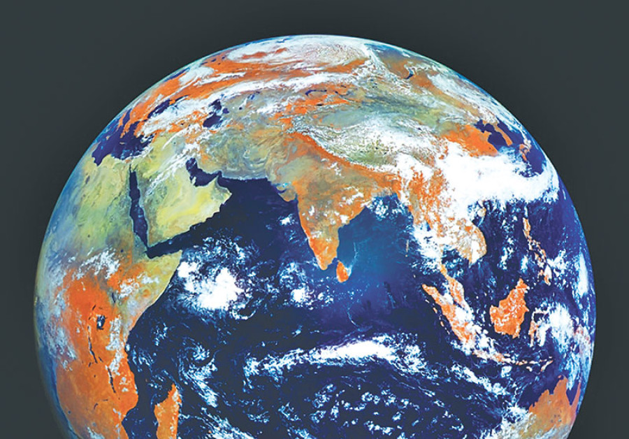
Ajaya Dixit
Around the second week of June, if conditions are normal over the Asiatic mainland and surrounding water bodies, the South Asian Monsoon (SAM) enters Nepal and covers the entire country over a period of about two weeks. It starts to weaken by the third week of September, then departs, returning the following June. Westerly disturbances active from December to February bring some rains to Nepal. Rains from these atmospheric systems sustain the regional hydrology that supports the lives and economy of about 650 million inhabitants who live in the Ganga River Basin (GRB), which includes all of Nepal and parts of China, India and Bangladesh.
Not all parts of the GRB receive the same amount of rainfall, however. Wide spatial variations that exhibit intra- and inter-seasonal and inter-annual variability exist. The monsoon keeps the regional hydrological cycle going, which begins with the interception of precipitation by vegetation, storage in soil, infiltration to groundwater aquifers and surface runoff to streams. The network of streams and rivers convey water to the ocean and seas. Within this cycle, dry spells, high flows and sedimentation are regular features that produce droughts and flood disasters. Uneven social structures, differential local economies and poor governance in the countries within the GRB worsen the impact of these disasters.
Altered hydrology
In the past 200 years, much infrastructure has been built on the rivers of the GRB to mitigate floods and obtain irrigation, drinking water and energy benefits. The services from these interventions have improved the quality of life for some in the GRB’s countries, but they have also reorganised movement of water within the hydrological cycle. Today, using dams, reservoirs and barrages, water is diverted into canals, tunnels and pipes to meet various needs. The wastewater generated is untreated and discharged into rivers already wrestling with embankments, dykes, walls, solid wastes and indiscriminate mining of bed and banks for sand and aggregates. In the downstream reaches, many rivers have little flow left. They are almost dead.
As urban areas grow, more land surface is paved, soil compacted and riverbanks squeezed by roads and settlements. In paved and compacted surfaces, infiltration is grossly reduced. Rainfall thus immediately runs off the surface to squeezed streams and rivers, resulting in instantaneous floods, while groundwater aquifers are not replenished. In the meantime, millions of mechanised water lifting devices pump out groundwater to the surface at rates far greater than recharge to meet agricultural, commercial and industrial needs. In many places, groundwater tables are lowered, exacerbating water deficiency and degradation. Urban growth has also encroached on many wetlands, ponds and lakes, reducing the natural capacity of land to hold water and minimise flood peaks.
Human-induced climate change increases the frequency of severe weather, further compounding these processes. Studies show that with atmospheric carbon dioxide and average temperature rising, the circulation of SAM and Westerly are likely to weaken and the frequency of extreme precipitation events will increase. What does weakened circulation of SAM, for example, mean for its intra- and inter-seasonal and inter-annual variability and the region’s overall wellbeing?
Some scenarios
Despite significant improvement in the computational capacity of computer-based climate models, they cannot predict changes in future precipitation in exact terms. Thus, in the future, uncertainty in SAM and Westerly will prevail. How do we deal with this uncertainty? One way is to use scenarios to envision possible futures and design response strategies.
Scenario I: SAM will arrive and leave on time, but there will be no rain for several days and when rain comes, the intensity will be very high. Both conditions will have serious impacts on livelihoods. Flash floods from high intensity rainfall would damage infrastructure and the services they generate. Within the given socio-political context, few people may be able to adapt autonomously to the impacts, and planned adaptation will require more than a business-as-usual approach.
Adapting livelihoods in such a future is more complex than, for example, changing the design approach of infrastructure to suit a flow response engendered by a weakened SAM. Conventional design approaches assume that characteristics of rainfall and stream flow will remain the same as in the past. When SAM’s circulation weakens, the assumption that rainfall and stream flow will continue to follow past trends will no longer be valid. Design codes as well as operation and maintenance protocols of infrastructure must be revised so that they can safely negotiate possible future extreme events and continue to deliver services or restore infrastructural damages in a shorter time. Such revision is an example of planned adaptation involving shifting of strategies to make infrastructure less vulnerable to the impact of changes.
At the same time, infrastructure already built without consideration of climate change risks must be retrofitted. How will developing countries like Nepal mobilise resources to meet this objective? How should climate change risks be incorporated in the infrastructure that is planned and designed today? Improved understanding of the climate regime can help in preparedness and minimise risks. But Nepal faces major constraints on this count too. For example, Nepal’s Department of Hydrology and Meteorology responsible for monitoring atmospheric and weather systems is under-budgeted. The agency’s share in the recently submitted Nepal’s national budget was less than 1 percent. Lack of adequate budget translates to lack of human resources and low capacity for analysis, forecasting and preparedness.
Scenario II: Continued increase in the concentration of atmospheric carbon dioxide will approach a tipping point. In such a worst-case scenario, SAM and Westerly will become increasingly unstable, with their arrival and withdrawal dates becoming extremely random. In the mountains, hills and plains, the timing, magnitude and spatial distribution of rainfall will change significantly.
The natural ecosystems that rely on the two weather systems and support the livelihoods of millions of Ganga River Basin inhabitants will be disrupted. Basic drinking water services will be significantly affected, and even those who can afford alternatives will not be spared. The impact will be too widespread for planned adaptation to work. The majority will be forced to seek safer places to live through the largest-scale migration ever seen in human history.
The world in a mess
We might think that such scenarios may happen only in the distant future but in reality the climate is changing as you read this. The major responsibility of avoiding a future with a rapidly changing climate rests with the ruling elites in Washington DC, New York, Beijing, New Delhi and London. They need to wake up and begin to shift to zero carbon development pathways. Unfortunately, the ruling elites in Washington DC have decided to pull out of the 2015 Paris agreement on climate change.
Referring to climate change, recently UN secretary general Antonio Guterres bluntly stated, “the world is in a mess”. The exit of the US government from the Paris agreement is likely to make the global climate politics messier while the target of keeping the average global temperature below the 2C increase from what is was in the pre-industrial era by 2100 will be unachievable. We could be veering towards the worst-case scenario with serious consequences on resource poor countries and people who have minimal roles in creating the problem in the first place.
Dixit is Executive Director of ISET-Nepal


 18.12°C Kathmandu

