Columns
Resolving border issues through dialogue
Nepalis are curious why India is unwilling to talk about the unresolved border issue.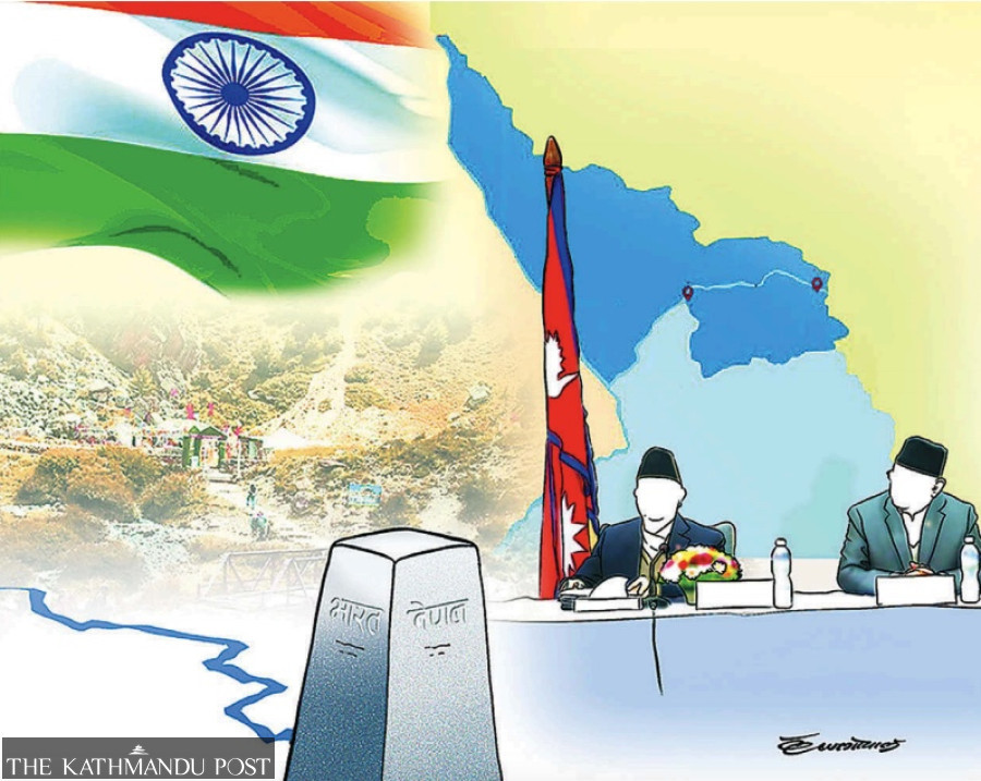
Buddhi Narayan Shrestha
Nepal’s Foreign Minister N P Saud, speaking on the occasion of India’s 75th Republic Day, organised by the Nepal-Bharat Friendship Society, said the border dispute between Nepal and India can be sorted out cordially through dialogue instead of making it a big political issue. He added that the Susta and Kalapani issues could be resolved in a friendly manner through a task force.
However, the Nepali civic society believes India is not ready to sit for a dialogue. In the run-up to the visit by Indian External Affairs Minister S Jaishankar to co-chair the seventh meeting of the Nepal-India joint commission on January 4, Nepal delved into issues related to boundary, economic cooperation, trade and commerce to discuss with India. However, these issues were not discussed due to India’s reluctance. How could Nepal compel India to come forward for dialogue in this situation?
Nepalis are curious why India is unwilling to talk about the unresolved border issue. This is more or less ambiguous. One circle of the Nepali track-II diplomats and learned men and women think India doesn't have strong proof of the Lipulek-Kalapani-Limpiyadhura area belonging to India. Conversely, Nepal has so many maps and documents that depict the area on the Nepali frontier. If there is a joint discussion, India will lose. So, it is not ready to talk.
Map conflict
India published its new “Political Map of India” on November 2, 2019. The Nepali sovereign area of Limpiyadhura-Kalapani-Lipulek was included in Indian territory. Nepal objected to it and invited India to dialogue, sending five diplomatic notes. Citing the concerns of the Covid-19 pandemic, India refused to engage in dialogue. Post-pandemic, Nepal again served a note, but India showed no eagerness.
Meanwhile, Nepal felt compelled to publish the beaked map (‘chuche naksa’) on May 20, 2020, including the Lipulek-Kalapani-Limpiyadhura area. It was passed by an overwhelming majority in Parliament, making amendments to the constitution, and endorsed by President Bidya Devi Bhandari with the red seal. Regarding this map, a spokesperson of the Indian External Ministry, during a weekly press brief, said, “It is noted.” So, the conflict on the maps is still at a stalemate.
Joint committee
Nepal and India formed a technical-level joint boundary committee in 1981 to demarcate the boundary between the two countries. It worked for 26 years before getting breached in December 2007. However, it demarcated 97 percent of the 1,880 km long border. It prepared 182 strip maps jointly. But this joint committee could not demarcate the remaining three percent of the Lipulek-Kalapani-Limpiyadhura, Susta and some other spots.
In August 2014, During the first visit of Indian Prime Minister Narendra Modi to Nepal, PM Modi and Nepal’s then-Prime Minister Sushil Koirala formed a four-tier joint mechanism. The first was the border working group under the leadership of the Director-General of the Survey Department of Nepal and the Surveyor-General of India. Second, the Deputy Director-General level survey officials committee and the third field survey team headed by chief district officer of Nepal and district magistrate of India were formed. The mandate was to relocate and construct the missing pillars, repair and maintain the dilapidated ones, and clear the no-man's land area. It worked till 2019, holding joint meetings twice a year, in Kathmandu and New Delhi each. Now, it has been stranded for the last four years. Nepal sent reminders to India to resume the border working group’s work. This, however, was not responded to as Nepal could not press India on this matter.
The fourth mechanism was at the level of foreign secretaries of both countries. They were directed to work on the outstanding issues, including Kalapani and Susta, and receive required technical inputs from the border working group as necessary. Unfortunately, the secretary-level mechanism has not started to work to date.
Way forward
According to the international boundary principle, there are four steps to resolve the boundary issues between two neighbouring countries: First, by holding dialogue-discussion-negotiation. Second, through mediation/arbitration. Third, by applying to the United Nations Security Council cartographic division. Last, with a writ petition to the International Court of Justice (ICJ).
The best means to resolve the border issue is the version of Foreign Minister Saud—to have a friendly discussion and reach a conclusion. If the issue is discussed diplomatically with a win-win situation, that will be settled forever. If one country wins with the decision of the ICJ, the loser party may hinder the execution of the decision. There is a possibility of enmity between the winner and loser parties for a long time.
In this context, the most important item to resolve the Lipulek-Kalapani-Limpiyadhura issue is to activate the foreign secretary-level mechanism to resolve outstanding boundary problems. During the bilateral talk between two foreign ministers at the Nepal-India joint commission meeting, Nepal should have taken up the issue of activating this already existing mechanism. That is a missed opportunity. If India continues to show unwillingness to sit for dialogue, Nepal must seek to put diplomatic pressure by bringing into confidence friendly countries like China, the United States or Russia. In lieu of a dialogue, an ideal way forward is to resolve the border issue diplomatically.


 11.12°C Kathmandu