 25.91°C Kathmandu

Mon, Jul 27, 2026
Columns
The fantasy of border settlement
The Indo-Bangladesh model that Nepali border pundits are calling for is unrealistic and impractical.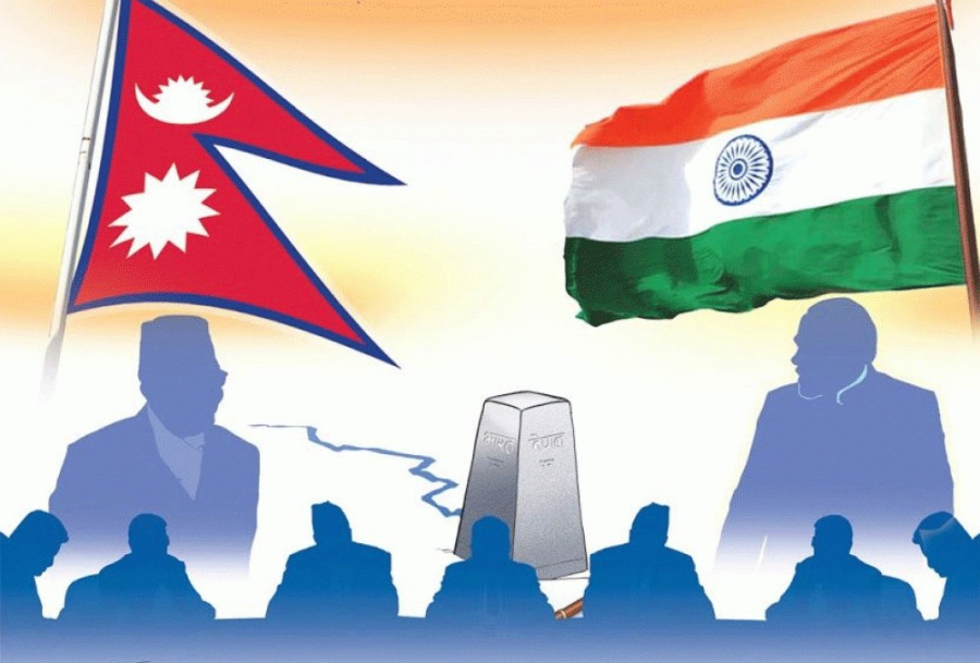
bookmark
Lok Raj Baral
Published at : June 20, 2023
Updated at : June 21, 2023 00:26
In his distinctive manner, Prime Minister Pushpa Kamal Dahal sometimes makes unwarranted remarks about issues with larger implications that need thorough study and strategy. While referring to the views of some "experts" on the Indo-Bangladesh model for swapping disputed territories (enclaves), he said there could be alternative models for settling border problems as the two countries did for exchanging enclaves. This was enough for some smart Nepalis (experts?) to suggest that Nepal may swap Limpiyadhura, Lipulekh and Kalapani for stretches of territories lying between the Siliguri corridor and Indo-Bangladesh border, enabling Nepal to reach Bangladesh and beyond for third-country trade.
Without getting into his actual statement, though, many opposition leaders, including KP Sharma Oli, lashed out at Dahal for being too docile by failing to raise the border issue with Indian Prime Minister Narendra Modi during his official visit to India.
Indeed, swapping territories between nations is a regular international practice if such territories are closer to the disputed areas. The Indo-Bangladesh model, to which some Nepali border pundits have been alluding, seems unrealistic and impractical, given the complexity of the location that India considers a lifeline regarding security and connectivity.
One of the "experts" has given details about how countries have swapped territories to remove inconveniences for people belonging to their respective areas. India and Bangladesh have exchanged enclaves considering various aspects concerning the peoples of such regions. Notably, these enclaves were not too crucial for mutual security, but they had become the sources of inconvenience for the physical, political and economic connectivity of locals whose social compositions were incompatible. Can the Indo-Bangladesh model be replicated in the given Indian context (called Chicken's Neck) because of its narrow breadth through which the whole of India is linked with the eight states of Northeast India?
The exchange of western Nepal's border lands for a transit route on the Siliguri corridor that stretches from Barsoi (Bihar) to the Bengal-Assam border at Srirampur is a one-sided view, short of a geopolitical and geostrategic consideration. India wants to avoid such geographical claustrophobia due to its "competition and fixation with China". It is searching for alternative routes to the Northeast, eventually reaching Myanmar and Thailand under the Bay of Bengal Initiative for Multi-sectoral Technical and Economic Cooperation (BIMSTEC). Evidently, BIMSTEC has been advanced as an alternative to the South Asian Association for Regional Cooperation (SAARC), a nonfunctioning entity due to hostilities between India and Pakistan.
The Indian initiation of BIMSTEC and the search for new water and land connectivity via Bangladesh are new avenues sought to reduce the congestion of the Siliguri corridor. The distance between Siliguri and Agartala, Tripura, is 1,600 km. If the new route via Bangladesh is accepted, the travel distance to Kolkata will reduce by 600 km.
However, it depends on how the two neighbours reach an understanding of such projects. If such connectivity is developed and India indeed agrees to provide a transit corridor to Nepal, it will be a win-win situation for the three neighbours. No matter whether such projects would be materialised or not, Siliguri corridor continues to be the fulcrum of Indian strategic autonomy and is unlikely to be made a subject of bilateral negotiation.
The Partition of India in 1947, carving East Pakistan (now Bangladesh) out of Greater Bengal, put India in a precarious geopolitical situation, making Pakistan and China common foes. The birth of Bangladesh, in which India played the role of a midwife, has diminished the immediate external security threat but continues to make India conscious of the new neighbours' sensitivity to an independent nation. Contrary to Indian expectation, a truncated Pakistan did not also lower its guard after the defeat in the 1971 war with India but, on the contrary, it increased severe threats to India by becoming a nuclear power as well as by its collusion with China to open a new front against India.
Due to staggering border conflicts, India's competition with China is mixed with rivalry and enmity. The Siliguri corridor is a determining factor for each other's supremacy as it is closer to the Doklam border (Bhutan-China), where recurrent skirmishes are reported. Robert D Kaplan observed that "India's rivalry with China is not like the one with Pakistan at all: It is more abstract, less emotional, and (far more significantly) less volatile. And it is a rivalry with no real history behind it".
As China continues to be more assertive and Pakistan continues to face existential problems, India remains a common enemy for the twin countries. The triangular relations are, therefore, more intractable and vulnerable. Nevertheless, despite being placed in a complex geopolitical situation, India cannot be threatened by both the rival powers as they cannot risk getting into a large-scale war that may threaten the territorial integrity of each of them. They might use other methods of harassment, but they cannot go to the extent of waging war.
For Nepal, India has already agreed to provide a transit route to Bangladesh via Fulbari in West Bengal, but there has been no traffic flow since the signing of the agreement in 1997. The lack of infrastructure on the Bangladeshi side, and Nepal's inability to attract traders to use this route instead of Haldia near Kolkata, can be counted as some of the reasons for its non-utilisation.
Then why would India be prepared to swap its territory, a cordon sanitaire, for neither contiguous nor socially compatible lands? Moreover, what is the compulsion of exchanging a portion of territory for lands in far-off places?
Thus, from different viewpoints, the new formula for settling border disputes, particularly about Limpiyadhura, Lipulekh and Kalapani, is not only short of realistic assessment but may not encourage India and Nepal even to discuss this model casually.
I am particularly intrigued by the overzealous Nepali experts who offer suggestions without considering other dimensions. India would not be interested in entertaining suggestions that argue for swapping land in the Siliguri corridor for Nepal's Kalapani, Lipulekh and Limpiyadhura.
Since India has not accepted the new map of Nepal, calling it a "cartographic assertion", it has become more complex after Nepal decided to make it a part of the Constitution of Nepal. How this will play out in negotiations, let alone swapping lands, is only guesswork as of now.
Lok Raj Baral
Baral is a professor of political science and former ambassador of Nepal to India.

.png&w=200&height=120)


Most Read from Columns


Editor's Picks

Proposed ‘Romeo and Juliet’ law may spare boys, but what about girls?

Three prime ministers, 10 premierships. Why is Sudurpaschim still Nepal’s poorest province?

Inside the strange, disciplined, unreachable world of Nepal’s Prime Minister

Three credit booms in three decades ended in economic downturn

How Nepal could lose a generation of footballers due to FIFA’s suspension
E-PAPER | July 27, 2026
×